- Activities
- MBASSS
MBASSS
Overview
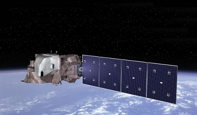
The Mer Bleue Arctic Surrogate Simulation Site (MBASSS) Sentinel-2 and Landsat 8 Validation Project draws its focus from the recommendations of the first Arctic and High Latitude Product Validation and Evolution (APVE I) workshop held in Ottawa, Canada in November 2014. Results of the workshop highlighted the need for more robust 'best practices' in validating land parameters derived from high resolution satellite sensors such as Sentinel-2 and Landsat 8. Although these recommendations were made for Arctic and high-latitude applications, this project is looking at the validation of land data products from Sentinel-2 and Landsat 8 Optical Land Imager (OLI) as applied to Mer Bleue. Located at the eastern boundary of the City of Ottawa, Canada, this surrogate site is an easily accessible and well-studied peatland.
MBASSS represents a first step in developing a systematic and robust validation approach for ongoing assessment and validation of satellite-based land information products. The project concept incorporates high resolution airborne hyperspectral imaging supported by ground-based field measurements. Image simulation tools are used to vary sensor settings and satellite mission parameters to model and validate products under different imaging scenarios.
Mer Bleue, a protected ombrotrophic bog represents an ideal test site for the project. Access to and development on the site is restricted and controlled by the National Capital Commission. Further, it has a long and ongoing history of systematic field data collection as a scientific environment of interest, and is logistically convenient for deploying airborne imaging assets and field teams. An additional benefit of the Bleue site is that it can serve as a realistic surrogate site for high latitude wetland ecosystems. Although not directly related to this project's objectives, this feature is of significant interest to all involved parties and is the reason the location was initially identified for consideration as a validation site for satellite imagery data products.
Contact Information
If you have any questions about this project, contact:
ESA Technical Officer: Ferran Gascon
Email: ferran.gascon@esa.int
Address: ESA-ESRIN, Via Galileo Galilei Frascati (RM), 00044 Italy
Organisation: ESA
Project Manager: Raymond Soffer
Email: ray.soffer@nrc-cnrc.gc.ca
Address: National Research Council, Airborne Research, Flight Research Laboratory, Ottawa, Canada
Organisation: National Research Council
Activity Consortium
The project is led by the Flight Research Laboratory at the National Research Council of Canada (NRC), in collaboration with the Canada Centre for Remote Sensing (CCRS), a division of Natural Resources Canada (NRCan), the Department of Geography at McGill University, and LOOKNorth, a centre of excellence for commercialisation and research operated by C-CORE.
