- All Categories (11)
- News (1)
- Missions (2)
- Events (1)
- Documents (7)
Mission - Heritage Missions
Seasat
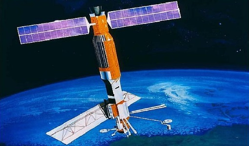
The instrument had the objectives of the determination of sea surface profiles, currents, wind speeds and wave heights.
Event - Workshop
Coastal and Marine Applications of SAR Workshop 2003
Applications were specifically focussed on wind, waves, sea ice, and currents.
Mission - Heritage Missions
Seasat Objectives
wealth of information on diverse ocean phenomena such as sea-surface winds and temperatures, surface and internal waves, currents
Document - General Reference
The Earth Observation Handbook, 2010 Update - Key Tables
This is the 2010 update of the CEOS Earth Observation Handbook. You can browse the live database at http://database.eohandbook.com/ or download the printable PDF of key tables based on the 2010 database contents for a handy reference.
Document - General Reference
Heritage Missions brochure
This brochure describes ESA's Heritage Space Programme and includes infographics describing some of the missions in the programme.
Document - Technical Note
SeaSat-SAR-IPF-Data-and-Processing-Issues.pdf
This document describes the rehabilitation and reprocessing of ESA’s historic SeaSat raw data archive.
News - Success Stories
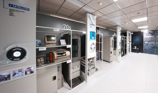
A stroll through Heritage Missions
In the current digital era, this confirms ESA’s commitment to maintain heritage data and keep information available, in support
Document - Product Specifications
JERS-SeaSat-SAR-Level-1-products-format-specifications.pdf
This document defines the Envisat and GEOTIFF/TIFF format of the L1 products generated from JERS/SeaSat SAR sensor data by the ESA JERS SAR Instrument Processing Facility.
Document - Product Specifications
JERS-SeaSat-SAR-Products-CEOS-Format-Specifications.pdf
This document defines the format of the SAR RAW, PRI, IMM and SLC products generated from JERS-1 and SeaSat SAR data by the ESA JERS and SeaSat SAR Instrument Processing Facilities.
Document - Technical Note
The SeaSat-A Synthetic Aperture Radar System
The SeaSat-A synthetic aperture radar imaging radar system (SAR) was the first imaging radar system used as a scientific instrument from Earth orbit. The system generated continuous radar imagery with a 100 km swath at a resolution of 25 m from an 800 km altitude orbit. The imagery is a pictorial representation of the radar backscatter of the Earth's surface in a map-like representation.

