- All Categories (138)
- News (1)
- Missions (7)
- Events (2)
- Activities (3)
- Documents (125)
Document - Technical Note

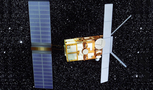
ERS-2 Scatterometer- Mission Performances and Current Reprocessing Achievements
Document - Proceedings

Emerging-Scatterometer-Applications-from-Research-to-Operations.pdf
The objective of the Workshop, held on 5-7 October 1998 at ESA-ESTEC (Noordwijk, The Netherlands), was to review the current
Document - Proceedings
3rd International Symposium on Retrieval of Bio and Geophysical Parameters from SAR Data for Land Applications
This Symposium provided a snapshot of where we currently stand in exploiting SAR data to understand geophysical and biophysical
Activity - Quality

EDAP
The following missions are currently being considered as part of the Automatic Identification System (AIS) and Radio Frequency
Activity - Quality
SCIRoCCo
Author: The SCIRoCCo Team Abstract: The ERS Scatterometers in the Global Climate Observing System report describes the current
Event - Training

EO Summer School 4
Keynote lectures on global change issues are also given to discuss the current state of the science of global change and
Mission - Heritage Missions
SAR (ERS) Processor Releases
It should be noted that for SAR, each product ordered is processed directly from the raw data, using the current version
Document - Publication - Paper

ERS-1-2 Scatterometer new products- mission reprocessing and data quality improvement
Paper presented at the Second Space for Hydrology Workshop - Geneve 2007: ERS-1/2 Scatterometer new products - mission reprocessing and data quality improvement
Document - General Reference

The Earth Observation Handbook, 2010 Update - Key Tables
This is the 2010 update of the CEOS Earth Observation Handbook. You can browse the live database at http://database.eohandbook.com/ or download the printable PDF of key tables based on the 2010 database contents for a handy reference.
Document - Technical Note
SAR-Interferometry-with-ERS-producing-detailed-and-accurate-three-dimensional-relief-maps-of-the-Earths-surface.pdf
Using the INSAR technique, it is possible to produce directly from SAR Image data detailed and accurate three-dimensional relief maps of the Earth's surface.
Document - General Reference
The Role of ERS-SAR Data for Central African Countries
This publication highlights the use and role of ERS data for Central African Countries.
Document - Proceedings
2nd ERS Applications Workshop
Proceedings of the second ERS Applications Workshop held on 6-8 December 1995 in London, United Kingdom.
Document - Publication - Paper
Uniqueness of the ERS Scatterometer for nowcasting and typhoon forecasting
Paper presented to IGARSS-2005: Uniqueness of the ERS Scatterometer for nowcasting and typhoon forecasting
Document - General Reference
The ERS Interferometric Quick Look Processor- a Powerful System to Assess and Exploit the ERS Tandem Archive
This paper describes the Interferometric Quick Look system, show examples of how its output is relevant to land classification, and discuss the use of the system to assess ERS Tandem data for land-use exploitation.
Document - Proceedings
32nd ESLAB Symposium on Remote Sensing Methodology for Earth Observation and Planetary Exploration
Proceedings from the 32nd ESLAB Symposium on Remote Sensing Methodology for Earth Observation and Planetary Exploration are presented here. The symposium took place at ESTEC in Noordwijk, the Netherlands, from 15 to 18 September 1998.
Document - Proceedings
Dragon Programme Mid-Term Results
Proceedings of the 2005 Dragon Symposium held on 27 June - 1 July 2005 in Santorini, Greece.
Document - General Reference
ERS - Envisat Symposium - Looking down to Earth in the New Millennium
The abstracts from the ERS-Envisat Symposium "Looking down to Earth in the new Millennium", which took place in Gothenburg, Sweden, from 16 to 20 October 2000 are presented here.
Document - General Reference
Farewell-to-ERS2.pdf
This is an article extracted from the ESA Bulletin Nr.148.