- All Categories (35418)
- Data (177)
- News (345)
- Missions (72)
- Events (102)
- Tools (41)
- Activities (58)
- Campaigns (39)
- Documents (34584)
News - Maintenance News

ESA Envisat AATSR - dissemination maintenance on 30 April 2024
A planned software maintenance activity will affect ESA’s Envisat AATSR data dissemination platform on Tuesday 30 April 2024 from 07:30 to 08:30 UTC
News - Operational News

Swarm Bravo on-board anomaly on 10 April 2024
Due to an issue on-board Swarm Bravo, the vector magnetic field data from the VFM instrument are not available from 10 April 2024 at 12:54 to 11 April 2024 at 10:27 (UTC time).
News - General News
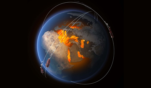
Earth scientists better exploit Swarm data with virtual workspace
The ESA-funded Swarm virtual workspace is helping scientists make the most of a decade of valuable magnetic field data.
News - General News

ESA's improved Earth system data records: what is in store for the future?
Fundamental Data Records (FDRs) are instrumental in advancing our understanding of Earth systems and for addressing societal challenges effectively. These long-term records contain uncertainty-quantified, calibrated and geo-located multi-instrument/multi-platform satellite sensor data spanning several decades to support climate-related applications.
News - General News

New Swarm Field Aligned Current web tool available
We are pleased to announce that a new Field Aligned Currents (FAC) web tool is available
News - How to guides
HEDAVI Discover: a step-by-step guide
The Heritage Data Visualisation tool (HEDAVI) is a platform developed by the French Science Consulting for Earth Observation group, VisioTerra, which allows users to freely access over 40 years of ESA Earth Observation Heritage data, Third Party Missions and some Copernicus data.
News - Success Stories
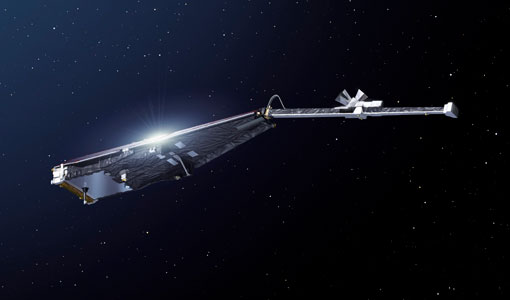
Ten years of Swarm data help reveal processes in Earth’s core
The tenth birthday of ESA’s three-satellite Swarm constellation has been a game changer for research into Earth’s magnetic field and core dynamics, as set out by an ESA-funded project.
News - Data Release news
CHAMP L3 magnetic data now available on Swarm dissemination server
We are pleased to announce the release of magnetic field data from CHAMP mission on Swarm dissemination server.
News - Maintenance News
ESA EO Dissemination Services - Maintenance on 25 and 26 March 2024
Scheduled software maintenance on ESA EO Dissemination Services on 25 and 26 March 2024
News - Operational News
Transition from FTP to FTPS for SMOS, Aeolus and Campaign data dissemination systems
As of 15 April 2024 access to the SMOS, Aeolus and Campaign data will be changed from simple FTP to FTPS.
News - Operational News

SMOS data distribution resumed
SMOS data distribution to end users was resumed on 12 March 2024 after confirmation of the adequate quality of the current data.
News - Data Release news
Additional EFI TII Raw And Corrected Imagery and Spectra (TRACIS) dataset 0201 available for Swarm
Additional EFI TII Raw And Corrected Imagery and Spectra (TRACIS) data is now available on the Swarm dissemination server for all the Swarm satellites.
News - Data Release news
Additional EFI TII Cross Track Flow dataset 0302 available for Swarm
Additional TII cross-track flow data is now available on the Swarm dissemination server for all the Swarm satellites.
Document - Newsletter

Earth Online Newsletter - 08 March 2024
This issue of the Earth Online Newsletter covers a selection of the latest news and events from ESA.
Event - Workshop

VH-RODA 2024
The 2024 VH-RODA workshop provides an open forum (for the new space, commercial and institutional space sectors) for presenting and discussing the current status and future developments related to Earth Observation data quality, calibration and validation of space-borne very high-resolution SAR and Optical sensors and data products.
News - Data Release news
FDR4ALT - ESA unveils new cutting-edge ERS/Envisat Altimeter and Microwave Radiometer Datasets
The European Space Agency (ESA) has developed a comprehensive suite of innovative Earth system data records as part of the Fundamental Data Records for Altimetry project - FDR4ALT.
Document - Product Document

FDR4ALT-Validation-Report-TDP-Sea-Ice
FDR4ALT Product Validation Report: Sea-Ice TDP
Document - Product Document
FDR4ALT-Validation-Report-TDP-Ocean-Waves
FDR4ALT Product Validation Report: Ocean Waves TDP