- All Categories (673)
- Data (15)
- News (45)
- Missions (2)
- Events (23)
- Tools (4)
- Activities (7)
- Documents (577)
News - Events and Proceedings
Featuring the power of Earth observation data at EGU
The European Geosciences Union General Assembly 2024 brings together geoscientists from all over the world, aiming to provide a forum where scientists and early career researchers can present their work and discuss their ideas with experts, in all fields of geoscience.
News - General News

ESA's improved Earth system data records: what is in store for the future?
Fundamental Data Records (FDRs) are instrumental in advancing our understanding of Earth systems and for addressing societal challenges effectively. These long-term records contain uncertainty-quantified, calibrated and geo-located multi-instrument/multi-platform satellite sensor data spanning several decades to support climate-related applications.
News - Operational News
Transition from FTP to FTPS for SMOS, Aeolus and Campaign data dissemination systems
As of 15 April 2024 access to the SMOS, Aeolus and Campaign data will be changed from simple FTP to FTPS.
News - Infographics
Showcasing success stories from ESA's Heritage Missions
Find out how ESA's Heritage Space Programme data continue to help, even decades after they finished operations, in our latest infographic.
Document - Newsletter

Earth Online Newsletter - 08 March 2024
This issue of the Earth Online Newsletter covers a selection of the latest news and events from ESA.
News - Data Release news
FDR4ALT - ESA unveils new cutting-edge ERS/Envisat Altimeter and Microwave Radiometer Datasets
The European Space Agency (ESA) has developed a comprehensive suite of innovative Earth system data records as part of the Fundamental Data Records for Altimetry project - FDR4ALT.
Data - EO Sign In Authentication (Open)
Land Ice Thematic Data Product [ALT_TDP_LI]
This is the Land Ice Thematic Data Product (TDP) V1 resulting from the ESA FDR4ALT project and containing estimates of ice sheet surface elevation and associated uncertainties. The collection covers data for three different missions: ERS-1, ERS-2 and Envisat, and based on Level 1 data coming from previous reprocessing (ERS REAPER and the Envisat V3.0) but taking into account the improvements made at Level 0/Level 1 in the frame of FDR4ALT (ALT FDR). The Land Ice TDP focuses specifically on the ice sheets of Greenland and Antarctica, providing these data in different files. For many aspects, the Land Ice Level 2 and Level 2+ processing is very innovative: Improved relocation approach correcting for topographic effects within the beam footprint to identify the Point of Closest Approach Homogeneous timeseries of surface elevation measurements at regular along-track reference nodes. The FDR4ALT products are available in NetCDF format. Free standard tools for reading NetCDF data can be used. Information for expert altimetry users is also available in a dedicated NetCDF group within the products. Please consult the FDR4ALT Product User Guide before using the data. The FDR4ALT datasets represent the new reference data for the ERS/Envisat altimetry missions, superseding any previous mission data. Users are strongly encouraged to make use of these datasets for optimal results.
Data - EO Sign In Authentication (Open)
Inland Waters Thematic Data Product [ALT_TDP_IW]
This is the Inland Waters Thematic Data Product (TDP) V1 resulting from the ESA FDR4ALT project and containing improved Water Surface Height (WSH) data record from the ERS-1, ERS-2 and Envisat missions estimated using the ICE1 retracking range for its better performance on the hydro targets. The FDR4ALT products are available in NetCDF format. Free standard tools for reading NetCDF data can be used. Information for expert altimetry users is also available in a dedicated NetCDF group within the products. Please consult the FDR4ALT Product User Guide before using the data. The FDR4ALT datasets represent the new reference data for the ERS/Envisat altimetry missions, superseding any previous mission data. Users are strongly encouraged to make use of these datasets for optimal results.
News - Success Stories
Trailblazing ERS-2 mission enables climate change applications
As ESA’s ERS-2 satellite approaches Earth’s atmosphere for reentry, it’s time to reflect on the mission’s great achievements in powering climate-related applications.
News - General News
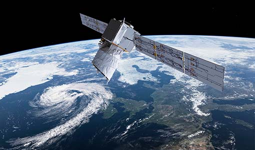
Aeolus data and lessons learned: what happens next for ESA’s wind mission?
The Aeolus satellite returned to Earth on 28 July 2023, in an assisted reentry that marked the end of nearly five years in space. For scientists working with Aeolus data, however, the mission lives on.
News - Success Stories
Young scientists bid farewell to ESA's wind mission
Students and early career researchers are saying an emotional goodbye to Aeolus ahead of its upcoming reentry.
News - Infographics
Overview of the Aeolus Level-1B wind product
Learn about the Aeolus Level-1B wind product, which supports applications for the weather, atmospheric processes and climate research, in our latest infographic.
News - Thematic area articles
Remote sensing data map impacts of natural hazards
As climate change increases the frequency and severity of natural disasters, remote sensing data can warn about extreme events and help tackle emergency situations.
News - Operational News
The divine keeper of the winds retires
ESA’s fifth Earth Explorer - Aeolus - is due to retire soon, but will provide fully nominal data up to the end of operations on 30 April.
News - Events and Proceedings
Scientists to showcase value of Earth observation data at EGU
Remote sensing scientists are getting ready to present innovative and exciting applications of satellite data at the European Geosciences Union general assembly which will take place from 24 to 28 April in Vienna, Austria.
News - Data Release news
Improved Aeolus Rayleigh-cloudy winds product now available
An improved Aeolus product is now available: Rayleigh channel winds measured in atmospheric conditions with clouds and/or dense aerosol, known as Rayleigh-cloudy winds.
News - Spotlight on EO community

An overview of the Aeolus mission
In this overview video, ESA's mission manager, Tommaso Parrinello, describes the successes and challenges of this amazing mission, whose impacts will live long beyond its lifetime in space.
News - Spotlight on EO community
Introducing the Aeolus and CryoSat missions
In this video, Tommaso Parrinello - Mission Manager of Aeolus and CryoSat - describes what is involved in managing the missions and the unique challenges offered by such innovative satellites.
News - Spotlight on EO community
Introducing Tommaso Parrinello
In this short introduction, ESA's Aeolus and CryoSat Mission Manager, Tommaso Parrinello, describes his role in these two diverse missions.
News - Thematic area articles
Monitoring water on Earth's surface
ESA's Earth observation satellites are playing a leading role in furthering our understanding of how Earth's terrestrial hydrosphere is being influenced by humankind.
