- News
- Retrieving Snow Depth Over Sea...
Retrieving Snow Depth Over Sea Ice Using Dual-Frequency Altimetric Measurements
21 Dec 2021
A new study from the sea ice team of the Laboratory of Space Geophysical and Oceanographic Studies (LEGOS) in Toulouse has shown that dual-frequency SARAL and CryoSat-2 altimetric measurements can be used to retrieve consistent snow depth data over sea ice in both hemispheres.
The launch of CryoSat-2 allowed Sea Ice Thickness (SIT) observations to be accurately derived from altimetric measurements. This is done by measuring the fraction of the sea ice above sea level, namely the sea ice freeboard, from the difference between the heights in leads (large cracks in sea ice revealing the sea level) and that of ice floes. However, due to snow load, the snow depth over sea ice is necessary to convert freeboards into sea ice thickness. Snow depth is still insufficiently known and it is one of the most significant contributors to the overall uncertainty of SIT.
One solution to provide large scale information on the spatial and temporal variabilities of snow depth is to use dual-frequency altimetric measurements. The principle is to compute snow depth from the difference of penetration between the Ku-band frequency of CryoSat-2’s SIRAL instrument (13.5 GHz), assuming it is reflected near the snow/ice interface, and the Ka-band frequency of the SARAL mission’s AltiKa instrument (35.7 GHz), assuming it is reflected at the air/snow interface.
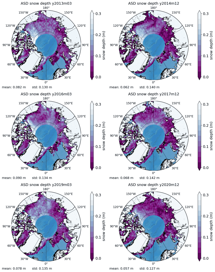
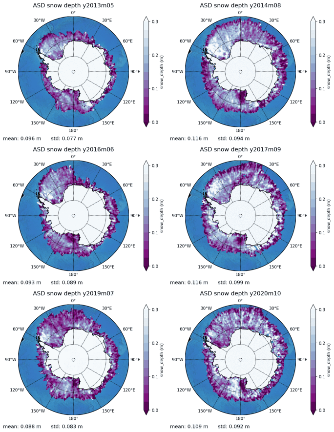
Following this methodology, the Altimetric Snow Depth (ASD) product has been developed for both hemispheres at LEGOS in the framework of the CryoSat+ Antarctic Ocean and Polar+ Snow on Sea Ice ESA projects.
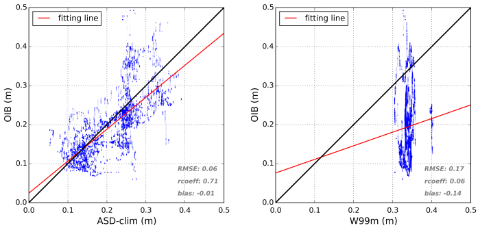
The consistency of these data is assessed through comparisons in the Arctic with buoy and airborne data, revealing mean deviations of only a few centimetres. Altimetric snow depths, which are only available from the launch of SARAL in 2013, have been shown to provide a better climatological solution than the snow depth climatology currently being used in the Arctic (the Warren-99 modified climatology, W99m), for at least the whole period of CryoSat-2.
Using ASD data instead of the W99m reduces the sea ice thickness mean estimations by about 30 cm, indicating that most of the current SIT estimations are very likely to overestimate the actual sea ice volumes. The study also evaluates the importance of snow depth on SIT retrievals, estimating that the mean uncertainty due to snow depth is about 20 cm and can reach up to 77 cm of thickness.

ASD data represent a very good pilot product to demonstrate the potential of the upcoming CRISTAL mission. Compared to ASD, CRISTAL snow depths will benefit from a much better resolution by providing along track snow depths simultaneously with freeboards. The polar orbit of CRISTAL data will also allow for a full coverage of the Arctic, which is not the case for ASD because of SARAL’s orbit.
The ASD data used in the study are freely available on the LEGOS website. An updated version now includes the latest ESA Baseline C PLRM GOP product (SARin zones) for the entire 2013-2020 time period.

