- News
- CryoTEMPO EOLIS and Operation ...
CryoTEMPO EOLIS and Operation IceBridge Data Added to Cryo2Ice Coincident Data Explorer
27 May 2021
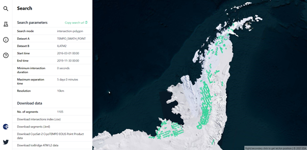
CryoTEMPO-EOLIS and Operation IceBridge data are now available in the Cryo2Ice Coincident Data Explorer. The same as for CryoSat-2 and IceSat-2 data, users can view the individual datasets as well as find where the datasets intersect.
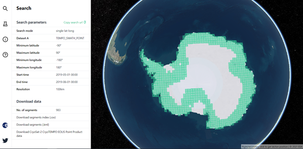
CryoTEMPO-EOLIS Background
Land-ice is declining globally, raising sea levels worldwide and impacting glacial risks and access to fresh-water in high-mountain glaciers regions. Land-ice monitoring via Earth Observation methods in general, and altimetry in particular, are essential for tracking the current status of ice volume change and its evolution as climate continues to evolve and mitigating actions are being pursued.
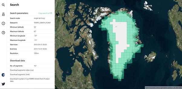
In this context, ESA launched the CryoSat ThEMatic PrOducts (Cryo-TEMPO) activity that supports a wide variety of end-users working in the areas of sea ice, polar oceans, land ice, coastal areas and hydrology. CryoTEMPO-EOLIS (Elevation Over Land Ice from Swath), went live in 2020 with the Greenland and Antarctic ice sheets. Remaining glaciers worldwide will be added in Autumn 2021. The EOLIS products exploit CryoSat’s SARIn mode and the novel Swath processing technique to deliver increased spatial and temporal coverage of time-dependent elevation over land ice, a critical metric for tracking ice mass trends.
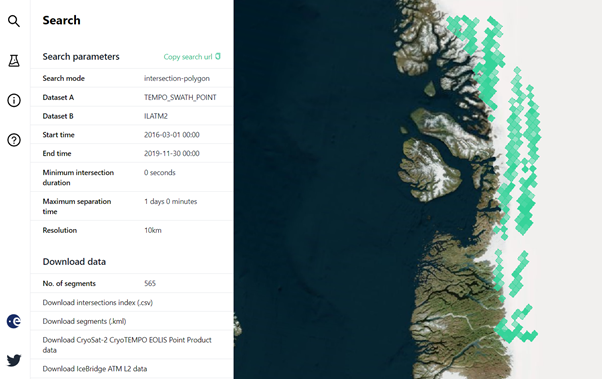
Intersection with Operation IceBridge
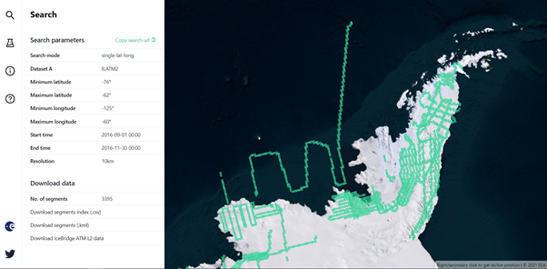
Operation IceBridge (OIB) is the largest airborne survey of Earth's polar ice ever flown. It yields an unprecedented three-dimensional view of Arctic and Antarctic ice sheets, ice shelves and sea ice. These flights provide a yearly, multi-instrument look at the behaviour of the rapidly changing features of Greenland and Antarctic ice.
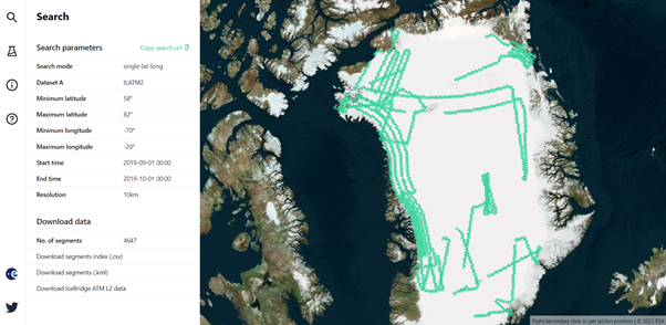
In the context of CryoTEMPO-EOLIS, OIB is used to calibrate uncertainty. Therefore, as is common for many other products, it is very useful to see coincident EOLIS and OIB datasets.
In addition, once CryoSat-2 and IceSat-2 datasets will be back populated in summer 2021, the intersections of CryoSat-2 and IceSat-2 with EOLIS and Operation IceBridge will be available.
Data Availability
EOLIS data is available from present day back to the beginning of 2016. Operation IceBridge is available for the entire mission back to March 2009.
CryoSat-2 L2 Baseline D and IceSat-2 datasets are available for the post satellite alignment period. Backloading of these datasets back to the beginning of 2018 will be complete this summer. IceSat-2 v004 will be available in mid-June. CryoVEx data is due later this year.
Examples
You can easily try out the Cryo2Ice Coincident Data Explorer by using our examples that populate the search parameters. EOLIS and OIB examples are available at the bottom of the list.
More datasets will be added in the coming months along with potential new functionalities such as fused datasets that will make using the data even easier.
The Cryo2Ice Coincident Data Explorer has been built as part of ESA’s CryoTEMPO programme.
Please send any feedback, suggestions or questions to info@earthwave.co.uk.