- News
- ALOS PRISM collection now open
ALOS PRISM collection now open
07 Dec 2020
Launched on 24 January 2006, ALOS-1, (also known as Daichi), completed its operational phase on 12 May 2011, after five years of successful acquisitions over the globe. ALOS was one of the world's largest Earth observation satellites whose function was to collect global and high-resolution land observation data.
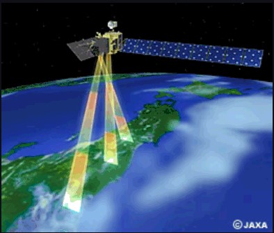
The satellite had three instruments on board: the Advanced Visible and Near Infrared Radiometer (AVNIR-2) for precise land coverage observation, the Phased Array type L-band Synthetic Aperture Radar (PALSAR) for day-and-night and all-weather land observation, and the Panchromatic Remote-sensing Instrument for Stereo Mapping (PRISM).
Its mission objectives were to provide its user community with data of sufficient resolution to be able to generate 1:25,000 scale maps; developing Digital Elevation Models and related geographic data products; performing regional observation to aid sustainable development goals; surveying natural resources; developing sensor and satellite technology for future Earth observation missions; and disaster monitoring worldwide.
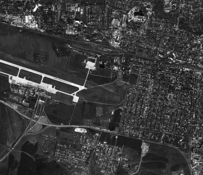
PRISM was a panchromatic radiometer onboard the ALOS-1 mission, with 2.5 m spatial resolution at nadir. PRISM had three independent optical systems for viewing nadir, forward and backward producing a stereoscopic image along the satellite's track. Its extracted data were designed to provide highly accurate digital surface model (DSM).
This collection, with more than a million Level 1B products, provides access to the ALOS-1 PRISM data acquired by ESA stations (Tromsoe and Matera) in the ADEN zone, plus some worldwide data requested by European scientists.
The ADEN zone was the area belonging to the European Data node and covered both the European and African continents, a large part of Greenland and the Middle East.
The ALOS instruments were capable of observing Earth's entire surface:
- Any place within two days
- Around the equator: about 60% of the area within one day
- At latitudes of 35°: about 70% of the area within one day
- At latitudes above 55°: any place every day (provided there is no cloud cover for the optical instruments)
The mission recently entered into its heritage phase and so was moved from ESA's Earthnet Programme to the responsibility of the Heritage Space Programme, which is responsible for preserving historical data from missions that are no longer operational.
Roberto Biasutti, ESA's Payload Data Ground Segment Operational Manager, states, "Thanks to its 3-view sensor, the ALOS-1 PRISM mission provided a very good dataset for the creation of a worldwide DEM, in support to SAR-derived ones. Also owing to its resolution, it has often been used as a base for the geometric correction of other datasets."