- News
- New BorealScat campaign datase...
New BorealScat campaign dataset released
22 Feb 2023
A new dataset has been released for the BorealScat campaign, which took place between 2017 and 2021 in Sweden.
ESA conducts airborne and ground-based campaigns to support the development of new instruments, and calibration and validation of existing instruments. These campaigns simulate satellite-based instruments and are conducted all over the world in support of a wide range of applications.
The goal of the BorealScat campaign was to characterise and quantify the temporal variations of radar observations of a boreal forest stand over timescales ranging from seconds to years. The data will help investigate the effects of environmental variables.
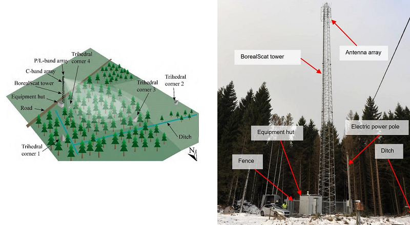
The campaign utilised a radar tower at a test site in Remningstorp, Sweden, to acquire P-, L-, and C-Band multi-polarisation, tomographic observations of the forest for over a year with five-minute intervals. Long-term data were acquired on daily, weekly, monthly, and yearly scales, observing the forest during different seasons to analyse how the radar data detected the effects of environmental changes including snow, freezing and thawing, and seasonal changes in spruce needle cover.

The dataset available from the campaign offers a unique opportunity to study the effects of environmental variables on radar observations, and how to improve scattering models and forest parameter estimation algorithms to mitigate the effects of electromagnetic scattering.
Data from the campaign are freely available to download following submission of a data access request.