- News
- How space data are transformin...
How space data are transforming the global food system
02 Mar 2022
European Earth observation activities are accelerating a data-driven transformation in the agriculture sector that is helping farmers adapt to the dual challenges of climate change and population increase.
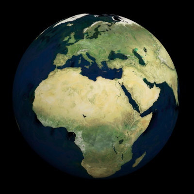
High-resolution data generated by numerous ESA missions are enabling scientists to build detailed pictures of the planet’s environment, including vegetation cover, soil properties, seasonal conditions and long-term changes.
This is facilitating the development of sustainable technologies and strategies that boost crop yields, helping farmers to meet growing global food demands while guarding against any potentially adverse environmental impacts.
How are satellites used for agriculture?
Satellites are acquiring data that contribute to long-term datasets, including vegetation cover, soil properties and seasonal conditions. These datasets enable scientists and farmers to monitor the health and development of agricultural areas, and threats such as floods or drought.
Illuminating the environment
ESA’s Earth Explorer missions – which form part of the agency’s Living Planet Programme – are focused on investigating interactions between Earth’s systems and elucidating the impact human activities have on these processes.
As well as improving understanding of climate change, this is generating information that is being used to support agriculture.
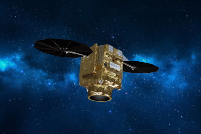
The Soil Moisture and Ocean Salinity (SMOS) mission – which launched in November 2009 – investigates how soil moisture and sea salinity changes in response to the continuous exchange of water between the ocean, sea and the land.
SMOS hosts the Microwave Imaging Radiometer with Aperture Synthesis (MIRAS) instrument, which characterises soil moisture and sea salt concentrations by observing microwave radiation emissions. Soil moisture and salinity decrease the emissivity of soil and oceans – and MIRAS tracks these variations by monitoring microwave radiation emitted at L-band over land and sea.
Reinforcing resilience
The upcoming Fluorescence EXplorer (FLEX) mission – which is also an Earth Explorer – will be the first satellite capable of measuring photosynthetic activity.
It will use its high-resolution Fluorescence Imaging Spectrometer to provide worldwide maps of vegetation fluorescence to reveal detailed information about plant health and stress, supporting sustainable agricultural management and global food security goals.
FLEX will fly in tandem with the Copernicus Sentinel-3 mission, working in synergy with its Sea and Land Surface Temperature Radiometer and Ocean and Land Colour Instrument to provide comprehensive maps of the planet’s surface.
SMOS data can be used to develop maps of soil moisture to reveal the risk and extent of agricultural droughts, enabling farmers and agri-businesses to adapt to this threat.
What are the benefits of precision agriculture?
Precision agriculture uses a combination of technology – including on the ground, in the air, and from space with satellites - to more accurately plan, develop, and maintain farms. With more information from space, crops can be planted in the most effective locations, enabling farmers to develop their farms more efficiently and contribute to food sustainability.
ESA’s Heritage missions
ESA’s Living Planet programme builds on the success of historic Earth observation activities, including the European Remote-Sensing Satellite (ERS) and Envisat missions.
Launched in 2002, Envisat used a suite of 10 innovative instruments to monitor the planet’s atmosphere and its surface.
By combining information collected by the mission’s instruments, remote sensing experts were able to generate maps of the land to distinguish between crops, and identify when crops were planted, as well as how well they are developing.
Envisat has now been inactive for a decade, but its data are still being continuously improved to generate a harmonised data series with Copernicus Sentinel data.
Growing global collaborations
ESA is also cooperating with its global partners to acquire commercial data from a number of third-party missions.
ICEYE, for example, is a constellation currently consisting of 11 X-band Synthetic Aperture Radar satellites – with seven more to be added by the end of 2022 – that provides high-resolution images of Earth’s surface. The constellation is able to collect information on field boundaries, planting events, as well as crop damage caused by natural events, such as storms or floods.
In addition, the Pléiades Neo satellites – launched on 29 April and 17 August 2021 – are providing imagery with resolutions of up to 30cm all over the world, with a high revisit frequency.
Pléiades Neo is an extension of the Pléiades programme, which is managed by Airbus Defence and Space on behalf of the French space agency CNES. The programme delivers high-quality data products, which have applications in forestry, geology and marine industries.
Transforming data into action
Environmental information generated by ESA’s Earth observation activities – as well as its third-party missions – has a huge number of applications for the agriculture sector, including predicting crop yields, monitoring crop damage, assessing the risk of water scarcity, and much more.
This information can help governments to implement strategies that support sustainable food production, as well as facilitating rural innovations such as precision farming, which is a targeted, flexible approach to agriculture.