GOCE+ Gravity Gradients GRIDS map
Gradients map
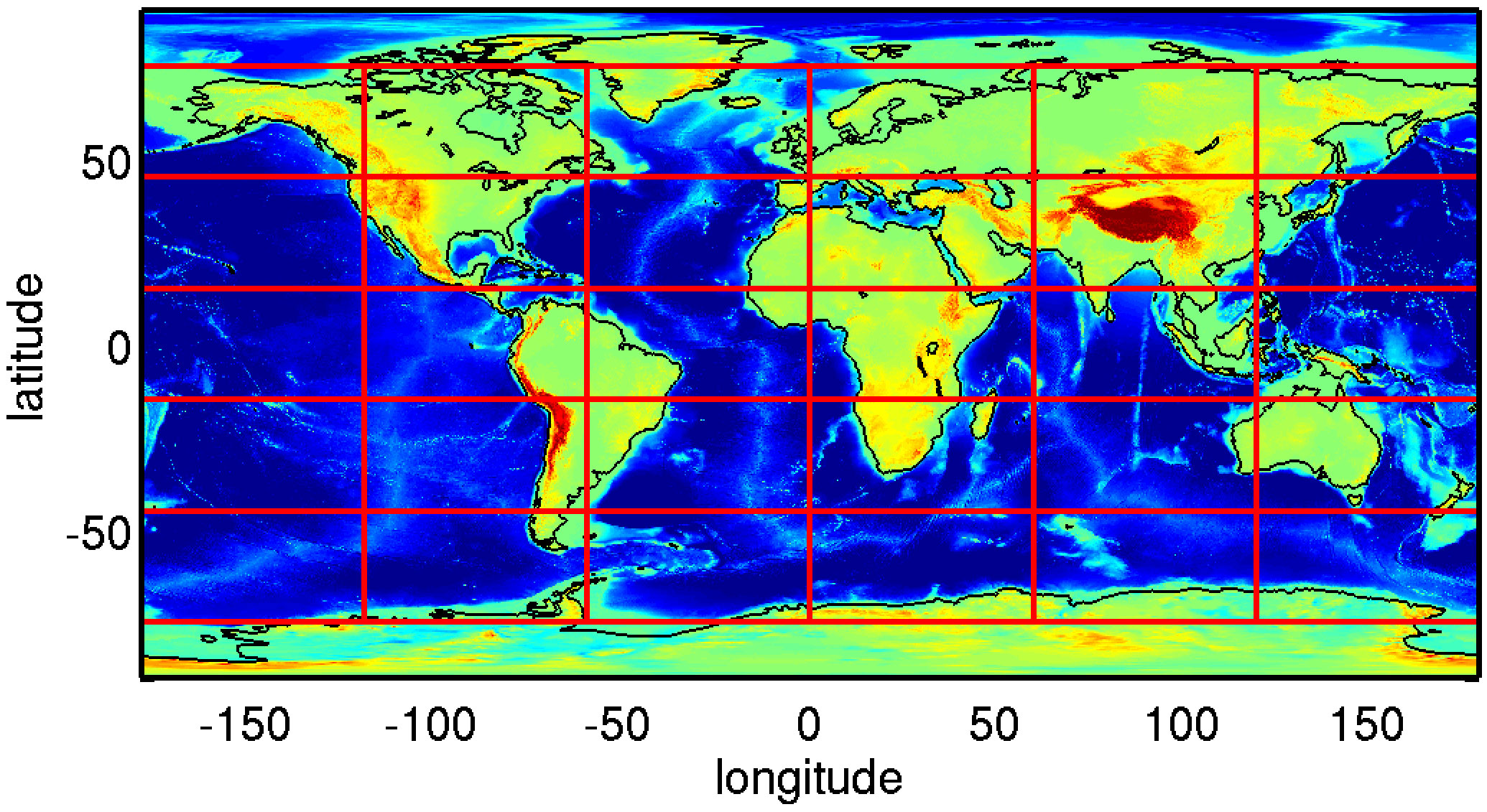
This image shows the division of gravity gradients grids. See the grids, with and without topographic correction in the image carousel below. Maps are obtained from the lower orbit phase data.
The GOCE Global Gravity Field Models and Grids collection contains gravity gradient and gravity anomalies grids at ground level and at satellite height.

View full image
Grid Ref A Original Gravity Gradients & Gradients with Topographic Reduction
Grid Ref A Original Gravity Gradients & Gradients with Topographic Reduction

View full image
Grid Ref B Original Gravity Gradients & Gradients with Topographic Reduction
Grid Ref B Original Gravity Gradients & Gradients with Topographic Reduction

View full image
Grid Ref 1 Original Gravity Gradients & Gradients with Topographic Reduction
Grid Ref 1 Original Gravity Gradients & Gradients with Topographic Reduction

View full image
Grid Ref 2 Original Gravity Gradients & Gradients with Topographic Reduction
Grid Ref 2 Original Gravity Gradients & Gradients with Topographic Reduction

View full image
Grid Ref 3 Original Gravity Gradients & Gradients with Topographic Reduction
Grid Ref 3 Original Gravity Gradients & Gradients with Topographic Reduction

View full image
Grid Ref 4 Original Gravity Gradients & Gradients with Topographic Reduction
Grid Ref 4 Original Gravity Gradients & Gradients with Topographic Reduction

View full image
Grid Ref 5 Original Gravity Gradients & Gradients with Topographic Reduction
Grid Ref 5 Original Gravity Gradients & Gradients with Topographic Reduction

View full image
Grid Ref 6 Original Gravity Gradients & Gradients with Topographic Reduction
Grid Ref 6 Original Gravity Gradients & Gradients with Topographic Reduction

View full image
Grid Ref 7 Original Gravity Gradients & Gradients with Topographic Reduction
Grid Ref 7 Original Gravity Gradients & Gradients with Topographic Reduction

View full image
Grid Ref 8 Original Gravity Gradients & Gradients with Topographic Reduction
Grid Ref 8 Original Gravity Gradients & Gradients with Topographic Reduction

View full image
Grid Ref 9 Original Gravity Gradients & Gradients with Topographic Reduction
Grid Ref 9 Original Gravity Gradients & Gradients with Topographic Reduction

View full image
Grid Ref 10 Original Gravity Gradients & Gradients with Topographic Reduction
Grid Ref 10 Original Gravity Gradients & Gradients with Topographic Reduction

View full image
Grid Ref 11 Original Gravity Gradients & Gradients with Topographic Reduction
Grid Ref 11 Original Gravity Gradients & Gradients with Topographic Reduction

View full image
Grid Ref 12 Original Gravity Gradients & Gradients with Topographic Reduction
Grid Ref 12 Original Gravity Gradients & Gradients with Topographic Reduction

View full image
Grid Ref 13 Original Gravity Gradients & Gradients with Topographic Reduction
Grid Ref 13 Original Gravity Gradients & Gradients with Topographic Reduction

View full image
Grid Ref 14 Original Gravity Gradients & Gradients with Topographic Reduction
Grid Ref 14 Original Gravity Gradients & Gradients with Topographic Reduction

View full image
Grid Ref 15 Original Gravity Gradients & Gradients with Topographic Reduction
Grid Ref 15 Original Gravity Gradients & Gradients with Topographic Reduction

View full image
Grid Ref 16 Original Gravity Gradients & Gradients with Topographic Reduction
Grid Ref 16 Original Gravity Gradients & Gradients with Topographic Reduction

View full image
Grid Ref 17 Original Gravity Gradients & Gradients with Topographic Reduction
Grid Ref 17 Original Gravity Gradients & Gradients with Topographic Reduction

View full image
Grid Ref 18 Original Gravity Gradients & Gradients with Topographic Reduction
Grid Ref 18 Original Gravity Gradients & Gradients with Topographic Reduction

View full image
Grid Ref 19 Original Gravity Gradients & Gradients with Topographic Reduction
Grid Ref 19 Original Gravity Gradients & Gradients with Topographic Reduction

View full image
Grid Ref 20 Original Gravity Gradients & Gradients with Topographic Reduction
Grid Ref 20 Original Gravity Gradients & Gradients with Topographic Reduction

View full image
Grid Ref 21 Original Gravity Gradients & Gradients with Topographic Reduction
Grid Ref 21 Original Gravity Gradients & Gradients with Topographic Reduction

View full image
Grid Ref 22 Original Gravity Gradients & Gradients with Topographic Reduction
Grid Ref 22 Original Gravity Gradients & Gradients with Topographic Reduction

View full image
Grid Ref 23 Original Gravity Gradients & Gradients with Topographic Reduction
Grid Ref 23 Original Gravity Gradients & Gradients with Topographic Reduction

View full image
Grid Ref 24 Original Gravity Gradients & Gradients with Topographic Reduction
Grid Ref 24 Original Gravity Gradients & Gradients with Topographic Reduction

View full image
Grid Ref 25 Original Gravity Gradients & Gradients with Topographic Reduction
Grid Ref 25 Original Gravity Gradients & Gradients with Topographic Reduction

View full image
Grid Ref 26 Original Gravity Gradients & Gradients with Topographic Reduction
Grid Ref 26 Original Gravity Gradients & Gradients with Topographic Reduction

View full image
Grid Ref 27 Original Gravity Gradients & Gradients with Topographic Reduction
Grid Ref 27 Original Gravity Gradients & Gradients with Topographic Reduction

View full image
Grid Ref 28 Original Gravity Gradients & Gradients with Topographic Reduction
Grid Ref 28 Original Gravity Gradients & Gradients with Topographic Reduction

View full image
Grid Ref 29 Original Gravity Gradients & Gradients with Topographic Reduction
Grid Ref 29 Original Gravity Gradients & Gradients with Topographic Reduction

View full image
Grid Ref 30 Original Gravity Gradients & Gradients with Topographic Reduction
Grid Ref 30 Original Gravity Gradients & Gradients with Topographic Reduction
Slide 0 of 0