TOKYO, March 31, 2011 (From AFP) - A 6.2-magnitude earthquake hit Thursday in an area of North-eastern Japan jolted by a massive quake and tsunami disaster earlier this month, the US Geological Survey said.
The quake struck at 4:15 pm (0715 GMT) about 417 kilometres (259 miles) northeast of Tokyo, at a depth of 39.6 kilometres (24.6 miles), the USGS said. The epicentre was off the coast of Miyagi prefecture, where a huge tsunami swept away houses and thousands of people on March 11.
No tsunami warning was issued following the quake, according to the Japan Meteorological Agency.
Satellite Planning for Tsunami in Japan
|
Event Timeline |
|
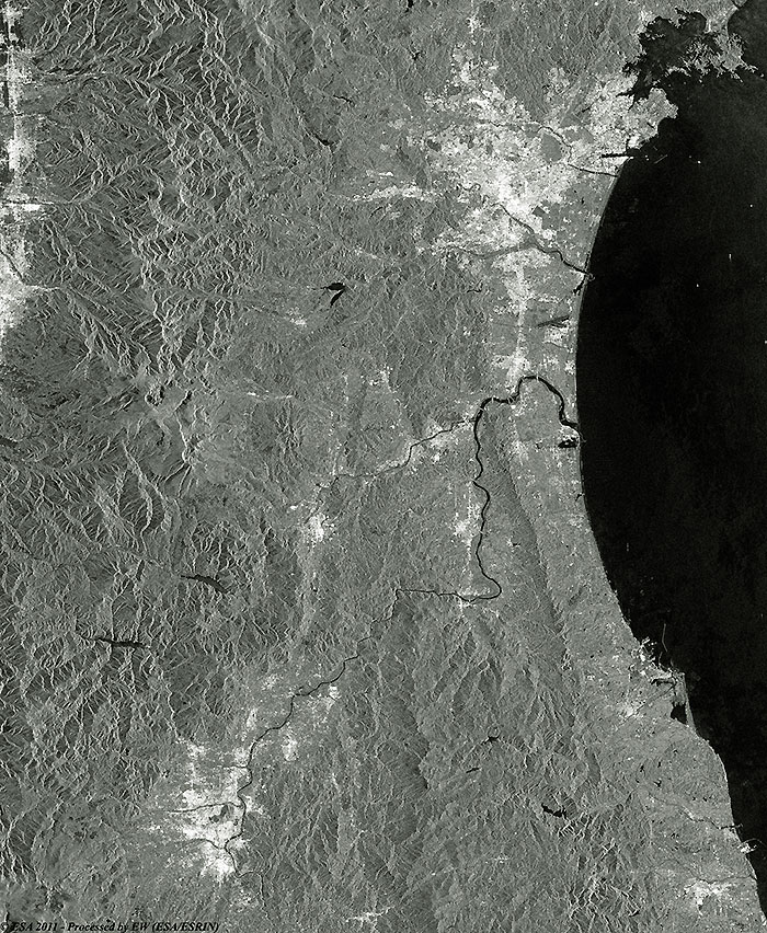
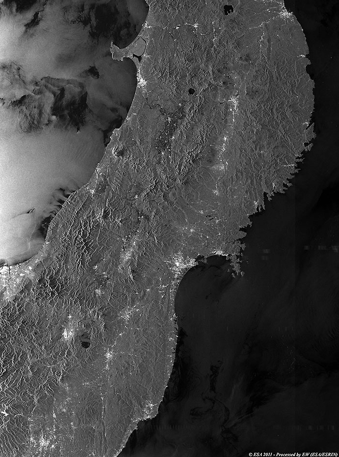
21 March 2011 |
|
After the earthquake/tsunami |
|
Technical Information |
|
Product: |
ASA_IM_IP |
|
Satellite: |
Envisat |
|
Instrument: |
ASAR image mode Precision Image |
|
Instrument features: |
Resolution image (30 m) |
|
Bands combination: |
Greyscale |
|
Date of Acquisition: |
21 Mar 2011 - Acq.time:00:40:49 |
|
Orbit number: |
47344 Track 347 |
|
Orbit Direction: |
Descending |
|
Technical Information |
|
Product: |
ASA_IM_IP |
|
Satellite: |
Envisat |
|
Instrument: |
ASAR image mode Precision Image |
|
Instrument features: |
Resolution image (30 m) |
|
Bands combination: |
Greyscale |
|
Date of Acquisition: |
19 Feb 2011 - Acq.time:00:40:15 |
|
Orbit number: |
46913 Track 347 |
|
Orbit Direction: |
Descending |
|
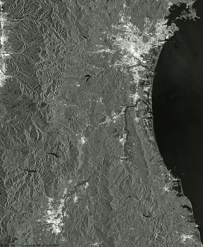
21 November 2010 |
|
Before the earthquake/tsunam |
|
Technical Information |
|
Product: |
ASA_IM_IP |
|
Satellite: |
Envisat |
|
Instrument: |
ASAR image mode Precision Image |
|
Instrument features: |
Resolution image (30 m) |
|
Bands combination: |
Grayscale |
|
Date of Acquisition: |
21 Nov 2010 - Acq.time:00:38:06 |
|
Orbit number: |
45620 Track 347 |
|
Orbit Direction: |
Descending |
|
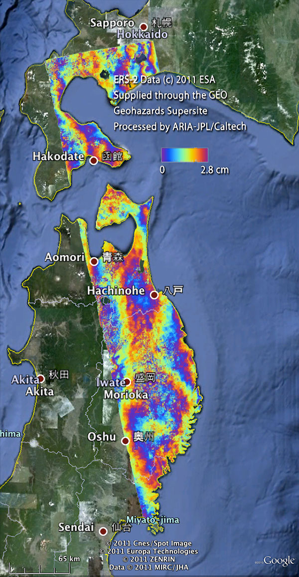
ERS-2 interferogram over the Sendai area |
|
ERS-2 Data (c) 2011 ESA Supplied through the GEO Geohazards Supersite - Processed by ARIA-JPL/Caltech |
Earthquake Japan 2011, ESA data dataset freely available within the Geo-hazard Supersites repository
|
Technical Information |
|
Product: |
ASA_WSM_1P |
|
Satellite: |
Envisat |
|
Instrument: |
ASAR wide swath standard image |
|
Instrument features: |
Resolution image (150 m) |
|
Bands combination: |
Greyscale |
|
Date of Acquisition: |
20 Mar 2011 - Acq.time:12:29:06 |
|
Orbit number: |
47337 |
|
Orbit Direction: |
Descending |
Back to top
 Earthquake/Tsunami - Japan, March 2011