 Tirana, Albania
Tirana is the capital and largest city of Albania. It became Albania's capital city in 1920. The population at the 2011 census was 418,495. The city is host to many public institutions and public and private universities, and is the centre of the political, economic, and cultural life of the country. The Municipality of Tirana is located in Tirana County, about 32 kilometres inland. Tirana's average altitude is 110 metres above sea level and its highest point measures 1,828m at Mali me Gropa. The city is mostly surrounded by hills, with Dajti Mountain on the east and a slight valley opening on the north-west overlooking the Adriatic Sea in the distance. The Tiranë river runs through the city, as does the Lanë stream. The city borders the surrounding municipalities of Paskuqan, Dajt, Farkë, Vaqarr, Kashar and Kamëz. The city has four artificial lakes: the Tirana Artificial Lake around which was built the Big Park, Paskuqani Lake, Farka Lake, and Tufina Lake. Tirana is on the same parallel as Naples, Madrid, Istanbul, and New York, and on the same meridian as Budapest and Kraków. More information is available on Wikipedia
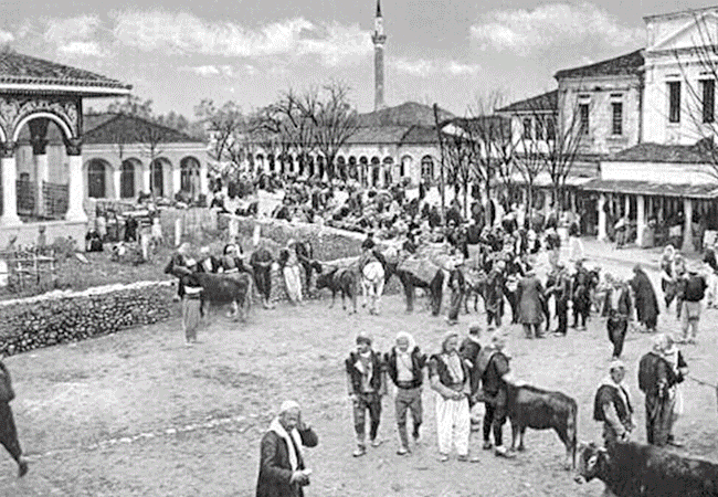
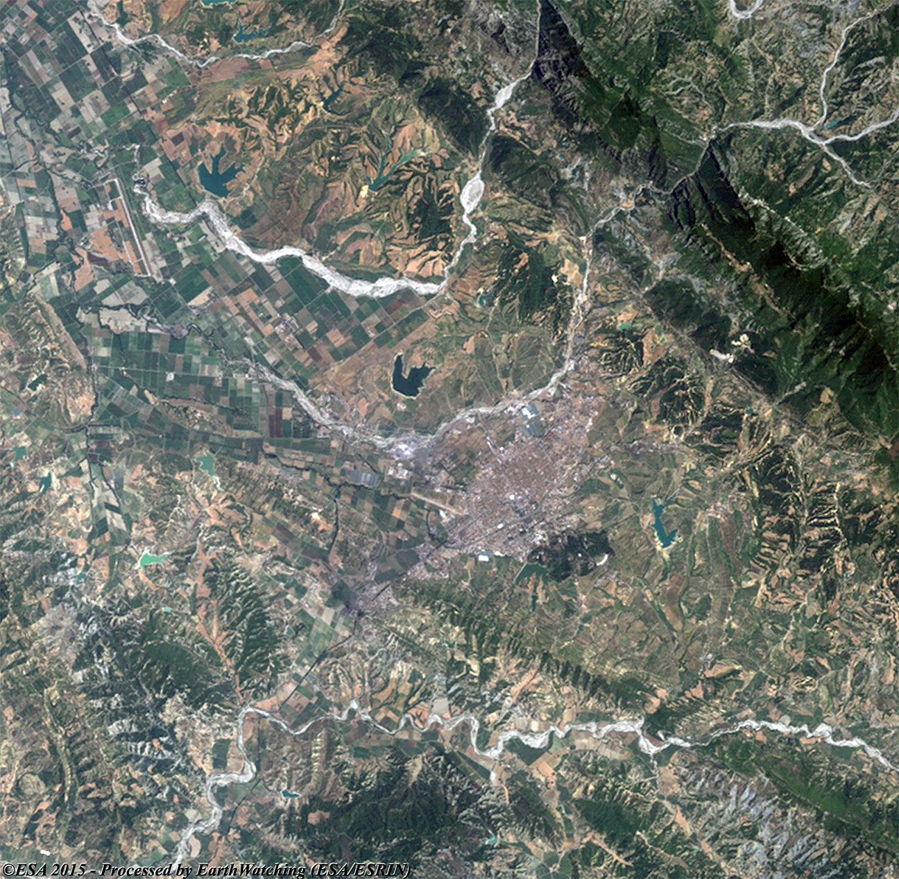
Today we feature Tirana; located on the Ishm River, just west of the Sar Mountains. It is the largest city and the commercial, manufacturing, and cultural centre of Albania. Tirana is connected by rail to the port city of Durrës, on the Adriatic Sea. Major products include textiles, metal goods, footwear, agricultural machinery, and processed food. The settlement, located at the crossroads of several caravan trails, was established in the early 17th century during the Ottoman Empire's domination of Albania, and was originally known as Teheran. It remained relatively small during the next two centuries of Turkish rule. In 1920, when the city was declared capital of independent Albania, its population numbered less than 20,000. In an attempt to increase the city's population, King Zog redesigned and rebuilt the city during the 1920s and 1930s. Despite this renovation, growth was still slow because the city lacked basic services. By the late 1930s the approximately 25,000 Tiraneans were still without electricity, running water, or a sewer system. Today Tirana, as shown in these Landsat images acquired in a time window of 30 years (before and after), has become a large city and a significant area of urban development visible in the 2015 image to the north west demonstrates this. Another aim of these images is to promote the opportunity to download Landsat data through the ESA portals, where images captured every day are made available in near real time to the users and the scientific community. Landsat full resolution data products are freely available for immediate download at: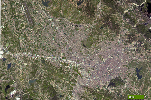 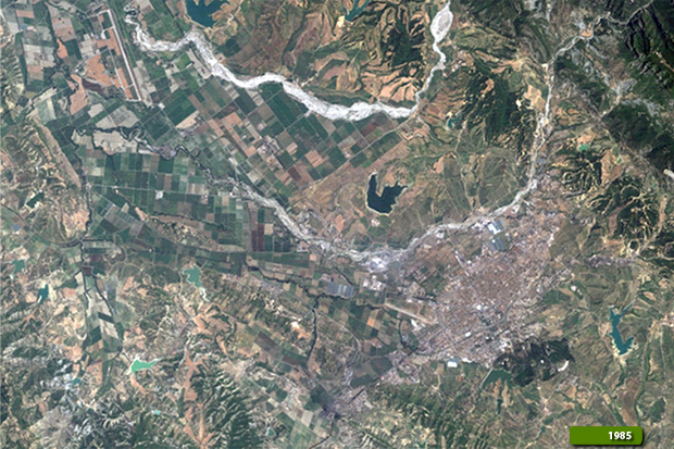
View large format slider View Landsat 8 OLI high resolution image (JPG 676 KB)
|
|||||||||||||||||||||