 Baku, Azerbaijan
Baku is the capital and largest city of Azerbaijan, as well as the largest city on the Caspian Sea and of the Caucasus region. Baku is located 28 metres below sea level, which makes it the lowest lying national capital in the world and also the largest city in the world located below sea level. It is located on the southern shore of the Absheron Peninsula, alongside the Bay of Baku. At the beginning of 2009, Baku's urban population was estimated at just over two million people. Officially, about 25 percent of all inhabitants of the country live in Baku's metropolitan area. Baku is divided into eleven administrative districts (raions) and 48 townships. Among these are the townships on the islands of the Baku Archipelago, and the town of Oil Rocks built on stilts in the Caspian Sea, 60 kilometres away from Baku. The Inner City of Baku, along with the Shirvanshah's Palace and Maiden Tower, were inscribed as a UNESCO World Heritage Site in 2000. According to the Lonely Planet's ranking, Baku is also among the world's top ten destinations for urban nightlife. The city is the scientific, cultural and industrial centre of Azerbaijan. Many sizeable Azerbaijani institutions have their headquarters there, including SOCAR, one of the world's top 100 companies. The Baku International Sea Trade Port is capable of handling two million tons of general and dry bulk cargoes per year. In recent years, Baku has become an important venue for international events. It hosted the 57th Eurovision Song Contest in 2012, the 2015 European Games, the 2016 European Grand Prix and will host UEFA Euro 2020. The city is renowned for its harsh winds, which is reflected in its nickname, the "City of Winds". More information is available on Wikipedia
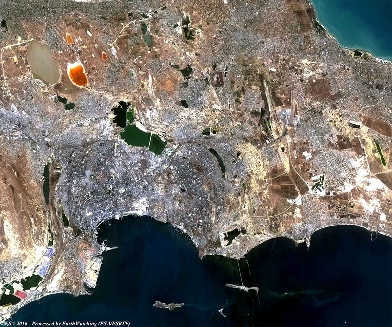
This week our tour over major cities continues with a visit to Baku (or Baki). Baku is situated on the Abşeron Peninsula in the east of Azerbaijan. A port on the west coast of the Caspian Sea, the city is close to major petroleum fields near the border with Iran, and oil refining is its chief industry. Many residents work in refineries, in factories producing equipment for oil production, and at nearby drilling centres. Pipelines carry oil products to Batumi, Georgia, on the Black Sea. Baku also has shipyards and factories producing metal cable, cotton, leather, and foodstuffs. Although the city saw some civil strife in the early 1990s as the country gained independence from the Union of Soviet Socialist Republics (USSR), the continuing productivity of the oil fields offers Baku greater prospects for prosperity than most cities in the region. In the vicinity of the city there are a number of mud volcanoes (Keyraki, Bogkh-bogkha, Lokbatan and others) and salt lakes (Boyukshor, Khodasan to name only two). These images acquired by the Landsat 5 and 8 satellites with a time window (before / after) of twenty-eight years, aim to show the urban difference in Baku from 1988 until today. In the image comparison, users can see the urban development especially in the north area of the city and along the coast of the harbour area, where new infrastructures are made. Another aim of these images is to promote the opportunity to download Landsat data through the ESA portals, where images captured every day are made available in near real time to the users and the scientific community. Landsat full resolution data products are freely available for immediate download at: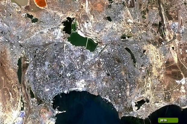 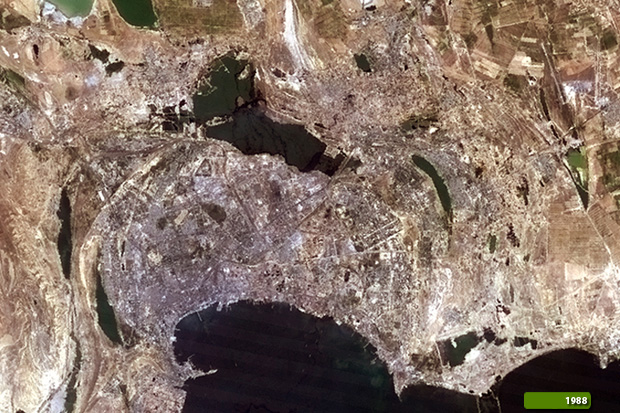 View Landsat 5 TM high resolution image (JPG 442 KB) View Landsat 8 OLI high resolution image (JPG 456 KB)
|
|||||||||||||||||||||