- All Categories (1099)
- Data (11)
- News (49)
- Missions (13)
- Events (19)
- Tools (11)
- Activities (1)
- Campaigns (3)
- Documents (992)
DATA
Discover and download the Earth observation data you need from the broad catalogue of missions the European Space Agency operate and support.
Data - EO Sign In Authentication (Open)
SMOS Tropical Cyclone Wind Radii Fixes
The SMOS WRF "fixes" to the best-track forecasts contain: the SMOS 10-min maximum-sustained winds (in knots) and wind radii
Data - EO Sign In Authentication (Open)
SMOS - CryoSat L4 Sea Ice Thickness
The SMOS-CryoSat merged Sea Ice Thickness Level 4 product, in NetCDF format, is based on estimates from both the MIRAS and
Data - EO Sign In Authentication (Open)
SMOS NRT L2 Swath Wind Speed
Each product contains parts of ascending and descending orbits and it is generated by Ifremer, starting from the SMOS L1B
Data - EO Sign In Authentication (Open)

SMOS Soil Freeze and Thaw State
The SMOS Level 3 Freeze and Thaw (F/T) product provides daily information on the soil state in the Northern Hemisphere based
Data - EO Sign In Authentication (Open)
SMOS L3 Daily Wind Speed
for a specific day, provided with the same grid than the Level 2 wind data (SMOS L2WS NRT) but separated into ascending and
Data - Campaigns (Open)
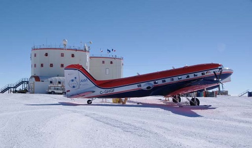
DOMECair (GOCE)
The airborne survey DOMECair 2013 and its instrumentation was designed to obtain calibration and validation data for two
Data - EO Sign In Authentication (Open)
SMOS NRT Data Products
The SMOS Near Real Time products include Level 1 geo-located brightness temperature and Level 2 geo-located soil moisture
Data - EO Sign In Authentication (Open)
SMOS L1 and L2 Science data
SMOS Level 1 data products are designed for scientific and operational users who need to work with calibrated MIRAS instrument
Data - EO Sign In Authentication (Open)
SMOS L3 Sea Ice Thickness
thickness is retrieved from the SMOS L1C product, up to a depth of approximately 0.5-1 m, depending on the ice temperature and
Data - EO Sign In Authentication (Open)
SMOS Auxiliary Data
It is used by both the ocean salinity and soil moisture operational processors to store the geophysical parameters from ECMWF
Data - Campaigns (Open)

WISE
The objective of WInd and Salinity Experiment 2001 (WISE 2001) was to get more data points and better wind speed (WS) measurements