- All Categories (178)
- Data (3)
- News (21)
- Missions (20)
- Events (15)
- Tools (1)
- Activities (9)
- Documents (109)
Event - Workshop

2nd Space for Hydrology Workshop
The workshop aimed to assess the current stage of knowledge and activities in space-based hydrological observations and to
Mission - Earth Explorers

Aeolus
This is currently the only technology that can provide direct wind profile observations in clear air, inside thin clouds
Document - General Reference

SCI-PUB-14-0002-v01-WMO-report-1.0.pdf
The ERS Scatterometers in the Global Climate Observing System report describes the current and anticipated relationship and
Data - Fast Registration with approval (Restrained)
ERS-1/2 ATSR Averaged Surface Temperature [AT1/AT2_AR__2P]
sets provide, for sea cells, nadir and dual view sea surface temperatures, and for land cells, land surface temperature (currently
Data - Fast Registration with immediate access (Open)

ERS PRARE Precise Orbit Product (ERS.ORB.POD/ERS.ORB/PRC)
Several orbit solutions are currently distributed: A new set of ORB POD (Precise Orbit Determination - REAPER v2) computed
News - Success Stories
Aeolus enhances volcanic ash forecasts for aviation safety
Current projects supporting PANGEA include the D-TECT ERC, the PANGEA4CalVal TWINNING and the L2A+, ACPV ESA studies.
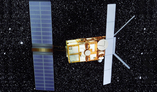
Mission - Earth Explorers
Aeolus Data
Aeolus Quality Control Reports on L1B/Instrument, L2A and L2B products are currently available to Aeolus Cal/Val teams and
Mission - Earth Explorers

ALADIN
Aeolus Quality Control Reports on L1B/Instrument, L2A and L2B products are currently available to Aeolus Cal/Val teams and
Activity - Instrument characterisation and algorithm studies

ESA satellites and instruments calibration landing page
Data Outages: Information currently not available online.
Event - Workshop

SEASAR 2012
Aouf 14:00 - 14:20 Towards consistent inversion of wind, waves and surface current from SAR Bertrand Chapron (IFREMER, France
Activity - Quality
SCIRoCCo
Author: The SCIRoCCo Team Abstract: The ERS Scatterometers in the Global Climate Observing System report describes the current
News - Thematic area articles

How satellite data help to shape society
Title: Current drought situation in Ebro basin Description: The SMOS soil-moisture-based drought monitor is updated monthly
Mission - Heritage Missions
SAR (ERS) Processor Releases
It should be noted that for SAR, each product ordered is processed directly from the raw data, using the current version
Event - Training

EO Summer School 4
Keynote lectures on global change issues are also given to discuss the current state of the science of global change and
Event - Workshop
SEASAR 2006
requirements Formulate recommendations for algorithm and new products development To present ESA studies results on wind, wave and currents
Event - Training
EO Summer School 1
Keynote lectures on global change issues are also given to discuss the current state of the science of global change and
Document - Technical Note

ERS-1-SAR-Antenna-Pattern-Estimation.pdf
This report covers: Re-estimation of the ERS-1 antenna pattern and analysis of the way the VMP applies the antenna pattern.
Activity - Quality
SnowPEx
to bring together scientists and institutions working in seasonal snow pack monitoring in order to assess the quality of current
Tools - Visualisation
HEDAVI
ESA’s Heritage EO data currently cover more than 30 years of observations and enable the analysis of spatio-temporal dynamics