- All Categories (20)
- Data (1)
- News (1)
- Missions (1)
- Events (1)
- Activities (1)
- Documents (15)
Document - General Reference

The Compact High Resolution Imaging Spectrometer (CHRIS)- The Future of Hyperspectral Satellite ---
Document - General Reference
Overview of an Intelligent Sensorweb for Integrated Earth Sensing Project
Document - General Reference
BIOMASS-Report-for-Mission-Selection-An-Earth-Explorer-to-observe-forest-biomass.pdf
The objective of the BIOMASS Mission is to determine the global distribution of forest biomass by reducing the uncertainty in the calculation of carbon stock and fluxes associated with the terrestrial biosphere.
Data - EO Sign In Authentication (Open)
PROBA-1 CHRIS Level 1A
spectral bands, nadir ground sampling distance 17m @ 556km All Proba-1 passes are systematically acquired according to the current
Document - Product Readme Note

Fine-Resolution-Air-Quality-Monitoring-from-a-Small-Satellite-CHRIS-PROBA.pdf
This paper was published in "Sensors" and demonstrates the ability of the European Space Agency's small satellite sensor CHRIS/PROBA to provide reliable AOT estimates at a spatially detailed level over Hong Kong, using a modified version of the dense dark vegetation (DDV) algorithm devised for MODIS.
Document - General Reference
Autonomy-in-action-Ten-years-of-Proba-1.pdf
This is an article extracted from the ESA Bulletin Nr.148.
Document - General Reference
CoReH2O-Report-for-Mission-Selection-An-Earth-Explorer-to-observe-snow-and-ice.pdf
This report describes the CoReH2O (Cold Regions Hydrology high-resolution Observatory) mission, which was selected for feasibility study in the third cycle of Earth Explorers.
Document - General Reference
On-the-Potential-of-CHRIS-PROBA-for-Estimating-Vegetation-Canopy-Properties-from-Space.pdf
On the Potential of CHRIS/PROBA for Estimating Vegetation Canopy Properties from Space.
Document - Technical Note

Note on CHRIS Acquisition Procedure and Image Geometry
The aim of this document is to clarify the acquisition procedure CHRIS on-board the PROBA satellite. It provides a detailed description of the acquisition procedure and summarises the implications for the geometrical properties of the CHRIS images.
Document - Publication - Paper

Mapping of chlorophyll and suspended particulate matter maps from CHRIS imagery of the Oostende ---
The image set created on 5 August 2003 by CHRIS/PROBA is analyzed to assess the feasibility of producing suspended particulate matter (SPM) and chlorophyll (CHL) maps.
Document - General Reference
Correction-of-systematic-spatial-noise-in-push-broom-hyperspectral-sensors.pdf
We present a new technique that faces the problem of removing the spatiallycoherent noise known as vertical striping, usually found in images acquired by push-broom sensors.
Document - Product Document

Leaf-area-index-from-CHRIS-satellite-data-and-applications-in-plant-yield-estimation.pdf
This paper focuses on the optical remote sensing aspects of the ISIES project.
Document - General Reference
The PROBA-CHRIS Mission- A Low-Cost Smallsat for Hyperspectral, Multi-Angle, Observation of the ---
Event - Training

Advanced Training Course in Land Remote Sensing 2012
Objectives The objectives of this advanced Dragon training course were: To inform on past, current and future EO satellite
Document - General Reference
Big-year-for-small-satellite-ESAs-second-in-orbit-technology-demonstration-mission-Proba-2.pdf
This is an article extracted from the ESA Bulletin Nr.144.
Document - General Reference
ESA-Achievements-More-than-thirty-years-of-pioneering-space-activity.pdf
This volume gives a general overview of ESA's activities and programmes by analyzing the single missions where it is involved.
Document - Technical Note
A-comparison-of-superresolution-reconstruction-methods-for-multiangle-CHRIS-Proba-images.pdf
This paper presents the results of three superresolution methods applied to multiangular CHRIS/Proba data: three methods, namely non-uniform interpolation and de-convolution, iterative back-projection, and total variation are examined.
News - Thematic area articles

Space helps monitor Earth’s changing biosphere
Ocean chlorophyll concentrations can change when ocean currents shift, or sea temperature rises - all impacts of climate
Mission - Third Party Missions
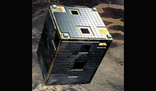
CHRIS Overview
covering the short-wave IR spectral band (SWIR, typically out to 2400 nm), in addition to the visible/near-IR (VNIR) band current
Activity - Projects
Dragon 3 Cooperation Programme
Surveying and Mapping China Mirjam Bilker-Koivula, Hannu Ruotsalainen Finnish Geodetic Institute Finland 10677 - GSM4GCM Current