- All Categories (47)
- News (3)
- Missions (6)
- Events (3)
- Tools (1)
- Activities (2)
- Documents (32)
Mission - Earth Explorers
GOCE
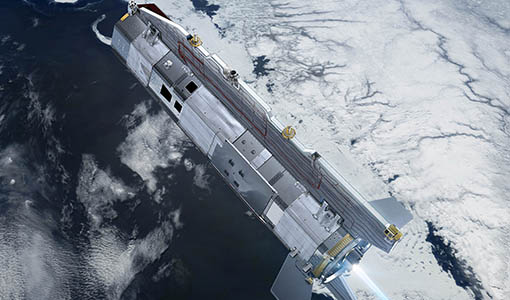
Explorer (GOCE) mission mapped Earth's geoid very accurately, opening a window into Earth's interior structure as well as the currents
Document - Proceedings
First-International-GOCE-Workshop-GOCE-Germany-Oceanography.pdf
describes using data from the GOCE satellite mission in order to determine structure and transport of the Antarctic Circumpolar Current
Activity - Quality
EDAP
The following missions are currently being considered as part of the Automatic Identification System (AIS) and Radio Frequency
Tools - Analysis
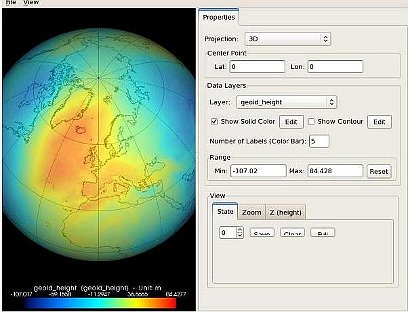
GOCE User Toolbox
Data output formats The current data formats that GUT can provide in output are: netCDF (Climate and Forecast Metadata Convention
Document - Conference Presentation - Poster
7-Highres-Surface-Velocity-Monitoring-Wide-Swath-SAR.pdf
High resolution Surface Velocity Monitoring with Wide Swath SAR: A User´s Guide to the Range Doppler Method Johnny Johannessen (NERSC, Norway)
News - Data Release news
GOCE EGG L1b reprocessed data published
The GOCE L2 data, including the gravity field models, are currently being regenerated and will be available in Q2 2019.
Mission - Earth Explorers
GOCE Objectives
Thanks to this current, the coastal waters of Europe are 4°C warmer than waters at equivalent latitudes in the north Pacific
Document - Proceedings
First-International-GOCE-Workshop-GOCE-Netherlands-Oceanography.pdf
This presentation from ESA's First International GOCE Workshop describes the dynamics and operation of the thermohaline circulation, the global scale transport of heat and salt (and other water characteristics) by the oceans.
Activity - Quality
SLAP
Currently, in excess of 701,000 Level 1 TM and 84,000 Level 1 ETM+ products have been reprocessed and released under the
Document - Proceedings
First-International-GOCE-Workshop-IMPACT-ON-OCEANOGRAPHY.pdf
This presentation from ESA's First International GOCE Workshop describes the impact of the GOCE mission for oceanography
Document - Proceedings
First-International-GOCE-Workshop-GOCE-UK-Oceanography.pdf
This presentation from ESA's First International GOCE Workshop describes the role of GEOID in ocean modelling and assimilation
Document - General Reference
Earth-Observation-from-Space-supporting-Biodiversity-Conservation.pdf
This brochure provides an overview of the ESA-funded Diversity project, which aims to demonstration the contribution Earth observation makes towards monitoring the trends and status of different marine and terrestrial ecosystems relevant to diversity.
News - Thematic area articles
Satellite data central to ocean monitoring
microwave monitoring instruments, optical imagers, and infrared radiometers, which can map ocean variables related to ocean currents
Mission - Earth Explorers
EGG
This opened a window into Earth's interior structure, as well as the currents circulating within the depths of its oceans
Document - General Reference
Earth-Observation-Services-Today-Using-Radar-from-Space.pdf
This booklet provides descriptions of EO services available today from specialist providers for the marine environment e.g. CLS (Collecte Localisation Satellites] and NERSC (Nansen Environmental and RemoteSensing Centre], Ocean Numerics, ARGOSS, MeteoMer and Satellite Observing Systems (SOS].
Document - Technical Note
34th AATSR QWG Meeting Summary
The 34th AATSR QWG Meeting was held on 28th/29th March 2017 at RAL, Harwell, U.K. ThisMemorandum states the objectives of the Meeting, gives a selected highlight, and summarisesthe discussions that took place.
Mission - Earth Explorers
SSTI ANTEX Data
data were generated from 154 days in 2009 GOCE SSTI-B PCVs data were generated from the available data in 2010-2012 The current
Document - Conference Presentation - Poster
04_OCT2013_ESA-EO_programmes.pdf
ESA EO missions and their exploitation for science and applications ESA


