- All Categories (62)
- Data (2)
- News (7)
- Missions (3)
- Events (4)
- Tools (1)
- Activities (4)
- Documents (41)
Document - Proceedings

1st MSG RAO Workshop
Proceedings of the workshop organised by ESA and EUMETSAT held in CNR of Bologna, Italy in May 2000.
Document - Conference Presentation - Poster

2_ppt_POLINSAR2013_dmonells_std.pdf
Performance Comparison between Dual Polarimetric and Fully Polarimetric data for DInSAR Subsidence monitoring D. Monells [Universitat Politecnica de Catalunya, UPC - Spain]
Document - Proceedings
2nd-MSG-RAO-Workshop.pdf
Proceedings of the 2nd MSG RAO Workshop, held on 9-10 September 2004 in Salzburg, Austria
Document - Proceedings
3rd-MSG-RAO-Workshop.pdf
Proceedings of the 3rd MSG RAO Workshop held on 5 June 2006 in Helsinki, Finland
Document - Technical Note

A-comparison-of-superresolution-reconstruction-methods-for-multiangle-CHRIS-Proba-images.pdf
This paper presents the results of three superresolution methods applied to multiangular CHRIS/Proba data: three methods, namely non-uniform interpolation and de-convolution, iterative back-projection, and total variation are examined.
Document - General Reference

Autonomy-in-action-Ten-years-of-Proba-1.pdf
This is an article extracted from the ESA Bulletin Nr.148.
Document - General Reference
Big-year-for-small-satellite-ESAs-second-in-orbit-technology-demonstration-mission-Proba-2.pdf
This is an article extracted from the ESA Bulletin Nr.144.
Document - General Reference
BIOMASS-Report-for-Mission-Selection-An-Earth-Explorer-to-observe-forest-biomass.pdf
The objective of the BIOMASS Mission is to determine the global distribution of forest biomass by reducing the uncertainty in the calculation of carbon stock and fluxes associated with the terrestrial biosphere.
Mission - Third Party Missions
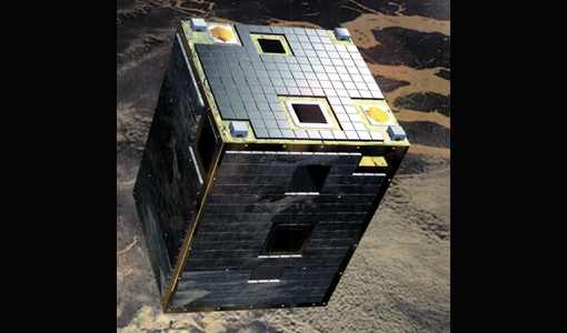
CHRIS Overview
covering the short-wave IR spectral band (SWIR, typically out to 2400 nm), in addition to the visible/near-IR (VNIR) band current
News - Success Stories
Commercial and international data for fire monitoring
The Finnish ICEYE constellation, added to the TPM programme in 2021, currently consists of 27 synthetic aperture radar (SAR
Document - General Reference
CoReH2O-Report-for-Mission-Selection-An-Earth-Explorer-to-observe-snow-and-ice.pdf
This report describes the CoReH2O (Cold Regions Hydrology high-resolution Observatory) mission, which was selected for feasibility study in the third cycle of Earth Explorers.
Document - General Reference
Correction-of-systematic-spatial-noise-in-push-broom-hyperspectral-sensors.pdf
We present a new technique that faces the problem of removing the spatiallycoherent noise known as vertical striping, usually found in images acquired by push-broom sensors.
Document - Conference Presentation - Poster
D3T3a_Schmullius_LTC2013.pdf
D3T3a Forest & Agriculture C. Schmullius
News - Success Stories

Earth Observation data to improve navigation risk modelling and shipping routes
improve the detection of unreported features in the maritime AIS system and the statistical evaluation of the accuracy of current
Document - Newsletter

Earth Online Newsletter 15 December 2023
This issue of the Earth Online Newsletter covers a selection of the latest news and events from ESA.
Activity - Quality

EDAP
The following missions are currently being considered as part of the Automatic Identification System (AIS) and Radio Frequency
Activity - Instrument characterisation and algorithm studies

ESA satellites and instruments calibration landing page
Data Outages: Information currently not available online.
Document - General Reference
ESA-Achievements-More-than-thirty-years-of-pioneering-space-activity.pdf
This volume gives a general overview of ESA's activities and programmes by analyzing the single missions where it is involved.
Document - Product Readme Note

Fine-Resolution-Air-Quality-Monitoring-from-a-Small-Satellite-CHRIS-PROBA.pdf
This paper was published in "Sensors" and demonstrates the ability of the European Space Agency's small satellite sensor CHRIS/PROBA to provide reliable AOT estimates at a spatially detailed level over Hong Kong, using a modified version of the dense dark vegetation (DDV) algorithm devised for MODIS.