- All Categories (50)
- News (14)
- Missions (1)
- Events (11)
- Tools (1)
- Activities (4)
- Campaigns (1)
- Documents (18)
News - Events and Proceedings
Φ-Week Triumphs
Opening Session Title: Φ-Week's Opening Session Description: During the fourth edition of ESA’s Φ -Week, Josef Aschbacher, current
Document - Product Specifications
WorldDEM-Technical-Specification.pdf
This document describes the specification and format of the TerraSAR-X/TanDEM-X WorldDEM(TM) product portfolio. It provides a description of the post-processing (editing) process, the characteristics of the Digital Elevation Models and the ancillary data that are collected and/or generated during the data finishing process as well as the delivery formats.
Event - Meeting
VH-RODA and CEOS SAR workshop
The workshop provided an open forum for the presentation and discussion of current status and future developments related
Event - Workshop
VH-RODA 2021 Workshop
the Workshop will provide an open forum (new space, commercial and institutional) for the presentation and discussion of current
Document - General Reference
Third Party Missions Brochure
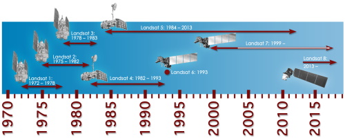
This brochure summarises ESA's Third Party Missions programme, providing a timeline and examples of content related to some of the missions.
Campaign
TerraSARSIM
The current mission design envisages flying two separate radars on separate platforms.
Document - Technical Note
Technical Note on Quality Assessment for Landsat 1-7
Technical Note on Quality Assessment for Landsat 1-7
News - Success Stories
Synergy of space data helps modernise irrigation systems
A key part of modernising irrigation systems, however, is gaining accurate information on current water management methods
News - General News
Stunning new features for ESA and NASA altimetry portal cs2eo.org
Currently available polygons include a selection of glacier outlines from the Randolph Glacier Inventory (RGI) Version 6,
News - Success Stories
Space data unearths small-scale mining in Burkina Faso
Burkina Faso is currently the fastest-growing and fifth-largest gold producer in Africa, with ASM providing a livelihood
Event - Workshop
Space and the Arctic 2009 Workshop
possibilities for the future : Volker Liebig, Director of ESA EO Programme Observations of the Arctic - EUMETSAT's Contribution to Current
Activity - Quality
SLAP
Currently, in excess of 701,000 Level 1 TM and 84,000 Level 1 ETM+ products have been reprocessed and released under the
Document - Proceedings
SEASAR-2012-sessions-summaries-seed-questions-recommendations.pdf
This document gathers together the sessions summaries with seed questions discussion and recommendations of the SEASAR 2012 workshop.
Event - Workshop
SEASAR 2012
Aouf 14:00 - 14:20 Towards consistent inversion of wind, waves and surface current from SAR Bertrand Chapron (IFREMER, France
News - Events and Proceedings
National missions in the spotlight at the Living Planet Symposium
two sessions tomorrow, Thursday 26 May, to introduce attendees to the profusion of national Earth observation missions currently
Mission - Third Party Missions
Multi Spectral Scanner (MSS) Processor Releases
GCP displacement B TM radiometric calibration Update to radiometric calibration strategy for TM reflective bands (Dark Current
News - Success Stories
Long-term satellite data show wind farms can affect local air currents
Long-term measurements allow before and after comparison Data from the heritage Envisat satellite currently maintained accessible
Document - Product Document
LANDSAT_Products_Description_Document.pdf
This document acts as a User Guide to the Landsat MSS, TM and ETM+ archives, focussing more specifically on the Landsat TM and ETM+ products from the Kiruna, Maspalomas and Matera archives (including from the Matera, Fucino, Neustralitz, O’Higgins, Malindi, Libreville and Bishkek ground stations) that have been generated as part of the ESA archive bulk-reprocessing project.
Event - Workshop
Insurance Industry Workshop on Earth Observation
Objectives The workshop objectives were: To ensure that the re/insurance community is aware of current and new generation


