- All Categories (13612)
- News (33)
- Missions (14)
- Events (8)
- Campaigns (2)
- Documents (13555)
News - Operational News
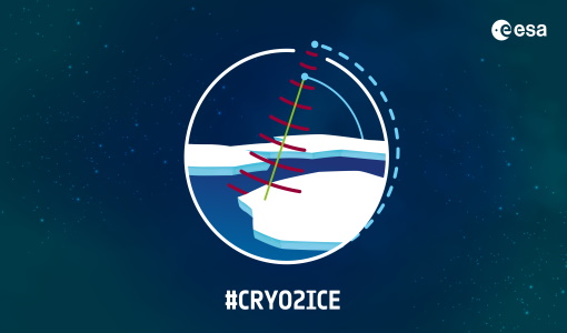
A Closer Look at CRYO2ICE Manoeuvres
The new in-sync measurements will also help map snow over the poles and advance our understanding of currents in polar oceans
Mission - Earth Explorers

About CRYO2ICE
The measurements will also help map snow over the poles and advance our understanding of currents in polar oceans, with further
Event - Training

Advanced Training Course in Ocean Remote Sensing 2011
Background and access to current and future Chinese, ESA and TPM satellite missions in ocean remote sensing were presented
News - Operational News

Announcement for CryoSat Quaternions Product users
The Quaternions Products, generated by the Ice Star Tracker processor are currently available to download from the cryo-proqua
News - Data Release news

Back-processed data from 2010 now available for CryoTEMPO-EOLIS Baseline 2
Arctic Canada North High Mountain Asia (Central/South East/South West Asia) Russian Arctic Svalbard Iceland Regions that are currently
News - Success Stories

COP26 fuels interest in satellite data
operational and non-operational ESA missions provide long-term Earth observational records, giving essential context to current
Document - General Reference

CoReH2O-Report-for-Mission-Selection-An-Earth-Explorer-to-observe-snow-and-ice.pdf
This report describes the CoReH2O (Cold Regions Hydrology high-resolution Observatory) mission, which was selected for feasibility study in the third cycle of Earth Explorers.
News - General News
CRYO2ICE is now on Earth Online
The resulting data will have applications in the fields of sea ice, land ice, polar ocean currents, inland water and atmosphere
News - Success Stories
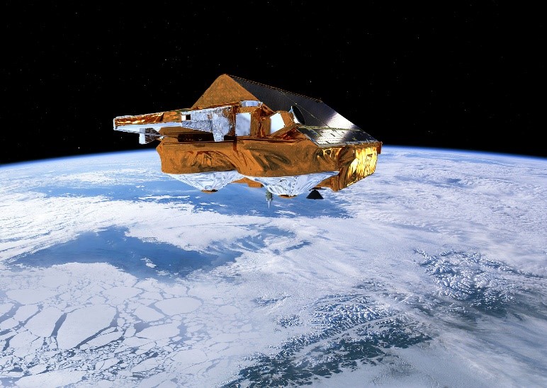
CRYO2ICE over Antarctica: revealing further insight on changing ice
The CryoSat-2 satellite is currently being aligned with ICESat-2 over Antarctica, unlocking fresh possibilities in the wealth
News - Operational News
CryoSat - Geographical Mode Mask 4.0 released
SAR Interferometric (SARIn) (purple) mode is used over steeply sloping ice-sheet margins, over some geostrophic ocean currents
Document - Quality Report

CryoSat Cyclic Quality Report 01 Dec 2013
The reason for missing L1B data products on this day is currently under investigation.
Document - Quality Report
CryoSat Cyclic Quality Report 01 Mar 2014
The current snow density value used in the CryoSat L2 products is 400 kg/m3. 7.4.9 SURFACE HEIGHT CryoSat offline
Document - Quality Report
CryoSat Cyclic Quality Report 01 Nov 2013
The current snow density value used in the CryoSat L2 products is 400 kg/m3. 7.4.9 SURFACE HEIGHT CryoSat offline
Document - Quality Report
CryoSat Cyclic Quality Report 01 Oct 2019
The SSHA value is used to compute the Freeboard in the sea-ice processing within the SAR chain; therefore it is not currently
Document - Quality Report
CryoSat Cyclic Quality Report 01 Sep 2019
The SSHA value is used to compute the Freeboard in the sea-ice processing within the SAR chain; therefore it is not currently
Document - Quality Report
CryoSat Cyclic Quality Report 02 Aug 2019
The SSHA value is used to compute the Freeboard in the sea-ice processing within the SAR chain; therefore it is not currently
Document - Quality Report
CryoSat Cyclic Quality Report 02 Oct 2013
The reason for missing L1B data products for these days is currently under investigation.
Document - Quality Report
CryoSat Cyclic Quality Report 02 Sep 2013
The current snow density value used in the CryoSat L2 products is 400 kg/m3. 7.4.9 SURFACE HEIGHT CryoSat offline
Document - Quality Report
CryoSat Cyclic Quality Report 03 Aug 2013
The current snow density value used in the CryoSat L2 products is 400 kg/m3. 7.4.9 SURFACE HEIGHT CryoSat offline
Document - Quality Report
CryoSat Cyclic Quality Report 03 Feb 2019
The SSHA value is used to compute the Freeboard in the sea-ice processing within the SAR chain; therefore it is not currently