- All Categories (51)
- Data (1)
- News (9)
- Missions (2)
- Events (6)
- Tools (1)
- Activities (1)
- Documents (31)
Event - Meeting
VH-RODA and CEOS SAR workshop
The workshop provided an open forum for the presentation and discussion of current status and future developments related
Event - Workshop
SEASAR 2012
Aouf 14:00 - 14:20 Towards consistent inversion of wind, waves and surface current from SAR Bertrand Chapron (IFREMER, France
News - Thematic area articles
How satellite data help to shape society
Title: Current drought situation in Ebro basin Description: The SMOS soil-moisture-based drought monitor is updated monthly
Mission - Third Party Missions
SAR (JERS-1) Processor Releases
The current JERS-1 SAR Instrument Processing Facility (IPF) version is v2.05p3, which was released on the 21 September 2015
News - Infographics
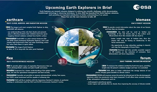
What are the next Earth Explorers?
Four more missions are currently planned - EarthCARE, Biomass, FLEX, and FORUM - which will further our understanding of
Document - Proceedings
SEASAR-2012-sessions-summaries-seed-questions-recommendations.pdf
This document gathers together the sessions summaries with seed questions discussion and recommendations of the SEASAR 2012 workshop.
Document - General Reference
The Earth Observation Handbook, 2010 Update - Key Tables
This is the 2010 update of the CEOS Earth Observation Handbook. You can browse the live database at http://database.eohandbook.com/ or download the printable PDF of key tables based on the 2010 database contents for a handy reference.
Document - Conference Presentation - Poster
3_towards_automated_classification.pdf
Toward automated classification of brightness fronts in RADARSAT-2 images of the ocean surface Christopher Jones (Dalhousie University Halifax, Canada)
News - Thematic area articles
Satellite data central to ocean monitoring
microwave monitoring instruments, optical imagers, and infrared radiometers, which can map ocean variables related to ocean currents
Event - Workshop
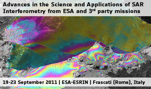
Fringe 2011 Workshop
The Fringe series of workshops started in 1992 and they are currently organised by ESA every two years.
Document - Conference Presentation - Poster
8_PolinSAR2013_soil_moisture_wetland_session_summary_Fina.pdf
Applications of SAR Polarimetry on Land: Soil Moisture and Wetlands
Document - Conference Presentation - Poster
04_OCT2013_ESA-EO_programmes.pdf
ESA EO missions and their exploitation for science and applications ESA
Mission - Heritage Missions
SAR (JERS-1) Products Information
main differences between the L1 CEOS products that were provided by JAXA (but are no longer available to users) and the current
Document - General Reference
Heritage Missions brochure
This brochure describes ESA's Heritage Space Programme and includes infographics describing some of the missions in the programme.
Document - General Reference
PolInSAR-2013-session-summaries-recommendations.pdf
This document provides the session summaries and recommendations from the PolInSAR 2013 workshop.
Document - Technical Note
JERS-Products-Comparison-Report.pdf
This Technical Note is in response to an action from the IDEAS+ MTR to assess the quality of JERS-1 SAR data with reference to the corresponding JAXA data.
Document - General Reference
Earth Explorers brochure
This brochure describes ESA's Earth Explorers Space Programme and includes infographics describing some of the missions in the programme.
Event - Workshop
POLinSAR 2013
Snow, Land Ice and Sea Ice Monitoring Hazards: Fire Monitoring, Volcanoes, Flooding, Earthquake Other applications Past, current


