- All Categories (19689)
- Data (6)
- News (42)
- Missions (63)
- Events (21)
- Activities (17)
- Campaigns (1)
- Documents (19539)
Activity - Projects

Dipolar Spherical Elementary Current Systems (DSECS) toolbox
this project is to create a user-friendly version of a previously developed analysis method for estimating ionospheric currents
Activity - Projects

Average Magnetic field and Polar current System model
The AMPS project outcome is a new climatological model of polar ionospheric currents, based on magnetic field measurements
News - Success Stories

Long-term satellite data show wind farms can affect local air currents
Long-term measurements allow before and after comparison Data from the heritage Envisat satellite currently maintained accessible
News - Operational News

Update on Swarm Field-Aligned Current Dual (FAC_AC) data missing from 7 November 2021
As a follow-up of the news published on 23 November 2021, we want to update Swarm users about the missing Field-Aligned Current
Mission - Heritage Missions
MOS-1/1B
MOS-1 and 1B, Japan’s first marine observation satellites, were designed to monitor ocean currents, sea surface temperature
News - Operational News

SMOS data distribution resumed
SMOS data distribution to end users was resumed on 12 March 2024 after confirmation of the adequate quality of the current
Mission - Earth Explorers

Aeolus
This is currently the only technology that can provide direct wind profile observations in clear air, inside thin clouds
Event - Workshop

CEOS SAR Workshop 2004
Satellites (CEOS) Working Group on Calibration and Validation, a SAR Workshop was held for the presentation and discussion of current
Mission - Earth Explorers

Swarm
its geological interpretation Determination of the 3D electrical conductivity of the mantle Investigatigation of electric currents
Data - EO Sign In Authentication (Open)
Envisat ASAR WS Single Look Complex L1 [ASA_WSS_1P]
for INSAR applications based either on wide-swath/wide-swath pairs or wide-swath/image mode pairs, applications of ocean current
Data - Fast Registration with approval (Restrained)
ERS-1/2 ATSR Averaged Surface Temperature [AT1/AT2_AR__2P]
sets provide, for sea cells, nadir and dual view sea surface temperatures, and for land cells, land surface temperature (currently
Mission - Third Party Missions
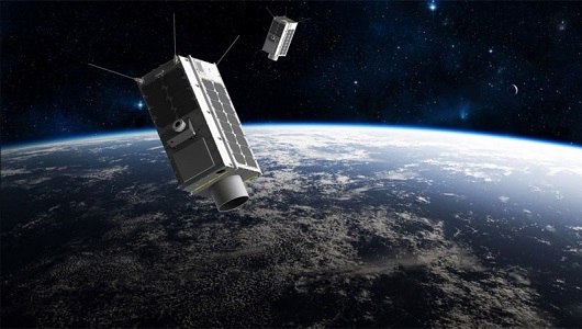
GHGSat
The GHGSat constellation currently consists of 12 satellites: GHGSat-D (GHGSat's technology demonstrator satellite) launched
Data - Fast Registration with immediate access (Open)
ERS-2 GOME Spectral Product L1
user to obtain spectrally and radiometrically calibrated radiances (including the correction for polarisation, leakage current
Mission - Third Party Missions
TanSat
60°, 120°, at 670 nm and 1640 nm The TanSat mission also performs a regular calibration, in four different modes: dark current
Data - Project Proposal (Restrained)
GHGSat archive and tasking
GHGSat data produce measures of vertical column densities of greenhouse gas emissions ((currently CH4, but eventually CO2
Data - Project Proposal (Restrained)

Spire live and historical data
The data also provides interesting research opportunities on topics as varied as ocean currents and GNSS-based planetary
News - Success Stories
Aeolus enhances volcanic ash forecasts for aviation safety
Current projects supporting PANGEA include the D-TECT ERC, the PANGEA4CalVal TWINNING and the L2A+, ACPV ESA studies.
News - Success Stories

10 years of Envisat data help to illuminate ocean processes
graphic shows the Geophysical Doppler shift over the Gulf Stream region in January 2010 overlaid on surface geostrophic current
News - Success Stories

Satellite data predicts lower wheat crop yield
Title: Current drought situation in Ebro basin Description: The SMOS soil-moisture-based drought monitor is updated monthly
Mission - Earth Explorers
Aeolus Data
Aeolus Quality Control Reports on L1B/Instrument, L2A and L2B products are currently available to Aeolus Cal/Val teams and