- All Categories (19675)
- Data (5)
- News (40)
- Missions (55)
- Events (21)
- Activities (17)
- Documents (19537)
Activity - Projects

Dipolar Spherical Elementary Current Systems (DSECS) toolbox
this project is to create a user-friendly version of a previously developed analysis method for estimating ionospheric currents
Activity - Projects

Average Magnetic field and Polar current System model
The AMPS project outcome is a new climatological model of polar ionospheric currents, based on magnetic field measurements
News - Success Stories

Long-term satellite data show wind farms can affect local air currents
Long-term measurements allow before and after comparison Data from the heritage Envisat satellite currently maintained accessible
News - Operational News

Update on Swarm Field-Aligned Current Dual (FAC_AC) data missing from 7 November 2021
As a follow-up of the news published on 23 November 2021, we want to update Swarm users about the missing Field-Aligned Current
Mission - Heritage Missions
MOS-1/1B
MOS-1 and 1B, Japan’s first marine observation satellites, were designed to monitor ocean currents, sea surface temperature
News - Operational News

SMOS data distribution resumed
SMOS data distribution to end users was resumed on 12 March 2024 after confirmation of the adequate quality of the current
Event - Workshop

2nd Space for Hydrology Workshop
The workshop aimed to assess the current stage of knowledge and activities in space-based hydrological observations and to
Mission - Earth Explorers

Aeolus
This is currently the only technology that can provide direct wind profile observations in clear air, inside thin clouds
Event - Workshop
CEOS SAR Workshop 2004
Satellites (CEOS) Working Group on Calibration and Validation, a SAR Workshop was held for the presentation and discussion of current
Mission - Earth Explorers

Swarm
its geological interpretation Determination of the 3D electrical conductivity of the mantle Investigatigation of electric currents
Data - Fast Registration with approval (Restrained)
ERS-1/2 ATSR Averaged Surface Temperature [AT1/AT2_AR__2P]
sets provide, for sea cells, nadir and dual view sea surface temperatures, and for land cells, land surface temperature (currently
Mission - Third Party Missions
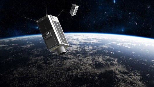
GHGSat
The GHGSat constellation currently consists of 12 satellites: GHGSat-D (GHGSat's technology demonstrator satellite) launched
Data - Fast Registration with immediate access (Open)
ERS-2 GOME Spectral Product L1
user to obtain spectrally and radiometrically calibrated radiances (including the correction for polarisation, leakage current
Mission - Third Party Missions
TanSat
60°, 120°, at 670 nm and 1640 nm The TanSat mission also performs a regular calibration, in four different modes: dark current
Data - Project Proposal (Restrained)
GHGSat archive and tasking
GHGSat data produce measures of vertical column densities of greenhouse gas emissions ((currently CH4, but eventually CO2
Data - Project Proposal (Restrained)

Spire live and historical data
The data also provides interesting research opportunities on topics as varied as ocean currents and GNSS-based planetary
News - Success Stories
Aeolus enhances volcanic ash forecasts for aviation safety
Current projects supporting PANGEA include the D-TECT ERC, the PANGEA4CalVal TWINNING and the L2A+, ACPV ESA studies.
News - Success Stories

Satellite data predicts lower wheat crop yield
Title: Current drought situation in Ebro basin Description: The SMOS soil-moisture-based drought monitor is updated monthly
Mission - Earth Explorers
Aeolus Data
Aeolus Quality Control Reports on L1B/Instrument, L2A and L2B products are currently available to Aeolus Cal/Val teams and
Mission - Earth Explorers

ALADIN
Aeolus Quality Control Reports on L1B/Instrument, L2A and L2B products are currently available to Aeolus Cal/Val teams and