- All Categories (399)
- News (12)
- Missions (8)
- Events (7)
- Activities (4)
- Campaigns (1)
- Documents (367)
News - Operational News

SMOS data distribution resumed
SMOS data distribution to end users was resumed on 12 March 2024 after confirmation of the adequate quality of the current
News - Success Stories

Satellite data predicts lower wheat crop yield
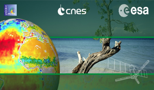
Title: Current drought situation in Ebro basin Description: The SMOS soil-moisture-based drought monitor is updated monthly
Activity - Instrument characterisation and algorithm studies

ESA satellites and instruments calibration landing page
Data Outages: Information currently not available online.
Activity - Quality
SCIRoCCo
Author: The SCIRoCCo Team Abstract: The ERS Scatterometers in the Global Climate Observing System report describes the current
Mission - Earth Explorers
SMOS product availability
+ NIR + Long LO + FTT LO + Electrical Stability LO + NIR + Long + FTT LO + Short LO + Long + Short Current
News - Operational News

SMOS data outage since 22 February 2024
spacecraft has been back in nominal mode since 25 February and on 27 February, the MIRAS instrument was switched on and is currently
Event - Training

EO Summer School 3
In line with observations it shows anti-cyclonically rotating surface currents and cyclonically rotating bottom currents.
Document - General Reference

The Nine Candidate Earth Explorer Missions - Magnetometry Mission
This report for assessment addresses the Magnetometry mission when it was selected with other nine Earth Explorer missions as a potential candidate for Phase A study.
Event - Training
EO Summer School 5
Keynote lectures on global change issues are also given to discuss the current state of the science of global change and
Mission - Earth Explorers

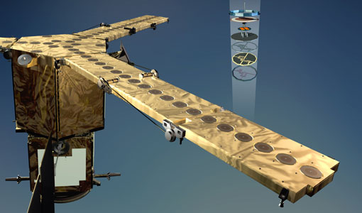
SMOS Objectives
SMOS Science The SMOS mission is a direct response to the current lack of global observations of soil moisture and ocean
Document - General Reference
Candidate-Earth-Explorers-in-Assessment-Phase.pdf
This flyer gives a quick overview on the candidate Earth Explorers missions in assessment phase.
Document - General Reference
New-possibilities-for-science-ESAs-operational-Sentinel-missions.pdf
This is an article extracted from the ESA Bulletin Nr. 140.
Document - General Reference
Earth-Observation-Market-Development-Benefits-to-Industry.pdf
This article was published in the ESA Bulletin Nr. 125 : it describes the Earth Observation Market Development programme, an activity designed to foster the use of Earth Observation based geo-information services within various market sectors.
Document - General Reference
The-CEOS-Earth-Observation-Handbook-2008.pdf
This report presents the main capabilities of satellite Earth observations, their applications, and a systematic overview of present and planned Committee on Earth Observation Satellites (CEOS) agency Earth observation satellite missions and their instruments. It also explores society's increasing need for information on our planet. This edition has a particular focus on climate change.
Document - General Reference
ERS-1-Mission-Announcement-of-Opportunity.pdf
The ERS-1 Announcement of Opportunity for basic scientific research studies and application-oriented projects issued in 1986 resulted in approximately 250 Proposals Principal Investigators (Pl's) being accepted within the ERS-1 Science and Application Plan.
Event - Conference
2nd SMOS Science Conference
The objectives of the 2nd SMOS Science Conference were: To provide the SMOS science communities with an update on past, current
News - Data Release news

New reprocessing of datasets celebrates 30 years of ERS
For each surface, the experts will use our current knowledge acquired over 30 years of experience, to improve the ERS altimetric
News - Thematic area articles

Satellite data central to ocean monitoring
microwave monitoring instruments, optical imagers, and infrared radiometers, which can map ocean variables related to ocean currents
Document - General Reference
Towards More Efficient Use of Radar-Altimeter Data
Twenty years ago, experimental altimeters on NASA's Skylab and Geos-3 were already demonstrating the potential of such instrumentation. This led in turn to the development and launch by NASA in July 1978 of the Seasat oceanographic satellite mission. Both Geos-3 and Seasat were very successful in their pioneering missions, but were limited somewhat by poor coverage in the case of Geos-3 and an abnormally short mission duration in Seasat's case.
Document - Product Cal/Val Plan/Report

CEOS-Working-Group-Calibration-and-Validation.pdf
This document describes the Committee on Earth Observation Satellite's involvement in Calibration and Validation activities for Earth Observation satellites.