- All Categories (44)
- Data (1)
- News (3)
- Missions (5)
- Events (1)
- Activities (2)
- Documents (32)
Document - Product Document

(A)ATSR 4th Reprocessing Product Format - User Summary.pdf
ATSR Technical Documents
Document - Technical Note

(A)ATSR Expert Support Laboratory FAST Level 1b Product Definition
(A)ATSR Expert Support Laboratory FAST Level 1b Product Definition.pdf
Event - Training

Advanced Training Course in Land Remote Sensing 2012
Objectives The objectives of this advanced Dragon training course were: To inform on past, current and future EO satellite
Mission - Heritage Missions
ATSR Overview
Applications KuroShio current captured by ERS The ATSR onboard the ERS missions had several applications spanning the disciplines
Document - General Reference

BIOMASS-Report-for-Mission-Selection-An-Earth-Explorer-to-observe-forest-biomass.pdf
The objective of the BIOMASS Mission is to determine the global distribution of forest biomass by reducing the uncertainty in the calculation of carbon stock and fluxes associated with the terrestrial biosphere.
Document - General Reference
CoReH2O-Report-for-Mission-Selection-An-Earth-Explorer-to-observe-snow-and-ice.pdf
This report describes the CoReH2O (Cold Regions Hydrology high-resolution Observatory) mission, which was selected for feasibility study in the third cycle of Earth Explorers.
Activity - Projects
Dragon 3 Cooperation Programme
Surveying and Mapping China Mirjam Bilker-Koivula, Hannu Ruotsalainen Finnish Geodetic Institute Finland 10677 - GSM4GCM Current
Document - User Guide

Envisat and ERS Missions Data Access Guide
The purpose of this document is to help users identify the various types of data that are available from the ENVISAT, ERS-1 and ERS-2 Earth observing satellites, the kind of applications that the data may be used for and, importantly, the practical procedures required for access - including user registration and then search, selection and retrieval or ordering of the data of interest.
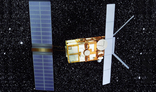
Mission - Heritage Missions

ERS Overview
global scale, the two ERS satellites expanded our understanding of the interaction between the oceans and atmosphere, ocean currents
Mission - Heritage Missions

ERS Radar Course 1
Therefore, microwaves easily penetrate clouds, and images can be acquired independently of the current weather conditions
Mission - Heritage Missions
ERS Radar Course 2
Therefore, microwaves easily penetrate clouds, and images can be acquired independently of the current weather conditions
Mission - Heritage Missions
ERS Radar Course 3
Therefore, microwaves easily penetrate clouds, and images can be acquired independently of the current weather conditions
Document - User Guide
ERS-1 Altimeter Products User Manual
The Altimeter Products User Manual describes the ERS-1 products for user's reference.