- All Categories (102)
- Data (6)
- News (28)
- Missions (2)
- Events (15)
- Tools (6)
- Activities (2)
- Campaigns (14)
- Documents (29)
NEWS
Discover the latest news on the European Space Agency's Earth Observation activities. Learn all about new data availability and how ESA's missions are performing.
News - Data Release news
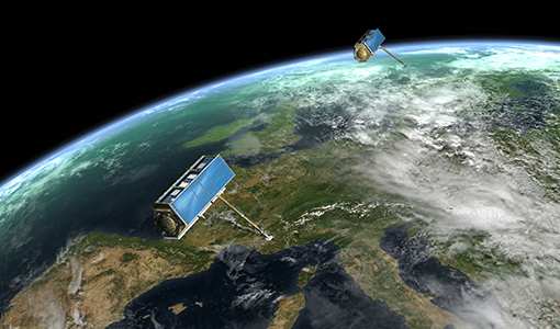
New FLEX-related campaign datasets released
New datasets have been released for three campaigns, covering activities supporting the upcoming FLEX mission.
News - Thematic area articles
Space data support Earth’s ecosystems
ESA’s Earth observation (EO) missions are making a critical contribution to monitoring transformations in our planet’s ecosystems, helping track changes in the vegetation, soil, and ocean that affect these systems.
News - Thematic area articles
How to use space data to probe humankind’s ancient past
Data disseminated by ESA’s Third Party Missions (TPM) programme are enabling archaeological investigations that could help to unravel the mysteries of past societies and cultures.
News - General News
3D Earth Online Visuals application takes off
A new app has just been launched, enabling you to explore ESA’s satellite missions in 3D and providing a new perspective on how satellite data contribute to our understanding of Earth systems, the climate, and their interactions.
News - Success Stories
Commercial and international data for fire monitoring
As climate change sparks a surge in the frequency and intensity of wildfires, satellite data disseminated through ESA’s Third Party Missions (TPM) programme are helping scientists to track and investigate these potentially damaging natural events.
News - Infographics
Twin satellites - TerraSAR-X and TanDEM-X
DLR's TerraSAR-X and TanDEM-X are twin satellites flying in close formation to acquire SAR data of unique geometric accuracy. Operating together, the missions deliver data that are used to generate Digital Elevation Models of Earth.
News - General News
International collaboration: Summarising ESA’s Third Party Missions
ESA’s Third Party Missions programme consists of more than 50 missions from around the world. Learn more about the Third Party Missions in this video.
News - General News
Pioneering science missions: Summarising ESA’s Earth Explorers
Designed for research purposes, ESA's Earth Explorer missions are dedicated to monitoring parts of Earth’s system. Learn more about the Earth Explorers in this video.
News - Success Stories
Showcasing success stories from ESA's Third Party Missions
ESA’s Third Party Missions programme consists of more than 50 missions from around the world.
News - Thematic area articles
Global understanding of Earth's land surfaces greatly boosted by satellite data
ESA perform land surface monitoring with a range of instruments onboard satellites acquiring optical and radar data. Collections of data from these missions are freely available for research purposes.
News - Infographics
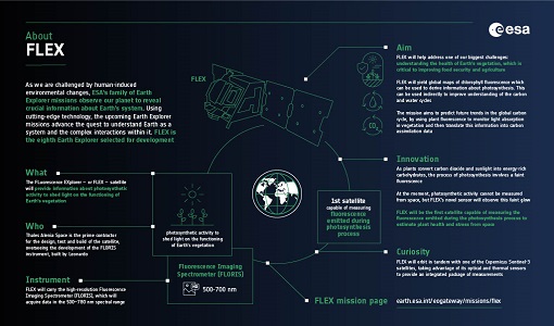
Measuring photosynthetic fluorescence - ESA's FLEX mission
Learn about ESA's upcoming FLEX mission, which is dedicated to gathering information about photosynthetic activity to shed light on the functioning of Earth's vegetation, in our latest infographic.
News - Success Stories
Tracking mountainous glaciers using TanDEM-X
Ice melting from mountain glaciers is one of the largest contributors to sea-level rise outside the large ice sheets of Antarctica and Greenland. New research leveraging the vast data from the TanDEM-X mission, has successfully mapped glacial elevation change over multiple mountainous regions of the world.
News - Infographics
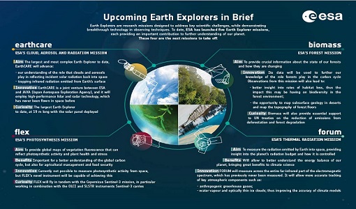
What are the next Earth Explorers?
Learn about the planned missions in the Earth Explorers programme - EarthCARE, Biomass, FLEX, and FORUM - which will further our understanding of Earth’s climate.
News - Thematic area articles
Space helps monitor Earth’s changing biosphere
Earth’s biosphere is continually changing. Through its pioneering Earth observation missions, ESA is making critical contributions to monitor these changes and their impacts on Earth’s water and carbon cycles.
News - Events and Proceedings
National missions in the spotlight at the Living Planet Symposium
In the framework of ESA’s Third Party Missions (TPM) programme, the agency offers access to the full data archives of almost 50 satellite missions, which are owned by organisations around the world.
News - Thematic area articles
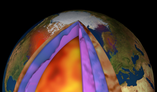
How ESA uses space data to explore deep Earth
As anthropogenic activities continue to unbalance our environment, scientists strive to fully understand the intricate interactions within Earth’s system.
News - Thematic area articles
Satellite data central to ocean monitoring
Over 95% of Earth’s water is found in our oceans, and yet sadly, oceans are under stress from climate change and pollution. Monitoring our oceans is vital for Earth’s survival and satellites are the primary means of long-term and independent observation of our vast ocean bodies and their associated coastal zones.
News - Thematic area articles
How space data are transforming the global food system
European Earth observation activities are accelerating a data-driven transformation in the agriculture sector that is helping farmers adapt to the dual challenges of climate change and population increase.
News - Thematic area articles
Satellite data boost global understanding of land surface
Understanding our changing land surface is essential in the study of climate change. Satellites are used to monitor changes to the material that covers Earth’s surface, so-called land cover, such as vegetation and water.
News - Data Release news
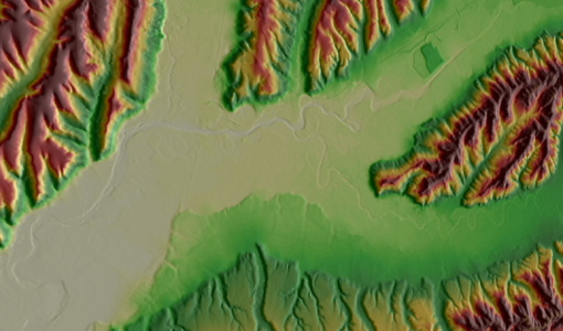
TerraSAR-X/TanDEM-X WorldDEM data now available to users
WorldDEM products have been added to the TerraSAR-X/TanDEM-X offering and are now available to users for research and application development following submission of a project proposal subject to evaluation and acceptance by ESA and the data owner.
