- All Categories (45)
- Data (16)
- News (11)
- Events (13)
- Documents (5)
NEWS
Discover the latest news on the European Space Agency's Earth Observation activities. Learn all about new data availability and how ESA's missions are performing.
News - Events and Proceedings
23 June 2023Last call for EarthCARE workshop abstracts
The abstract submission deadline for the EarthCARE Pre-Launch Science and Validation Workshop is just a week away. If you would like to present your work at the workshop, submit your abstract by 10 July.
News - Thematic area articles
3 Mar 2023Monitoring water on Earth's surface
ESA's Earth observation satellites are playing a leading role in furthering our understanding of how Earth's terrestrial hydrosphere is being influenced by humankind.
News - Thematic area articles
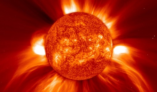
24 Jan 2023Satellites expand research on Space Weather and Sun-Earth Interactions
Earth observation data provide vital warnings about the impact of solar activity and strive to unravel the influence the Sun has on Earth’s system.
News - Thematic area articles
9 Dec 2022Global understanding of Earth's land surfaces greatly boosted by satellite data
ESA perform land surface monitoring with a range of instruments onboard satellites acquiring optical and radar data. Collections of data from these missions are freely available for research purposes.
News - Events and Proceedings
 2 Dec 2022
SMOS data advances space weather and ionospheric research
ESA is taking steps to innovate ways to use SMOS data to support solar scientists and the space weather community, as set out in a workshop held recently in ESRIN.
News - Infographics
 31 Oct 2022
EarthCARE - ESA's cloud, aerosol and radiation explorer mission
Learn about ESA’s upcoming cloud, aerosol and radiation explorer mission – EarthCARE – in our latest infographic.
News - Thematic area articles
 2 Feb 2022
Satellite data boost global understanding of land surface
Understanding our changing land surface is essential in the study of climate change. Satellites are used to monitor changes to the material that covers Earth’s surface, so-called land cover, such as vegetation and water.
News - Success Stories
 24 Mar 2021
Water mission takes on space weather
Adding to SMOS’ list of talents, new findings show that what was considered noise in the mission’s data can actually be used to monitor solar activity and space weather, which can damage communication and navigation systems.
News - Success Stories
 22 Dec 2020
Using Satellite Data to Predict Floods and Droughts
Scientists are turning to remote sensing to fill the in-situ data gap in hydrological data models in some parts of the world.
News - Success Stories
 10 Nov 2020
Publication of Coastal Current Intrusions from Satellite Altimetry
A new study entitled “Coastal current intrusions from satellite altimetry” has just been published in the journal Remote Sensing. This study comes from an international collaboration between the European Space Agency (ESA), MIO (Fr), CNR (It) and Serco (It) with the goal of monitoring coastal intrusions into the Gulf of Lion by analyzing multi-mission Satellite Altimetry data with Machine Learning methods
News - Data Release news
 8 Oct 2020
RADARSAT data on demand
In the framework of the Earthnet programme, ESA is distributing RADARSAT data on-demand to support EO science and research activities.