- All Categories (439)
- Data (2)
- News (40)
- Missions (1)
- Events (17)
- Tools (7)
- Activities (6)
- Campaigns (8)
- Documents (358)
NEWS
Discover the latest news on the European Space Agency's Earth Observation activities. Learn all about new data availability and how ESA's missions are performing.
News - Success Stories
7 Feb 2024Trailblazing ERS-2 mission enables climate change applications
As ESA’s ERS-2 satellite approaches Earth’s atmosphere for reentry, it’s time to reflect on the mission’s great achievements in powering climate-related applications.
News - General News
4 Oct 2023PROBA-V’s companion explores low-cost remote sensing
With the launch of PROBA-V’s Companion CubeSat (PV-CC), ESA supports a future where clusters of cheaper, small satellites could complement full-scale missions for Earth observation.
News - Spotlight on EO community
30 June 2023Meet the Quality Assurance for EO Team
The Quality Assurance For Earth Observation (also known as QA4EO) Service began its operations on 1 November 2019, providing support to the Data Quality and Algorithms Management Office at ESRIN, within the Sensor Performance, Processing and Algorithm section.
News - Spotlight on EO community
13 June 2023Meet one of ESA's first Africa Programme Research Fellows
Research Fellow, Dr Gladys Mosomtai, from the International Centre of Insect Physiology and Ecology (icipe), works on applying Earth observation data to better understand the spread of infectious disease in livestock, in Kenya.
News - Success Stories
8 May 2023PROBA-V data improve surface albedo products in Africa
As ESA’s PROBA-V satellite marks its 10-year launch milestone, data tasked during the mission’s lifetime are still being used to assess changes in land cover.
News - Thematic area articles
25 Apr 2023Remote sensing data map impacts of natural hazards
As climate change increases the frequency and severity of natural disasters, remote sensing data can warn about extreme events and help tackle emergency situations.
News - Data Release news
11 Apr 2023PROBA-V ‘Collection 2’ - Reprocessed Dataset available
The improved PROBA-V data (Collection 2) has been released. Data is available via the PROBA-V MEP and Terrascope platforms so users can freely exploit the data using Virtual machines, Jupyter Notebooks, and the new viewing application.
News - General News
21 Mar 2023ESA's excellent Earth Explorer missions extended to 2025
Since 2009, ESA’s Earth Explorer missions have pioneered breakthrough technologies and transformed our understanding of Earth’s system, from its core to the outer stretches of the atmosphere.
News - Data Release news
30 Jan 2023New version of the SMOS-CryoSat level 4 sea ice thickness product is now available
The new version 205 of the merged SMOS-CryoSat level 4 sea ice thickness product is now available on the SMOS dissemination service
News - Thematic area articles
9 Dec 2022Global understanding of Earth's land surfaces greatly boosted by satellite data
ESA perform land surface monitoring with a range of instruments onboard satellites acquiring optical and radar data. Collections of data from these missions are freely available for research purposes.
News - Thematic area articles
 2 Nov 2022
Satellites investigate Earth’s terrestrial hydrosphere
ESA’s Earth observation satellites are playing a leading role in furthering our understanding of how Earth’s water cycle is being influenced by humankind.
News - Thematic area articles
 16 Aug 2022
Satellites reveal changes to Earth’s icy zones
ESA’s Earth observation activities are helping scientists investigate the influence of climate change on widespread ice-losses across the planet.
News - General News
14 July 2022Campaign using surface reflectance data to support validation of Earth observation products
Scientists from around the world are set to take part in a drone monitoring campaign and inter-comparison exercise that will deliver surface reflectance data to support the validation of Earth observation products.
News - Thematic area articles
 30 June 2022
Transforming space data into climate action
ESA’s Earth observation activities are playing a key role in the revitalised global drive to combat climate change.
News - Thematic area articles
 31 Mar 2022
Satellite data central to ocean monitoring
Over 95% of Earth’s water is found in our oceans, and yet sadly, oceans are under stress from climate change and pollution. Monitoring our oceans is vital for Earth’s survival and satellites are the primary means of long-term and independent observation of our vast ocean bodies and their associated coastal zones.
News - Thematic area articles
 2 Feb 2022
Satellite data boost global understanding of land surface
Understanding our changing land surface is essential in the study of climate change. Satellites are used to monitor changes to the material that covers Earth’s surface, so-called land cover, such as vegetation and water.
News - Data Release news
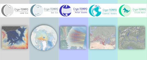 27 Jan 2022
New CryoSat-2 Thematic Products Now Available
As of January 2022, ESA has started releasing new CryoSat-2 Thematic Products, dedicated to five distinct areas: Sea Ice, Land Ice, Polar Oceans, Coastal Oceans and Inland Waters.
News - Success Stories
 13 Dec 2021
Ship trails in the Bay of Biscay observed using PROBA-V imagery
Ship trails have been perceived as convincing evidence of aerosol-cloud interaction. Ship emissions have been proven to contribute by about 1.9% and 2.9% to the increase in the global total and fine-mode aerosol optical thickness (AOT) respectively over a five year period (Peters et al. 20212).
News - Success Stories
 25 Nov 2021
COP26 fuels interest in satellite data
As COP26 stimulates action to reduce global warming, the essential role of satellite data in understanding and monitoring climate change is apparent.
News - Success Stories
 10 Nov 2021
Long-live PROBA-V
After eight years in space, the PROBA-V satellite ended its vegetation mission last 31 October, having gone well beyond expectations for global vegetation monitoring.