- All Categories (83)
- Data (7)
- News (17)
- Missions (2)
- Events (7)
- Tools (3)
- Activities (2)
- Documents (45)
NEWS
Discover the latest news on the European Space Agency's Earth Observation activities. Learn all about new data availability and how ESA's missions are performing.
News - How to guides
HEDAVI Discover: a step-by-step guide
The Heritage Data Visualisation tool (HEDAVI) is a platform developed by the French Science Consulting for Earth Observation group, VisioTerra, which allows users to freely access over 40 years of ESA Earth Observation Heritage data, Third Party Missions and some Copernicus data.
News - Success Stories
Discover Earth like never before: the HEDAVI tool
The Heritage Data Visualisation tool, or HEDAVI, enables the analysis of global spatio-temporal dynamics of natural and artificial environments, covering over 40 years of ESA Earth Observation Heritage data, Third Party Missions and some Copernicus data.
News - Success Stories
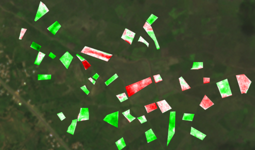
Monitoring the health of wheat crops from space
Very high resolution space data can be used to improve the detection of a plant disease that impacts a major global cereal crop.
News - Thematic area articles
Cloud-free collections key for land monitoring
Satellite imagery is a crucially important tool for monitoring the land, but cloud cover can often block parts of Earth’s surface from view, limiting subsequent analyses.
News - Data Release news
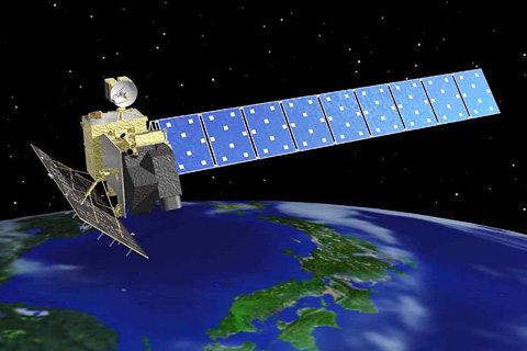
ALOS PRISM L1C European Coverage Cloud Free data collection now available for users
As part of Earthnet’s Third Party Missions Programme framework, ESA is pleased to announce that the ALOS PRISM L1C European Coverage Cloud Free data collection is now available for research purposes.
News - Success Stories
Commercial space data help to regreen grasslands in Africa
Commercial satellite imagery made available through ESA’s Third Party Missions programme is guiding an ambitious community-focused initiative to regrow natural grasslands in Sub-Saharan Africa.
News - Data Release news
ALOS PRISM Level 1C data collection now available for users
ESA offers registered users access to the ALOS PRISM (Panchromatic Remote-sensing Instrument for Stereo Mapping) OB1 L1C data acquired by ESA ground stations in the ADEN zone, plus some worldwide data requested by European scientists.
News - Infographics
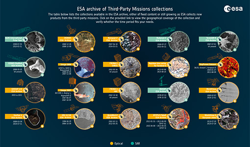
A summary of ESA Third Party Mission collections
A new summary is available, showcasing the ESA archives for Third Party Mission collections.
News - Events and Proceedings
Data preservation takes centre stage at Living Planet Symposium
Against the backdrop of the famed Rhine River, world-class scientists and Earth observation data-users are gathered this week in the historical city of Bonn, at the Living Planet Symposium (LPS).
News - Events and Proceedings
National missions in the spotlight at the Living Planet Symposium
In the framework of ESA’s Third Party Missions (TPM) programme, the agency offers access to the full data archives of almost 50 satellite missions, which are owned by organisations around the world.
News - Data Release news
PlanetScope and Skysat data available through ESA’s Third Party Missions Programme
Through ESA’s Third Party Missions Programme, researchers, scientists and companies from around the world can apply to access Planet’s high-frequency, high-resolution satellite data for non-commercial use.
News - Success Stories
Predicting crop yield using Planet data
The world’s population continues to grow, while the climate crisis is raising Earth’s temperatures and increasing the likelihood of extreme weather events – all of which affect food security.
News - Data Release news
Static Maps for ALOS African coverage available for users
ALOS Africa is a dataset of the best available (cloud minimal, below 10%) African coverage acquired by AVNIR-2 in OBS mode and PRISM in OB1 mode (all Backward, Nadir and Forward views, in separated products), two different collections one for each instrument.
News - Data Release news
ALOS PRISM collection now open
A Japanese Earth-imaging satellite from JAXA, the Advanced Land Observing Satellite (ALOS-1) was part of ESA's Third Party Missions Programme, in which ESA has an agreement with JAXA to distribute its data products.
News - General News
Improved resolution for SkySat data and extension of Planet data availability
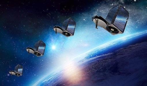
The SkySat satellites orbits has been lowered from 500km to 450km altitude and various processing improvements have been implemented by Planet.
News - Data Release news
ALOS PALSAR WB1 Collection now available online
Area Observation Mode (Burst Mode 1) collection, which will complete the existing ALOS PALSAR data offer.
News - Data Release news
PlanetScope and SkySat data now available
PlanetScope and SkySat missions under evaluation. Interested users can investigate suitability of the data for scientific and R&D activities.
