- All Categories (104)
- Data (28)
- News (27)
- Missions (4)
- Events (27)
- Tools (2)
- Activities (2)
- Campaigns (6)
- Documents (8)
NEWS
Discover the latest news on the European Space Agency's Earth Observation activities. Learn all about new data availability and how ESA's missions are performing.
News - General News
ESA's improved Earth system data records: what is in store for the future?
Fundamental Data Records (FDRs) are instrumental in advancing our understanding of Earth systems and for addressing societal challenges effectively. These long-term records contain uncertainty-quantified, calibrated and geo-located multi-instrument/multi-platform satellite sensor data spanning several decades to support climate-related applications.
News - Events and Proceedings
ESA Earth observation event supports quality of New Space data
In the context of a rapidly growing New Space economy, ESA’s traditional position as an Earth Observation (EO) data provider is interchanged with new additional roles, such as customer, partner or enabler, as set out at the VH-RODA workshop.
News - Success Stories
New CryoSat data to boost understanding of the oceans
A new CryoSat sea level anomaly product designed to enable ocean science and the development of operational marine applications has been released.
News - Data Release news
Envisat MIPAS data now available on new ESA Dissemination Server
The latest reprocessed Envisat MIPAS Level 1 and Level 2 datasets have now been migrated from simple FTP access to the new Online Dissemination service for ESA Heritage Missions (HM) Atmospheric data.
News - Events and Proceedings
Scientists to showcase value of Earth observation data at EGU
Remote sensing scientists are getting ready to present innovative and exciting applications of satellite data at the European Geosciences Union general assembly which will take place from 24 to 28 April in Vienna, Austria.
News - Operational News
New Aeolus Processing Baseline 16 now activated
The new Aeolus processing baseline 16 was activated on Tuesday 18 April 2023.
News - Spotlight on EO community
An overview of the Aeolus mission
In this overview video, ESA's mission manager, Tommaso Parrinello, describes the successes and challenges of this amazing mission, whose impacts will live long beyond its lifetime in space.
News - Operational News
GOSAT – TANSO-FTS observations unavailability
Due to an inclination control manoeuvre of the JAXA GOSAT-1 satellite, the TANSO-FTS sensor observations have been suspended.
News - Infographics
Showcasing the atmosphere-studying Odin mission
Learn about the Odin mission in our new infographic.
News - Thematic area articles
Monitoring water on Earth's surface
ESA's Earth observation satellites are playing a leading role in furthering our understanding of how Earth's terrestrial hydrosphere is being influenced by humankind.
News - Data Release news
TanSat AGCS and CAPI products now available for users
In the framework of Earthnet’s Third Party Missions Programme, ESA is opening a new TanSat collection to users, freely accessible and available worldwide upon submission of a fast registration.
News - Success Stories
Atmosphere-studying Odin mission enjoys ongoing success
More than two decades after it began operations, the Odin remote sensing satellite is continuing to make strong contributions to high-impact atmospheric science.
News - Thematic area articles
Global understanding of Earth's land surfaces greatly boosted by satellite data
ESA perform land surface monitoring with a range of instruments onboard satellites acquiring optical and radar data. Collections of data from these missions are freely available for research purposes.
News - Success Stories
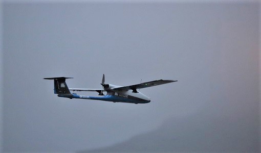
Drones join the campaign to validate Aeolus data
In June and September 2022, the Askos component of the Joint Aeolus Tropical Atlantic Campaign (JATAC), organised by ESA and its international partners, was expanded with new ground-based, drone and radiosonde measurements. The main objective of this campaign was to calibrate and validate Aeolus satellite observations.
News - Success Stories
Satellites track the health of the ozone layer
ESA’s Earth observation activities are contributing to international efforts to monitor and preserve the layer of stratospheric ozone that blankets the planet.
News - Events and Proceedings
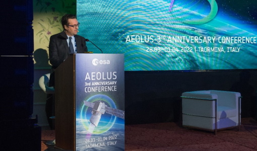
Exploring the prevailing achievements and future directions of Aeolus
A tight-knit community of European remote sensing experts converged on the Italian island of Sicily last month to discuss how the strong success of ESA’s Aeolus mission is shaping scientists’ understanding of the winds that sweep across the planet.
News - General News
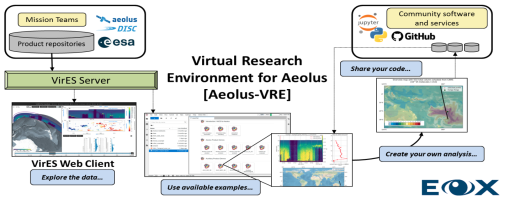
Launch of Aeolus VRE
The Aeolus Virtual Research Environment (VRE) is a cloud service, which provides users with a web-based development environment in the form of a JupyterLab workspace.
News - Success Stories
10 years of Envisat data help to illuminate ocean processes
A decade after Envisat beamed its final image to the planet, the pioneering ESA mission is continuing to foster improved understanding of Earth’s systems.
News - Thematic area articles
Satellite data boost global understanding of land surface
Understanding our changing land surface is essential in the study of climate change. Satellites are used to monitor changes to the material that covers Earth’s surface, so-called land cover, such as vegetation and water.
News - Success Stories
Dust aerosol campaign validates Aeolus data
Prepared, implemented and executed by a consortium of French universities and research institutions, under the umbrella of the French Space Agency (CNES) and the French National Centre for Scientific Research (CNRS), the Clouds-Atmospheric Dynamics–Dust Interactions in West Africa (CADDIWA) campaign took place on Sal Island in Cape Verde, from 6 to 25 September 2021.

