- All Categories (365)
- Data (16)
- News (33)
- Missions (3)
- Events (18)
- Tools (9)
- Activities (4)
- Campaigns (6)
- Documents (276)
NEWS
Discover the latest news on the European Space Agency's Earth Observation activities. Learn all about new data availability and how ESA's missions are performing.
News - Announcement of Opportunity updates
 18 Mar 2024
Announcement of Opportunity for SAOCOM – deadline extended
The submission deadline for the ESA/CONAE Announcement of Opportunity for SAOCOM mission data has been extended until 31 December 2024.
News - Data Release news
 19 Dec 2018
COSMO-SkyMed ESA archive online dataset available
ESA is pleased to announce the on-line availability of a new dataset: COSMO-SkyMed data for ESA Category-1 users.
News - Success Stories
 6 Sept 2022
Data Quality for Third Party Missions
Earthnet Data Assessment Project (EDAP+) will continue to build on the success of the Earthnet Data Assessment Pilot (EDAP) project and aims to assess the quality and suitability of candidate non-ESA Earth observation (EO) missions under consideration for ESA’s Third Party Mission programme.
News - Success Stories
 8 Oct 2021
Earth Observation data to improve navigation risk modelling and shipping routes
With the increased frequency of shipping activities, such as tourism and transport of freights, navigation safety has become a major concern. Even if new technologies have already supplied aids to pilots for navigation risk reduction, the International Maritime Organisation (IMO) reports that the majority of accidents could have been avoided by providing suitable input to the navigation decision-making process — this is where Earth Observation data can represent complementary information, to improve traffic monitoring and guidance along safe routes.
News - Infographics
 16 July 2021
ERS - ESA’s first Earth observation satellites
To mark the 30th anniversary of ERS, we've released a new infographic summarising the mission.
News - Announcement of Opportunity updates
23 Jan 2024ESA encourages S-band applications with NovaSAR-1 Announcement of Opportunity
ESA is offering possibilities to develop new applications in the S-band microwave frequency range, with a new Announcement of Opportunity for NovaSAR-1 data, via ESA’s Third Party Mission programme.
News - Thematic area articles
9 Dec 2022Global understanding of Earth's land surfaces greatly boosted by satellite data
ESA perform land surface monitoring with a range of instruments onboard satellites acquiring optical and radar data. Collections of data from these missions are freely available for research purposes.
News - How to guides
27 Mar 2024HEDAVI Discover: a step-by-step guide
The Heritage Data Visualisation tool (HEDAVI) is a platform developed by the French Science Consulting for Earth Observation group, VisioTerra, which allows users to freely access over 40 years of ESA Earth Observation Heritage data, Third Party Missions and some Copernicus data.
News - Success Stories
 6 Mar 2020
Heritage data still widely used today
For about 30 years now, ESA satellites have been cruising some 800 km above our heads, collecting information about our planet-but why are older missions still so fundamental today?
News - Thematic area articles
 18 May 2022
How ESA uses space data to explore deep Earth
As anthropogenic activities continue to unbalance our environment, scientists strive to fully understand the intricate interactions within Earth’s system.
News - Success Stories
14 Mar 2024How scientists are unlocking the potential of SAOCOM
A team of scientists has drawn on SAOCOM data to measure the heights of forests in Argentina, marking the first time that tree canopies have been mapped using the two-satellite constellation.
News - Data Release news
 1 Mar 2019
ICEYE data familiarization phase for the Earthnet TPM programme continues with new ICEYE-X2 data
The ICEYE data familiarization phase freely offers ICEYE imagery over several demonstration sites
News - Data Release news
 22 Mar 2024
ICEYE Dwell mode now available to users
ICEYE Dwell mode products are now available through ESA’s Third Party Missions programme.
News - Data Release news
 27 Apr 2021
Increased ERS SAR data availability
A large amount of additional ERS-1/2 SAR data is now available to users via the dedicated ESA (A)SAR dissemination service.
News - Spotlight on EO community
 12 Apr 2022
Interviewing Mirko Albani
ESA’s Heritage Space Programme Manager describes the goals of the programme, some of the challenges involved in preserving and improving 40 years of historical Earth observation data, and his passion for curating this long-term archive.
News - Spotlight on EO community
4 Mar 2022Introducing Mirko Albani
In this short introduction, ESA's Heritage Missions Programme Manager describes what he likes most about ESA's long term archive of satellite mission data and his role in the programme.
News - Spotlight on EO community
20 June 2023Introducing the Biomass and SMOS Mission Manager
In this video, Klaus Scipal describes his role as Mission Manager of Biomass and SMOS, and what he enjoys about his involvement with these dedicated science missions.
News - Success Stories
 10 Nov 2022
Long-term satellite data show wind farms can affect local air currents
Decades of satellite data have allowed for the first long-term study of the impact of offshore wind farms on downstream wind flow in coastal areas.
News - Spotlight on EO community
 22 Sept 2022
Meet a young researcher who studies the behaviour of volcanoes worldwide
Researcher Camila Novoa Lizama, of the University of Leeds, recently analysed how the use of Synthetic Aperture Radar (SAR) imagery over the Puyehue Cordón-Caulle Volcanic Complex, in Chile, acquired by ALOS-1, Envisat and the Copernicus Sentinel-1 satellites, helped her team to better comprehend the temporal and spatial behaviour of ground displacements before, during and after the volcano’s last eruption.
News - Data Release news
 8 Sept 2022
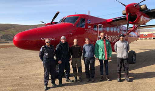
New CryoVEx campaign datasets released
Two new datasets have been released for the CryoVEx campaign, covering activities in Spring and Summer 2019.