- All Categories (3582)
- Data (36)
- News (23)
- Missions (7)
- Events (27)
- Tools (4)
- Activities (2)
- Campaigns (1)
- Documents (3482)
MISSIONS
Explore the European Space Agency's Earth Observation satellite missions. Learn all about ESA's dedicated Earth Explorers or collaborations with other agencies through the Third Party Missions programme.
Mission - Heritage Missions

Envisat
Envisat was ESA's successor to ERS. Envisat carried ten instruments aboard for a wide range of Earth observing fields. The mission was operational from 2002 to 2012.
Mission - Heritage Missions

ERS
The ERS programme was composed of two missions, ERS-1 and ERS-2, which together observed the Earth for 20 years, from 1991 to 2011.
Mission - Third Party Missions
NovaSAR-1
Launched on 16 September 2018, NovaSAR-1 features an S-band synthetic aperture radar (SAR) instrument offering a variety of modes with different resolutions and swath widths.
Mission - Third Party Missions

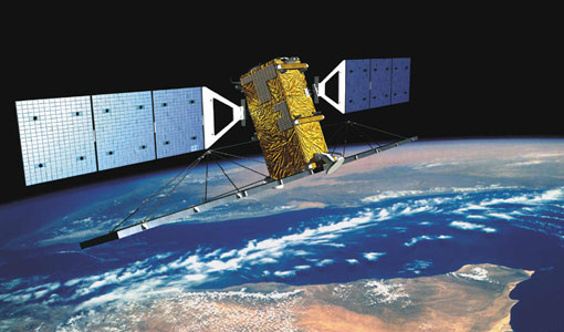
SAOCOM
The SAOCOM (SAtélite Argentino de Observación COn Microondas) satellite series represents Argentina's approved polarimetric L-band SAR constellation of two spacecraft. It's objective is to provide an effective Earth observation and disaster monitoring capability.
Mission - Copernicus Sentinels

Copernicus Sentinel-1
The Copernicus Sentinel-1 mission comprises a constellation of two polar-orbiting satellites, operating day and night performing C-band synthetic aperture radar imaging, enabling them to acquire imagery regardless of the weather.
Mission - Heritage Missions
RADARSAT
The RADARSAT programme consists of a pair of remote sensing satellites from the Canadian Space Agency (CSA).
Mission - Heritage Missions

JERS-1
The overall objectives of JERS-1 (Japanese Earth Resources Satellite) were the generation of global data sets with SAR and OPS sensors aimed at surveying resources, establishing an integrated Earth observation system