- All Categories (23844)
- Data (33)
- News (123)
- Missions (3)
- Events (24)
- Tools (24)
- Activities (6)
- Campaigns (8)
- Documents (23623)
Data - Campaigns (Open)
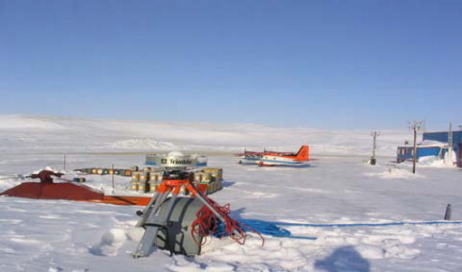
CryoVEx 2004
CryoVex 2004 was the second combined airborne and surface campaign for the preparation of the CryoSat mission, after successful completion of CryoVex 2003 by DTU.
Document - Newsletter

Earth Online Newsletter - 19 April 2024
This issue of the Earth Online Newsletter covers a selection of the latest news and events from ESA.
News - Data Release news
New Ocean data and more boost CryoSat data platform
Eight new datasets have been added to the CS2EO platform to support, enhance, and simplify research using CryoSat data. They include the CryoSat Ocean Product, and the Cryo-TEMPO Land Ice, Sea Ice, Polar Ocean, Coastal Ocean and Inland Water datasets.
News - How to guides
HEDAVI Discover: a step-by-step guide
The Heritage Data Visualisation tool (HEDAVI) is a platform developed by the French Science Consulting for Earth Observation group, VisioTerra, which allows users to freely access over 40 years of ESA Earth Observation Heritage data, Third Party Missions and some Copernicus data.
Tools - Catalogues
CS2EO
CS2EO is a data catalogue that allows users to easily and quickly combine and download airborne and spaceborne altimetry data from CryoSat-2, ICESat-2, CryoVEx, IceBridge and CryoTEMPO-EOLIS.
News - Maintenance News

ESA EO Dissemination Services - Maintenance on 25 and 26 March 2024
Scheduled software maintenance on ESA EO Dissemination Services on 25 and 26 March 2024
Data - Sample Data (Open)

CryoSat Data Samples
Download CryoSat data samples from Baseline-B, C, and D products.
News - Data Release news

CryoSat swath data boosted with new glacier regions and gridded products
Additional products have been added to CryoTEMPO-EOLIS Baseline 2, increasing global coverage and adding to the range of available gridded data.
News - Maintenance News
CryoSat CalVal server downtime on 27 February 2024
Due to routine maintenance activities on 27 February 2024, between 08:00-10:00 UTC, the distribution of CryoSat L0 products and AUX files may be impacted.
News - Operational News

Announcement for CryoSat Quaternions Product users
CryoSat users who use the Quaternions Products should be aware that the method to access these products is changing.
News - Thematic area articles
Space data support Earth’s ecosystems
ESA’s Earth observation (EO) missions are making a critical contribution to monitoring transformations in our planet’s ecosystems, helping track changes in the vegetation, soil, and ocean that affect these systems.
News - Infographics
Learn more about Envisat MERIS Full Resolution Level-1 data
Learn more about the Envisat MERIS Level 1 products in our latest infographic.
Document - Product Document

Envisat-MERIS-Level-1-Data-Infographic
Envisat MERIS Level 1 Data Infographic.
News - Operational News

Delay in the availability of CryoSat Products
A technical issue occurred at the CryoSat Payload Data Ground Segment (PDGS).
Document - Product Document
GOCE impact of re-processed Level 1b data on gravity field products
This technical note summarizes the status of the GOCE Level 2 products obtained at the end of the nominal operational phase of GOCE.
Document - Product Document
GOCE Level 2 Product Report
This technical note summarises the status of the GOCE Level 2 products obtained at the end of the nominal operational phase of GOCE.
News - Success Stories
CryoSat land ice data track destabilisation of Antarctic glacier
Even apparently stable glaciers in Antarctica are at risk of losing large quantities of ice due to warming seas. The warning comes after satellite data showed the Cadman glacier – previously stable for 50 years - retreated by 8 km between November 2018 and May 2021.
News - Success Stories
Discover Earth like never before: the HEDAVI tool
The Heritage Data Visualisation tool, or HEDAVI, enables the analysis of global spatio-temporal dynamics of natural and artificial environments, covering over 40 years of ESA Earth Observation Heritage data, Third Party Missions and some Copernicus data.
News - Success Stories
CryoSat safe and sound
A fuel leak aboard the CryoSat satellite threatened to bring the mission to an end in 2025 however operators at ESOC initiated a swap to a back-up system thus saving the satellite for years to come.
News - Maintenance News
ESA EO Dissemination Services - Maintenance on 06 November 2023
Due to software maintenance on 06 November, several ESA Earth Observation data dissemination platforms will be unavailable.