- All Categories (262)
- Data (2)
- News (24)
- Missions (3)
- Events (10)
- Tools (8)
- Activities (5)
- Documents (210)
Document - User Guide
TPM-L-OADS-dissemination-service-User-Manual.pdf
This guide describes the Third Party Missions Dissemination System.
News - Infographics
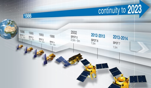
Timeline to over 40 years of historical satellite missions
ESA's Heritage Space Programme preserves historical data from over 40 years of Earth observation missions.
Document - General Reference
Third Party Missions Brochure
This brochure summarises ESA's Third Party Missions programme, providing a timeline and examples of content related to some of the missions.
Document - General Reference
surface-reflectance-aerosol-properties-proba-v-observations-abstract.pdf
Joint Retrieval Of Surface Reflectance And Aerosol Properties: Application To Proba-V Observations
Document - General Reference
Sterckx-Sindy-ICOS-2017.pdf
Poster presentation at IOCS (International Ocean Colour Science) 2017, 5 -19 May 2017, Lisbon, Portugal.
Document - Technical Note
SPOTScene-SPOTView-preprocessing-levels.pdf
SPOT technical information - SPOTScene and SPOTView preprocessing levels
Data - Fast Registration with approval (Restrained)
SPOT 1-5 ESA archive
The ESA SPOT 1-5 collection is a dataset of SPOT 1 to 5 Panchromatic and Multispectral products that ESA collected over the years. The HRV(IR) sensor onboard SPOT 1-4 provides data at 10 m spatial resolution Panchromatic mode (-1 band) and 20 m (Multispectral mode -3 or 4 bands). The HRG sensor on board of SPOT-5 provides spatial resolution of the imagery to < 3 m in the panchromatic band and to 10 m in the multispectral mode (3 bands). The SWIR band imagery remains at 20 m. The dataset mainly focuses on European and African sites but some American, Asian and Greenland areas are also covered. Spatial coverage: Check the spatial coverage of the collection on a map available on the Third Party Missions Dissemination Service. The SPOT Collection
News - General News
SPOT 1 to 5 production to be suspended
Airbus will suspend the production of SPOT 1 to 5 data until further notice at the end of May 2020.
News - General News
SPOT 1 to 5 production now suspended
Following the news of 14 May 2020, Airbus will now suspend the production of SPOT 1 to 5 data.
Mission - Heritage Missions
SPOT 1
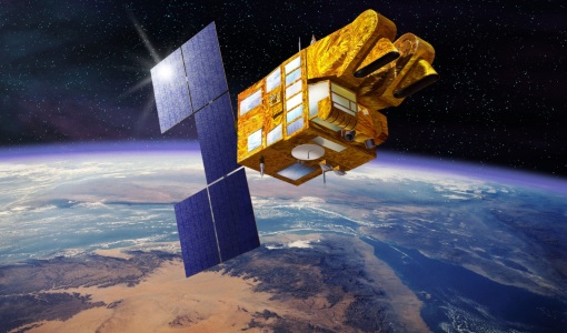
SPOT 1 was designed to improve the knowledge and management of Earth's resources, detecting and forecasting phenomena involving climatology and oceanography, and monitoring human activities and natural phenomena.
Mission - Heritage Missions
SPOT
The SPOT (from French "Satellite pour l'Observation de la Terre") series of missions has been supplying high-resolution, wide-area optical imagery since 1986.
Tools - Analysis
SNAP
SNAP is a common architecture for all Sentinel Toolboxes. It is ideal for Earth observation processing and analysis.
News - Success Stories
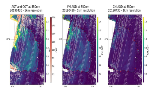
Ship trails in the Bay of Biscay observed using PROBA-V imagery
Ship trails have been perceived as convincing evidence of aerosol-cloud interaction. Ship emissions have been proven to contribute by about 1.9% and 2.9% to the increase in the global total and fine-mode aerosol optical thickness (AOT) respectively over a five year period (Peters et al. 20212).
Tools - Analysis
Sentinel-2 Toolbox
The Toolbox consists of a rich set of visualisation, analysis and processing tools for the exploitation of optical high-resolution products including the Sentinel-2 MSI sensor.
News - Thematic area articles
Satellite data boost global understanding of land surface
Understanding our changing land surface is essential in the study of climate change. Satellites are used to monitor changes to the material that covers Earth’s surface, so-called land cover, such as vegetation and water.
Document - Technical Note
Review of semi-empirical BRDF models performance on Proba-V and Spot-Vgt time series
Proba-V heritage mission: SPOT-VGT data processing and dissemination - Scientific paper providing overview of SPOT-VGT 15-years of data processing and dissemination
News - General News
Quality Reports Advanced Search Portal takes off
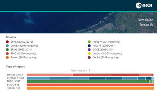
The Quality Reports Advanced Search (QRAS) Portal is a system that provides a set of functionalities for searching, filtering, visualising and downloading of Earth Observation reports data, from multiple missions.
Document - General Reference
PV-LAC-COAST-VR-v2.0.pdf
This is the second version (V2) of the Validation Report for the PV-LAC coastal activities.

