- All Categories (106)
- Data (5)
- News (9)
- Missions (4)
- Events (17)
- Tools (2)
- Activities (1)
- Campaigns (6)
- Documents (62)
News - Thematic area articles
How to use space data to probe humankind’s ancient past
Data disseminated by ESA’s Third Party Missions (TPM) programme are enabling archaeological investigations that could help to unravel the mysteries of past societies and cultures.
News - Events and Proceedings
Scientists to showcase value of Earth observation data at EGU
Remote sensing scientists are getting ready to present innovative and exciting applications of satellite data at the European Geosciences Union general assembly which will take place from 24 to 28 April in Vienna, Austria.
Campaign
WaddenSAR
The “WaddenSAR – Airborne bistatic C-band SAR experiment to demonstrate different acquisition geometries” was initiated to support the development of the Earth Explorer 10 Harmony mission.
News - Success Stories
New worldwide dataset captures the planet in fine detail
Scientists have developed an open source planetwide dataset of high-resolution Earth observation imagery, thanks to commercial data delivered by ESA’s Third Party Missions (TPM) programme.
Event - Workshop
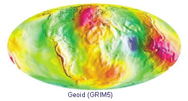
1st International GOCE User Workshop
The workshop provided a forum for presentations and discussions on the development, use and exploitation of GOCE Level 2 (global and regional) geoid products and Level 3 (science and application) data products.
News - General News
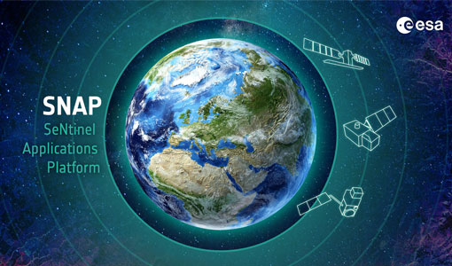
How SNAP facilitates access to ESA Third Party Missions data
The tool – called the Sentinel Applications Platform (SNAP) – incorporates high-quality remote sensing data from numerous missions, including those operated by the agency’s international partners, known as Third Party Missions (TPM).
Document - Proceedings
EO-Summer-School-6-ESA-explorer-mission-GOCE-earth-gravity-from-space.pdf
This presentation from ESA's EO Summer School 6 presents the ESA explorer mission GOCE earth gravity from space
Event - Training
EO Summer School 6
ESA's series of summer schools, on Monitoring of the Earth System, aims to promote the exploitation of Earth observation data.
Event - Conference
Living Planet Symposium 2022
Learn about the 2022 edition of ESA's Living Planet Symposium.
News - Events and Proceedings
Data preservation takes centre stage at Living Planet Symposium
Against the backdrop of the famed Rhine River, world-class scientists and Earth observation data-users are gathered this week in the historical city of Bonn, at the Living Planet Symposium (LPS).
News - Spotlight on EO community
Interviewing Mirko Albani
ESA’s Heritage Space Programme Manager describes the goals of the programme, some of the challenges involved in preserving and improving 40 years of historical Earth observation data, and his passion for curating this long-term archive.
Event - Workshop
2nd International GOCE User Workshop
This workshop provided a forum for presenting progress on the development of the GOCE mission's payload, ground segment and data products.
Event - Workshop
3rd International GOCE User Workshop
This workshop focussed on the oceanographic applications, such as absolute dynamic topography, of GOCE data in conjunction with other space-borne data, such as radar altimetry, and in-situ data and models.
Event - Workshop
Space and the Arctic 2009 Workshop
Temperatures in the Arctic are rising at an unprecedented rate. This workshop looked at the needs and challenges of working and living in the rapidly changing Arctic and explore how space-based services might help to meet those needs.
Event - Workshop
Insurance Industry Workshop on Earth Observation
This ESA workshop examined the potential value of satellite Earth Observation data to the insurance industry.
News - Infographics
An overview of ESA's Third Party Missions programme
ESA’s Third Party Missions programme consists of almost 50 satellite missions, which are owned by organisations around the world. ESA has agreements with these organisations to acquire, process, and distribute data from their missions
Activity - General activities
EO Science for Society
ESA's Earth Observation Science for Society programme aims to promote scientific exploitation of satellite data, forges new scientific discoveries and pioneers new services, stimulating downstream industrial and economic growth.
Data - Project Proposal (Restrained)
SPOT-6 to 7 full archive and tasking
The SPOT 6 and 7 satellites ensure data continuity with the no longer operational SPOT 5 satellite and provide an archive of very high resolution optical acquisition as well as the possibility to task the satellites for new acquisitions. Following the completion of the SPOT 7 mission in March 2023, new acquisition tasking is only available for the SPOT 6 satellite. The ortho-products are automatically generated by the SPOT 6 and 7 ground segment, based on SRTM database or Reference3D when available. The projection available for SPOT 6 and 7 ortho-products is UTM, datum WGS84. Bands combinations: Pansharpened: colour image at 1.5 m resolution Bundle: 1.5 m panchromatic image and 6 m multispectral image. Geometric processing levels: Primary: The Primary product is the processing level closest to the natural image acquired by the sensor. This product restores perfect collection conditions: the sensor is placed in rectilinear geometry, and the image is clear of all radiometric distortion. Standard Ortho: The Ortho product is a georeferenced image in Earth geometry, corrected from acquisition and terrain off-nadir effects. Tailored ortho: Aside from the Standard Ortho product, when different specifications are needed, a custom orthorectification, with a more precise 3D model provided by the client or acquired for the purpose, can be provided on demand. As per ESA policy, very high-resolution imagery of conflict areas cannot be provided.
Tools - Other
Urban TEP
The Urban Thematic Exploitation Platform enables access, processing, uploading, visualisation, manipulation and comparison of data over urban areas.
Tools - Other
Hydrology TEP
The Hydrology Thematic Exploitation Platform (TEP) enables access, processing, uploading, visualisation, manipulation and comparison of hydrological data.


