- All Categories (27)
- Data (2)
- News (4)
- Missions (1)
- Tools (6)
- Documents (14)
Document - Conference Presentation - Poster

7_Patruno.pdf
Multi frequency polarimetric SAR sensors analysis - The archaeological UNESCO site of Djebel Barkal (Sudan) J. Patruno [Univerisity of Rennes1 - France]
News - Success Stories

A stroll through Heritage Missions
At ESA's Earth Observation centre—ESRIN—in Frascati, Italy, there is a place where one can walk back in time, to better understand the history and importance of Heritage Missions and their data.
News - Infographics

A summary of ESA Third Party Mission collections
A new summary is available, showcasing the ESA archives for Third Party Mission collections.
Document - Data Access Information

Access-to-ESA-Earth-Observation-Data-Quick-Guide.pdf
How to Access ESA Earth Observation Data - a Quick Guide
Document - Proceedings

Advances-in-Atmospheric-Science-and-Applications.pdf
Proceedings in Advances in Atmospheric Science and Applications held in 18-22 June 2012 in Bruges, Belgium.
Document - General Reference

BIOMASS-Report-for-Mission-Selection-An-Earth-Explorer-to-observe-forest-biomass.pdf
The objective of the BIOMASS Mission is to determine the global distribution of forest biomass by reducing the uncertainty in the calculation of carbon stock and fluxes associated with the terrestrial biosphere.
Document - General Reference
CoReH2O-Report-for-Mission-Selection-An-Earth-Explorer-to-observe-snow-and-ice.pdf
This report describes the CoReH2O (Cold Regions Hydrology high-resolution Observatory) mission, which was selected for feasibility study in the third cycle of Earth Explorers.
Tools - Catalogues

EO CAT
EO CAT is a data catalogue, offering a Next Generation Earth Observation system designed to manage end-user Earth Observation services.
Tools - Analysis

ESA PDGS Jupyter Notebook
A series of Jupyter Notebooks are available, in order to understand how to exploit the API that provides the data access service for different types of datasets included in the ESA PDGS datacube.
Document - Data Access Information
ESA-archive-third-party-mission-collections.pdf
Discover the ESA archive data collections offered for the Third Party Missions programme.
Tools - Catalogues

FedEO
FedEO is a data catalogue that provides a unique entry point to a number of scientific catalogues and services for, but not limited to, European and Canadian missions.
Tools - Other

Geohazards TEP
The Geohazards Thematic Exploitation Platform (TEP) aims to provide Earth observation data for supporting geohazards applications.
Document - General Reference
Heritage Missions brochure
This brochure describes ESA's Heritage Space Programme and includes infographics describing some of the missions in the programme.
Document - General Reference

Heritage Space Programme interactive brochure
Learn about ESA's Heritage Space Programme in this interactive brochure.
Mission - Heritage Missions
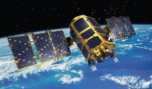
KOMPSAT-2
KOMPSAT-2 (Korea Multi-Purpose Satellite-2), also known as Arirang-2, was developed by KARI (Korea Aerospace Research Institute) to continue the observation programme of the KOMPSAT-1 mission.
Data - EO Sign In Authentication (Open)
KOMPSAT-2 ESA archive
KOMPSAT-2 ESA archive collection is composed by bundle (Panchromatic and Multispectral separated images) products from the Multi-Spectral Camera (MSC) onboard KOMPSAT-2 acquired from 2007 to 2014: 1m resolution for PAN, 4m resolution for MS. Spectral Bands: Spectral Band Application PAN 500 – 900 nm Locate, identify and measure surface features and objects primarily by their physical appearance MS1 Blue 450 – 520 nm Mapping shallow water, differentiating soil from vegetation MS2 Green 520 - 600 nm Differentiating vegetation by health MS3 Red 630 - 690 nm Differentiating vegetation by species MS4 NIR 760 – 900 nm Mapping vegetation, mapping vegetation vigor/health, Differentiating vegetation by species Spatial coverage: Check the spatial coverage of the collection on a map available on the Third Party Missions Dissemination Service.
Document - User Guide

KOMPSAT-2 Image Data Manual
The KOMPSAT-2 Image data Manual was designed and produced by KARI.This document intends for users of data supplied by KOMPSAT-2, andincludes basic information about the KOMPSAT-2 system, processing& specification of KOMPSAT-2 imagery data and a brief overview& evaluated values of the theoretical concepts of imagequality.
News - Success Stories

New open-source Python library improves rapid mapping services
In emergency services, rapid response is paramount. ICube-SERTIT’s Rapid Mapping Service provides near real-time delivery of geo-information to help emergency services respond quickly to disasters such as flooding, fires and landslides. A new Python open-source library, called EOReader, speeds up this mapping response by enabling the easy opening of imagery from multiple satellite sensors, both optical and synthetic aperture radar (SAR).
Document - General Reference
PREMIER-Report-for-Mission-Selection-An-Earth-Explorer-to-observe-atmospheric-composition.pdf
The objective of the PREMIER mission is to quantify the processes controlling global atmospheric composition in the mid/upper troposphere and lower stratosphere (5-25 km height range), which is a region of particular importance for climate change.
Tools - Analysis

Sentinel-2 Toolbox
The Toolbox consists of a rich set of visualisation, analysis and processing tools for the exploitation of optical high-resolution products including the Sentinel-2 MSI sensor.