- All Categories (23056)
- Data (91)
- News (126)
- Missions (54)
- Events (57)
- Tools (7)
- Activities (10)
- Campaigns (19)
- Documents (22692)
Document - Conference Presentation - Poster

10_torano_TDX_boreal_classification_polinsar_2013.pdf
Boreal forest biomass classification with TanDEM-X A. Torano Caicoya [German Aerospace Center - DLR]
Event - Training

10th Advanced Training Course on Land Remote Sensing EO and AI for Forestry
This ESA course was dedicated to training the next generation of EO scientists and experts working in forestry domain to exploit data from EO missions and use AI for science and applications development.
Document - Conference Presentation - Poster
11_LeToan_POLinSAR2013_Biomass.pdf
Status of the retrieval algorithms of the Biomass mission T. Le Toan [CESBIO - France]
Event - Workshop

11th International Workshop on PolInSAR and Biomass
Organised by ESA, the workshop will be held at Espaces Vanel Toulouse, France on the 19 - 23 June 2023
News - Data Release news

15 cm HD and 30 cm HD products added to EUSI ESA archive collections
Two new products, 15 cm HD and 30 cm HD, have been added to the collections from GeoEye-1, QuickBird-2, and WorldView (1 – 4).
Document - Conference Presentation - Poster
1_Forestry_Dubois_Fernandez_2013.pdf
Assessment of single baseline PolInSAR in tropical context for vegetation characterisation P. Dubois-Fernandez [ONERA - France]
Document - Conference Presentation - Poster
1_Pardini_TDXtomography_Polinsar13.pdf
Towards Forest Vertical Structure Monitoring From Space: First Experiments With Multi-Baseline TanDEM-X Data M. Pardini [German Aerospace Center - DLR]
Document - Conference Presentation - Poster
1_POLinSAR2013_compact_v1.pdf
Time Series Decomposition Analysis for Compact Polarimetry S.R. Cloude [AEL Consultants - UK]
Document - Conference Presentation - Poster
1_PolinSAR2013_HJ.pdf
Interpretation Pol-InSAR Vegetation Signatures at X-Band H.J. Joerg [German Aerospace Center - DLR]
Document - Proceedings

2004 Envisat and ERS Symposium
The 2004 Envisat and ERS Symposium was held in Salzburg - Austria from 6 to 10 September 2004. The 2004 Envisat and ERS Symposium provided a forum for investigators to present results of ongoing research project activities and assess the development of applications and services.
Event - Workshop

2007 International Geohazards Week
The ESA event was part of the United Nations International Year of Planet Earth, to increase awareness of the importance of Earth sciences for the advancement of sustainable development.
News - Data Release news

2012 CryoSat Ice Baseline D reprocessed data now available
We're pleased to inform the CryoSat scientific community that the reprocessed CryoSat Ice Baseline D data for all of 2012 has been published on the Science Server and is now available for download.
Event - Conference

27th IUGG General Assembly
The 27th IUGG General Assembly offered the opportunity for participants from Canada and from around the world to come together and share their science and culture.
Document - Conference Presentation - Poster
2_Dinh_BIOMASS_6MHz_POLINSAR_2013.pdf
P-band tomography imaging of tropical forest at 6 MHz bandwidth: capabilities for forest biomass estimation D. Ho Tong Minh [Politecnico di Milano - Italy]
Document - Conference Presentation - Poster
2_lVillard.pdf
Impacts of Geophysical Changes on the P-band Pol-InSAR Phase Center of Tropical Dense Forests - EM Simulations & TropiScat Experimental Results A. Hamadi [CESBIO - France]
Event - Training

2nd Advanced Training Course on Land Remote Sensing 2009
This 2009 advanced ESA training course focused on land remote sensing theory and applications.
Event - Workshop
2nd CHRIS PROBA Workshop
This 2004 workshop was on the treatment of Compact High Resolution Images Spectrometer (CHRIS) data.
Event - Conference
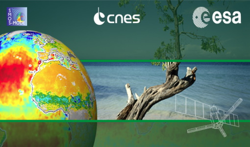
2nd SMOS Science Conference
The conference focused on the applications of SMOS data, including operational services, the development of novel data products, the synergistic use of SMOS data with other data sources and the potential of SMOS data for the generation of long-term data sets.
Event - Workshop
2nd Space for Hydrology Workshop
The workshop aimed to assess the current stage of knowledge and activities in space-based hydrological observations and to exchange knowledge and know how with hydrologists and researchers.