- All Categories (390)
- Data (15)
- News (32)
- Missions (4)
- Events (20)
- Tools (11)
- Activities (7)
- Campaigns (3)
- Documents (298)
News - General News
ESA's improved Earth system data records: what is in store for the future?
Fundamental Data Records (FDRs) are instrumental in advancing our understanding of Earth systems and for addressing societal challenges effectively. These long-term records contain uncertainty-quantified, calibrated and geo-located multi-instrument/multi-platform satellite sensor data spanning several decades to support climate-related applications.
News - How to guides
HEDAVI Discover: a step-by-step guide
The Heritage Data Visualisation tool (HEDAVI) is a platform developed by the French Science Consulting for Earth Observation group, VisioTerra, which allows users to freely access over 40 years of ESA Earth Observation Heritage data, Third Party Missions and some Copernicus data.
News - Maintenance News
ESA EO Dissemination Services - Maintenance on 25 and 26 March 2024
Scheduled software maintenance on ESA EO Dissemination Services on 25 and 26 March 2024
News - Thematic area articles
Space data support Earth’s ecosystems
ESA’s Earth observation (EO) missions are making a critical contribution to monitoring transformations in our planet’s ecosystems, helping track changes in the vegetation, soil, and ocean that affect these systems.
News - Infographics
Learn more about Envisat MERIS Full Resolution Level-1 data
Learn more about the Envisat MERIS Level 1 products in our latest infographic.
Document - Product Document
Envisat-MERIS-Level-1-Data-Infographic
Envisat MERIS Level 1 Data Infographic.
News - Success Stories
Discover Earth like never before: the HEDAVI tool
The Heritage Data Visualisation tool, or HEDAVI, enables the analysis of global spatio-temporal dynamics of natural and artificial environments, covering over 40 years of ESA Earth Observation Heritage data, Third Party Missions and some Copernicus data.
News - Maintenance News
ESA EO Dissemination Services - Maintenance on 06 November 2023
Due to software maintenance on 06 November, several ESA Earth Observation data dissemination platforms will be unavailable.
News - Thematic area articles
Cloud-free collections key for land monitoring
Satellite imagery is a crucially important tool for monitoring the land, but cloud cover can often block parts of Earth’s surface from view, limiting subsequent analyses.
News - Thematic area articles
Tracking the world’s forests from space
As human activities continue to threaten the planet’s forests, data delivered by satellites are boosting global efforts to conserve these crucial natural resources.
News - Success Stories
Commercial and international data for fire monitoring
As climate change sparks a surge in the frequency and intensity of wildfires, satellite data disseminated through ESA’s Third Party Missions (TPM) programme are helping scientists to track and investigate these potentially damaging natural events.
News - Infographics
Focusing on Envisat MERIS Full Resolution Level-2 data
ESA's Envisat mission continued and expanded upon the legacy of its predecessors, the ERS (European Remote Sensing) satellites. Operating between 2002 and 2012, the satellite's 10 instruments acquired a decade of data for many applications.
News - Spotlight on EO community
Meet the Quality Assurance for EO Team
The Quality Assurance For Earth Observation (also known as QA4EO) Service began its operations on 1 November 2019, providing support to the Data Quality and Algorithms Management Office at ESRIN, within the Sensor Performance, Processing and Algorithm section.
Document - Product Document
ATSR-Level-1B-ERn-AT-1-RBT-Product-Notices-Readme
This Readme file contains the Product Notice (PN) information for the ATSR-1 and ATSR-2 Level 1B products:
News - Thematic area articles
Global understanding of Earth's land surfaces greatly boosted by satellite data
ESA perform land surface monitoring with a range of instruments onboard satellites acquiring optical and radar data. Collections of data from these missions are freely available for research purposes.
News - How to guides
How to request level zero radar data from ERS and Envisat
To apply to use level zero (A)SAR radar data from ESA’s European Remote Sensing satellites (ERS-1 and ERS-2) and its Envisat mission for research purposes, you should prepare and submit an online form – called a Data Service Request – to put forward your proposed project to ESA for evaluation.
Data - EO Sign In Authentication (Open)
Landsat 5 TM European and Mediterranean Countries Cloud Free Collection
This dataset contains the cloud-free products from Landsat 5 Thematic Mapper collection acquired over Europe, North Africa and the Middle East; for each scene only one product is selected, with the minimal cloud coverage. The acquired Landsat TM scene covers approximately 183 x 172.8 km. A standard full scene is nominally centred on the intersection between a path and row (the actual image centre can vary by up to 100 m). The data are system corrected.
Tools - Catalogues
FedEO
FedEO is a data catalogue that provides a unique entry point to a number of scientific catalogues and services for, but not limited to, European and Canadian missions.
Tools - Catalogues
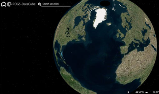
ESA PDGS DataCube
ESA's DataCube is a data catalogue that enables multi-temporal and pixel-based access to a subset of data available from ESA
Tools - Catalogues
EO CAT
EO CAT is a data catalogue, offering a Next Generation Earth Observation system designed to manage end-user Earth Observation services.


