- All Categories (8)
- Data (2)
- News (4)
- Missions (1)
- Events (1)
News - General News
Go-to guide to Third Party Mission data offering
ESA’s latest Third Party Missions Data Access Guide has been published, providing technical details and information on available data collections for all current or past Third Party Missions.
News - Data Release news
PlanetScope and Skysat data available through ESA’s Third Party Missions Programme
Through ESA’s Third Party Missions Programme, researchers, scientists and companies from around the world can apply to access Planet’s high-frequency, high-resolution satellite data for non-commercial use.
News - Success Stories
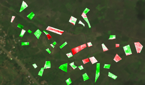
Predicting crop yield using Planet data
The world’s population continues to grow, while the climate crisis is raising Earth’s temperatures and increasing the likelihood of extreme weather events – all of which affect food security.
News - Infographics
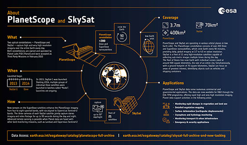
PlanetScope and SkySat - The high-resolution nanosatellite constellation
Find out more about the PlanetScope and SkySat missions in our new infographic.
Data - Project Proposal (Restrained)
IRS-1C/1D Full archive
The following products are available: PAN: Panchromatic, resolution 5 m, Coverage 70 km x 70 km, radiometrically and ortho (DN) corrected, LISS-III: Multi-spectral, resolution 25 m, Coverage 140 km x 140 km, radiometrically and ortho (DN) corrected (ortho delivered without Band 5) WiFS: Multi-spectral, resolution 180 m, Coverage 800 km x 800 km, radiometrically and ortho (DN) corrected. Sensor Type Resolution (m) Coverage (km x km) System or radiometrically corrected Ortho corrected (DN) Global archive PAN Panchromatic 5 70 x 70 X X 1996 – 2007 (IRS-1C) 1998 – 2009 (IRS-1D) LISS-III Multi-spectral 25 140 x 140 X X (without band 5) WiFS Multi-spectral 180 800 km x 800 km X X Note: Whether system corrected or radiometrically corrected products are available depends on sensor and processing centre For PAN and LISS-III ortho corrected: If unavailable, user has to supply ground control information and DEM in suitable quality For WiFS ortho corrected: service based on in house available ground control information and DEM.
Data - EO Sign In Authentication (Open)
IRS-1C/1D European coverage
IRS-1C/1D dataset is composed of products generated by the Indian Remote Sensing (IRS) Satellites 1C/1D PAN sensor. The products, acquired from 1996 to 2004 over Europe, are radiometrically and ortho corrected level 1 black and white images at 5 metre resolution and cover an area of up to 70 x 70 km. Sensor Type Resolution (m) Coverage (km x km) System or radiometrically corrected Ortho corrected (DN) Acquisition in Neustrelitz PAN Panchromatic 5 70 x 70 X X 1996 - 2004 IRS-1C/1D PAN data coverage of Europe acquired between 1996 to 1998. Copyright: 2015 GAF AG IRS-1C/1D PAN data coverage of Europe acquired between 1999 to 2001. Copyright: 2015 GAF AG IRS-1C/1D PAN data coverage of Europe acquired between 2002 to 2004. Copyright: 2015 GAF AG Spatial coverage: Check the spatial coverage of the collection on a map available on the Third Party Missions Dissemination Service.
Event - Meeting
VH-RODA and CEOS SAR workshop
The workshop provided an open forum for the presentation and discussion of current status and future developments related to the calibration and validation of space borne very high-resolution SAR and optical sensors and data products.
Mission - Third Party Missions
SkySat
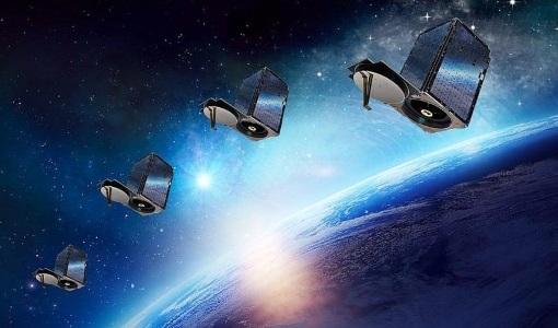
SkySat is a constellation of high-resolution Earth imaging satellites from the commercial company Planet Labs.


