- All Categories (37)
- Data (4)
- News (19)
- Missions (2)
- Events (10)
- Tools (1)
- Documents (1)
Data - Sample Data (Open)
SkySat Sample Data
Download free SkySat sample datasets to preview products available for this mission.
News - General News
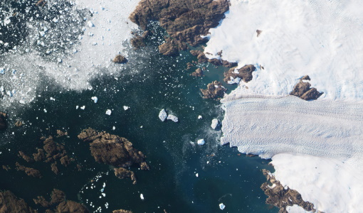
Go-to guide to Third Party Mission data offering
ESA’s latest Third Party Missions Data Access Guide has been published, providing technical details and information on available data collections for all current or past Third Party Missions.
Tools - Visualisation
PROBA-V Mission Exploitation Platform (MEP)
The MEP PROBA-V addresses a broad vegetation user community with the final aim to ease and increase the use of PROBA-V data by any user.
News - Thematic area articles
How to use space data to probe humankind’s ancient past
Data disseminated by ESA’s Third Party Missions (TPM) programme are enabling archaeological investigations that could help to unravel the mysteries of past societies and cultures.
News - General News
PROBA-V’s companion explores low-cost remote sensing
With the launch of PROBA-V’s Companion CubeSat (PV-CC), ESA supports a future where clusters of cheaper, small satellites could complement full-scale missions for Earth observation.
News - Spotlight on EO community
Meet one of ESA's first Africa Programme Research Fellows
Research Fellow, Dr Gladys Mosomtai, from the International Centre of Insect Physiology and Ecology (icipe), works on applying Earth observation data to better understand the spread of infectious disease in livestock, in Kenya.
News - Success Stories
PROBA-V data improve surface albedo products in Africa
As ESA’s PROBA-V satellite marks its 10-year launch milestone, data tasked during the mission’s lifetime are still being used to assess changes in land cover.
Event - Meeting
PROBA-V QWG meeting 16
The Proba-V QWG meeting 16 – Hybrid Event: VITO (Mol) and Microsoft Teams held on 22-23 March 2023
News - Data Release news
PROBA-V ‘Collection 2’ - Reprocessed Dataset available
The improved PROBA-V data (Collection 2) has been released. Data is available via the PROBA-V MEP and Terrascope platforms so users can freely exploit the data using Virtual machines, Jupyter Notebooks, and the new viewing application.
News - Thematic area articles
Global understanding of Earth's land surfaces greatly boosted by satellite data
ESA perform land surface monitoring with a range of instruments onboard satellites acquiring optical and radar data. Collections of data from these missions are freely available for research purposes.
Event - Conference
Living Planet Symposium 2022
Learn about the 2022 edition of ESA's Living Planet Symposium.
News - Data Release news
Two new ESA archive collections have been opened for PlanetScope and SkySat
PlanetScope ESA archive and SkySat ESA archive collections are available through ESA’s Third Party Missions programme via Fast Approval Registration.
Data - Fast Registration with approval (Restrained)
SkySat ESA archive
The SkySat ESA archive collection consists of SkySat products requested by ESA supported projects over their areas of interest around the world and that ESA collected over the years. The dataset regularly grows as ESA collects new products. Two different product types are offered, Ground Sampling Distance at nadir up to 65 cm for panchromatic and up to 0.8m for multi-spectral. EO-SIP Product Type Product Description Content SSC_DEF_SC Basic and Ortho scene Level 1B 4-bands Analytic /DN Basic scene Level 1B 4-bands Panchromatic /DN Basic scene Level 1A 1-band Panchromatic DN Pre Sup resolution Basic scene Level 3B 3-bands Visual Ortho Scene Level 3B 4-bands Pansharpened Multispectral Ortho Scene Level 3B 4-bands Analytic/DN/SR Ortho Scene Level 3B 1-band Panchromatic /DN Ortho Scene SSC_DEF_CO Ortho Collect Visual 3-band Pansharpened Image Multispectral 4-band Pansharpened Image Multispectral 4-band Analytic/DN/SR Image (B, G, R, N) 1-band Panchromatic Image The Basic Scene product is uncalibrated, not radiometrically corrected for atmosphere or for any geometric distortions inherent in the imaging process: Analytic - unorthorectified, radiometrically corrected, multispectral BGRN Analytic DN - unorthorectified, multispectral BGRN Panchromatic - unorthorectified, radiometrically corrected, panchromatic (PAN) Panchromatic DN - unorthorectified, panchromatic (PAN) L1A Panchromatic DN - unorthorectified, pre-super resolution, panchromatic (PAN) The Ortho Scene product is sensor and geometrically corrected, and is projected to a cartographic map projection: Visual - orthorectified, pansharpened, and colour-corrected (using a colour curve) 3-band RGB Imagery Pansharpened Multispectral - orthorectified, pansharpened 4-band BGRN Imagery Analytic SR - orthorectified, multispectral BGRN. Atmospherically corrected Surface Reflectance product. Analytic - orthorectified, multispectral BGRN. Radiometric corrections applied to correct for any sensor artifacts and transformation to top-of-atmosphere radiance. Analytic DN - orthorectified, multispectral BGRN, uncalibrated digital number imagery product Radiometric corrections applied to correct for any sensor artifacts Panchromatic - orthorectified, radiometrically correct, panchromatic (PAN) Panchromatic DN - orthorectified, panchromatic (PAN), uncalibrated digital number imagery product The Ortho Collect product is created by composing SkySat Ortho Scenes along an imaging strip. The product may contain artifacts resulting from the composing process, particular offsets in areas of stitched source scenes. Spatial coverage: Check the spatial coverage of the collection on a map available on the Third Party Missions Dissemination Service. As per ESA policy, very high-resolution imagery of conflict areas cannot be provided.
Event - Meeting
PROBA-V QWG meeting 15
The Proba-V QWG meeting 15 - Hybrid Event: University of Valencia and Microsoft Teams held on 09-10 June 2022
News - Data Release news
PlanetScope and Skysat data available through ESA’s Third Party Missions Programme
Through ESA’s Third Party Missions Programme, researchers, scientists and companies from around the world can apply to access Planet’s high-frequency, high-resolution satellite data for non-commercial use.
News - Success Stories
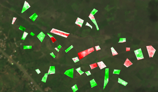
Predicting crop yield using Planet data
The world’s population continues to grow, while the climate crisis is raising Earth’s temperatures and increasing the likelihood of extreme weather events – all of which affect food security.
News - Infographics
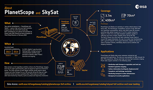
PlanetScope and SkySat - The high-resolution nanosatellite constellation
Find out more about the PlanetScope and SkySat missions in our new infographic.
News - Success Stories
New open-source Python library improves rapid mapping services
In emergency services, rapid response is paramount. ICube-SERTIT’s Rapid Mapping Service provides near real-time delivery of geo-information to help emergency services respond quickly to disasters such as flooding, fires and landslides. A new Python open-source library, called EOReader, speeds up this mapping response by enabling the easy opening of imagery from multiple satellite sensors, both optical and synthetic aperture radar (SAR).
News - Thematic area articles
Satellite data boost global understanding of land surface
Understanding our changing land surface is essential in the study of climate change. Satellites are used to monitor changes to the material that covers Earth’s surface, so-called land cover, such as vegetation and water.
News - Infographics
An overview of ESA's Third Party Missions programme
ESA’s Third Party Missions programme consists of almost 50 satellite missions, which are owned by organisations around the world. ESA has agreements with these organisations to acquire, process, and distribute data from their missions


