- All Categories (46)
- Data (3)
- News (8)
- Missions (2)
- Events (1)
- Tools (5)
- Activities (1)
- Campaigns (1)
- Documents (25)
Document - Algorithms Theoretical Baseline Document
Landsat-TM-Data-Format-Control-Book-DFCB.pdf
This document describes the algorithms, radiometric and geometric processing of the European Space Agency (ESA) Landsat Multispectral Scanner (MSS), Thematic Mapper (TM) and Enhanced Thematic Mapper Plus (ETM+) products. It is intended to point towards useful resources for more information rather than provide full descriptions of the specific algorithms used during the processing.
Document - Proceedings
Advances-in-Atmospheric-Science-and-Applications.pdf
Proceedings in Advances in Atmospheric Science and Applications held in 18-22 June 2012 in Bruges, Belgium.
Document - General Reference
BIOMASS-Report-for-Mission-Selection-An-Earth-Explorer-to-observe-forest-biomass.pdf
The objective of the BIOMASS Mission is to determine the global distribution of forest biomass by reducing the uncertainty in the calculation of carbon stock and fluxes associated with the terrestrial biosphere.
Document - General Reference
Earth-from-Space-Middle-East.pdf
This brochure is a collection of ENVISAT ASAR and MERIS, PROBA, ERS-2, Landsat mosaics.
Document - General Reference
Earth-from-Space-Deserts.pdf
This brochure is a collection of Envisat MERIS, Envisat ASAR, Proba and Landsat mosaics of desert areas on our planet.
Document - General Reference
Earth-from-Space-Deltas-and-Lakes.pdf
This brochure is a collection of Envisat MERIS, Envisat ASAR, ERS, Proba and Landsat mosaics.
Document - General Reference
Earth-from-Space-Oceans-and-Coastal-Zone.pdf
This brochure is a collection of ERS-2 SAR; ENVISAT ASAR, MERIS, AATSR; Landsat TM and Proba CHRIS mosaics.
Document - General Reference
PREMIER-Report-for-Mission-Selection-An-Earth-Explorer-to-observe-atmospheric-composition.pdf
The objective of the PREMIER mission is to quantify the processes controlling global atmospheric composition in the mid/upper troposphere and lower stratosphere (5-25 km height range), which is a region of particular importance for climate change.
Document - General Reference
The Earth Observation Handbook, 2010 Update - Key Tables
This is the 2010 update of the CEOS Earth Observation Handbook. You can browse the live database at http://database.eohandbook.com/ or download the printable PDF of key tables based on the 2010 database contents for a handy reference.
Document - Product Document
LANDSAT_Products_Description_Document.pdf
This document acts as a User Guide to the Landsat MSS, TM and ETM+ archives, focussing more specifically on the Landsat TM and ETM+ products from the Kiruna, Maspalomas and Matera archives (including from the Matera, Fucino, Neustralitz, O’Higgins, Malindi, Libreville and Bishkek ground stations) that have been generated as part of the ESA archive bulk-reprocessing project.
Document - Product Cal/Val Plan/Report
Landsat-Product-Radiometric-Calibration.pdf
This document reports the new calibration procedures for Landsat.
Document - General Reference
CoReH2O-Report-for-Mission-Selection-An-Earth-Explorer-to-observe-snow-and-ice.pdf
This report describes the CoReH2O (Cold Regions Hydrology high-resolution Observatory) mission, which was selected for feasibility study in the third cycle of Earth Explorers.
Document - General Reference
Operational-Atmospheric-Correction-of-Landsat-TM-Imagery.pdf
This article is extracted from Earth Observation Quarterly Nr.56-57 of December 1997. It describes the atmospheric correction method of ESA Landsat Thematic Mapper (TM) product line.
Document - Technical Note
Landsat-ETM-Data-Format-Control-Book.pdf
USGS Level 1 product specification, with which the ESA reprocessed TM and ETM+ products are compliant.
Document - User Guide
User Manual - LEDA 13 Landsat
This infosheet describes the Landsat databank. The databank is a catalogue of imagery remotely sensed by the Landsat series of satellites (Landsat l to 5) available at ESA/Earthnet and acquired at Fucino (Italy), Kiruna (Sweden) and Maspalomas (Canaries).
Document - User Guide
Third Party Missions, Cat-1 Data Availability
This brochure gives a quick overview on the availability of the Third Party Missions IRS-P3, JERS-1, NIMBUS, Proba, Landsat, KOMPSAT-1, SCISAT-1, Terra/Aqua, NOAA, QSCAT, OrbView, SPOT-1,-2,-3,-4, ALOS.
Event - Workshop
CEOS-IVOS Workshop on Inter-comparison of Large Scale Optical and Infrared Sensors
The 2004 workshop was an opportunity to present and exchange experiences and knowledge from work on inter-comparing large scale optical sensors at different product levels.
News - Success Stories
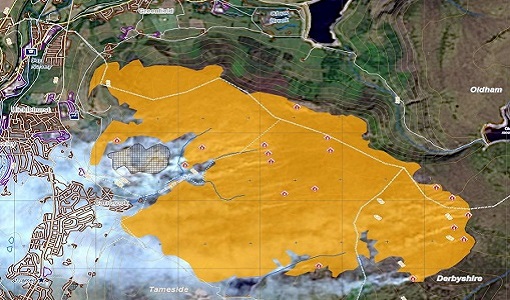
Satellite data allows real-time detection of potential fires
A pilot Fire Detection Service, based on real-time processing of Landsat-8 data being assessed within the framework of ESA's Earthnet Programme.
News - Operational News
Landsat-8 web portal now available on new environment
The Landsat-8 Portal service has been migrated to a new server and is accessible on the previous web address.
Tools - Visualisation
HEDAVI
The HEDAVI (HEritage DAta Visualisation) service enables users to discover a wealth of heritage data from ESA's ERS and Envisat missions, as well as from Landsat-5 and Landsat-7.

