- All Categories (23)
- Data (4)
- News (9)
- Missions (4)
- Tools (1)
- Activities (4)
- Documents (1)
Document - Proceedings
ERS-Envisat-symposium-proceedings.pdf
This document contains the proceedings of the ERS-Envisat Symposium, which took place in 2000.
Mission - Third Party Missions
SkySat
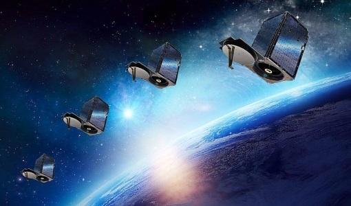
SkySat is a constellation of high-resolution Earth imaging satellites from the commercial company Planet Labs.
Activity - Projects
Auroral Electrojet and auroral Boundaries estimated from Swarm observations
In the Swarm-AEBS project, a set of new Swarm data products that characterise the auroral electrojets and auroral oval boundaries will be derived from Swarm magnetic field measurements.
News - Data Release news
PlanetScope and SkySat data now available
PlanetScope and SkySat missions under evaluation. Interested users can investigate suitability of the data for scientific and R&D activities.
Tools - Other
Swarm-Aurora
Swarm-Aurora, a web-based tool, was designed to facilitate and drive the use of Swarm in-situ measurements in auroral science.
Mission - Earth Explorers
GOCE
ESA's Gravity field and Ocean Circulation Explorer (GOCE) mission mapped Earth's geoid very accurately, opening a window into Earth's interior structure as well as the currents circulating within the depths of its oceans.
Mission - Earth Explorers
Swarm
Swarm is dedicated to creating a highly detailed survey of Earth’s geomagnetic field and its temporal evolution as well as the electric field in the atmosphere using a constellation of three identical satellites.
Data - Project Proposal (Restrained)
SkySat Full Archive and New Tasking
The SkySat Level 2B Basic Scene, Level 3B Ortho Scene and Level 3B Consolidated full archive and new tasking products are available as part of Planet imagery offer. The SkySat Basic Scene product is uncalibrated and in a raw digital number format, not corrected for any geometric distortions inherent in the imaging process. Rational Polynomial Coefficients (RPCs) is provided to enable orthorectification by the user. Basic Scene Product Components and Format Processing Levels Analytic (unorthorectified, radiometrically corrected, multispectral BGRN) Analytic DN (unorthorectified, multispectral BGRN) Panchromatic DN (unorthorectified, panchromatic) Product Components and Format Image File (GeoTIFF format) Metadata File (JSON format) Rational Polynomial Coefficients (Text File) UDM File (GeoTIFF format) Image Configuration 4-band Analytic DN Image (Blue, Green, Red, NIR) 1-band Panchromatic DN Image (Pan) Ground Sampling Distance 3.7 m at nadir (average at reference altitude 475 km) Ground Sampling Distance (nadir) Panchromatic 0.86m and Multispectral 1.0m for SkySat-1&2 Panchromatic 0.65m and Multispectral 0.8m for SkySat-3 to 13 (0.72 m and 1.0m for data acquired before 30/06/2020) Accuracy <50 m RMSE The SkySat Ortho Scene is sensor- and geometrically-corrected (by using DEMs with a post spacing of between 30 and 90 meters) and is projected to a cartographic map projection; the accuracy of the product will vary from region to region based on available GCPs. Different products are available: The SkySat Visual Ortho Scene product is orthorectified, pansharpened, and color-corrected (using a color curve) 3-band RGB Imagery The SkySat Pansharpened Multispectral Scene product is orthorectified, pansharpened 4-band BGRN Imagery The SkySat Analytic DN Ortho Scene product is orthorectified, multispectral BGRN, uncalibrated, digital number imagery product. The product has been processed to remove distortions caused by terrain; It eliminates the perspective effect on the ground (not on buildings), restoring the geometry of a vertical shot. Transformation to at-sensor radiance is not included The SkySat Panchromatic DN Ortho Scene product is orthorectified, panchromatic, uncalibrated, digital number imagery product. It has a finer GSD than the Analytic Product. Transformation to at-sensor radiance is not included. The SkySat Analytic Ortho Scene are calibrated multispectral imagery products with radiometric corrections applied to correct for any sensor artifacts and transformation to top-of-atmosphere radiance. The SkySat Consolidated Product are Ortho Collect product created by composing ~60 SkySat Ortho Scenes (Visual, Pansharpened Multispectral, Analytic DN, Panchromatic DN) along an imaging strip into segments Ortho Scene Product Components and Format Visual Ortho Pansharpened Multispectral Analytic DN Ortho Panchromatic DN Ortho Analytic Ortho Product Components and Format Image File (GeoTIFF format) Metadata File (JSON format) Rational Polynomial Coefficients (Text File) UDM File (GeoTIFF format) Image File (GeoTIFF) Metadata File (JSON format) Rational Polynomial Coefficients (Text File) UDM File (GeoTIFF format) Image File (GeoTIFF format) Metadata File (JSON format) Rational Polynomial Coefficients (Text File) UDM File (GeoTIFF format) Image File (GeoTIFF format) Metadata File (JSON format) Rational Polynomial Coefficients (Text File) UDM File (GeoTIFF format) Image File (GeoTIFF format) Metadata File (JSON format) Rational Polynomial Coefficients (Text File) UDM File (GeoTIFF format) Image Configuration 3-band Pansharpened Image (PS Red, PS Green, PS Blue) 4-band Pansharpened Image (PS Blue, PS Green, PS Red, PS NIR) 4-band Analytic DN Image (B, G, R, N) 1-band Panchromatic Image 4-band Analytic Image (B, G, R, N) Ground Sampling Distance 50 cm 50 cm 50 cm 50 cm 50 cm Projection UTM WGS84 UTM WGS84 UTM WGS84 UTM WGS84 UTM WGS84 Accuracy <10 m RMSE <10 m RMSE <10 m RMSE <10 m RMSE radiometric accuracy: +/- 5% Relative accuracy at < 10 degrees off-nadir angle As per ESA policy, very high-resolution imagery of conflict areas cannot be provided.
News - General News
Improved resolution for SkySat data and extension of Planet data availability
The SkySat satellites orbits has been lowered from 500km to 450km altitude and various processing improvements have been implemented by Planet.
Mission - Copernicus Sentinels
Copernicus Sentinel-3
Copernicus Sentinel-3 is an European Earth Observation satellite mission developed to support Copernicus ocean, land, atmospheric, emergency, security and cryospheric applications.
Activity - General activities
GSCB and LTDP
The Copernicus programme is based on a fleet of European Earth observation satellites, built and operated by ESA, member states and commercial entities. Copernicus will also offer data from non-European satellites.
Activity - Projects
TOLEOS
The TOLEOS (Thermosphere Observations from Low-Earth Orbiting Satellites) project will produce thermosphere mass density observations from the accelerometer measurements of the GRACE, GRACE-FO, and CHAMP satellites.
Activity - Projects
Dragon 2 Cooperation Programme
The Dragon 2 Programme focussed on the exploitation of ESA, ESA's Third Party Missions and Chinese Earth observation data for science and applications development in land, ocean and atmospheric applications.
News - Announcement of Opportunity updates
Swarm DISC Deadline Extension
Swarm DISC Invitation to Tender deadline extension for SD-ITT-4.4: Swarm for Space Weather
News - Success Stories
How Envisat helped to shape global understanding of Earth’s systems
Twenty years have passed since a ground-breaking European spacecraft designed to deliver unprecedented insight into the planet’s changing environment was lofted into orbit.
News - General News
New paper “Swarm Langmuir probes' data quality validation and future improvements” published
The paper “Swarm Langmuir probes' data quality validation and future improvements” by F. Catapano et al. has been published in the Geoscientific Instrumentation, Methods and Data Systems (GI) journal in March 2022.
News - Success Stories
Predicting crop yield using Planet data
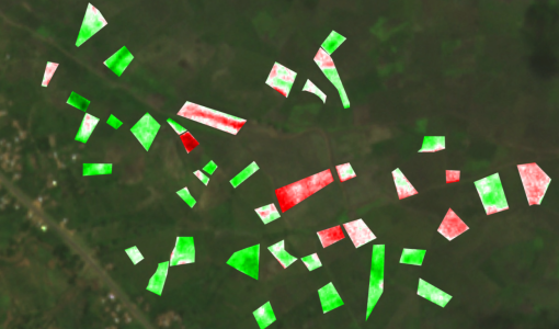
The world’s population continues to grow, while the climate crisis is raising Earth’s temperatures and increasing the likelihood of extreme weather events – all of which affect food security.
News - Data Release news
PlanetScope and Skysat data available through ESA’s Third Party Missions Programme
Through ESA’s Third Party Missions Programme, researchers, scientists and companies from around the world can apply to access Planet’s high-frequency, high-resolution satellite data for non-commercial use.
Data - Fast Registration with approval (Restrained)
SkySat ESA archive
The SkySat ESA archive collection consists of SkySat products requested by ESA supported projects over their areas of interest around the world and that ESA collected over the years. The dataset regularly grows as ESA collects new products. Two different product types are offered, Ground Sampling Distance at nadir up to 65 cm for panchromatic and up to 0.8m for multi-spectral. EO-SIP Product Type Product Description Content SSC_DEF_SC Basic and Ortho scene Level 1B 4-bands Analytic /DN Basic scene Level 1B 4-bands Panchromatic /DN Basic scene Level 1A 1-band Panchromatic DN Pre Sup resolution Basic scene Level 3B 3-bands Visual Ortho Scene Level 3B 4-bands Pansharpened Multispectral Ortho Scene Level 3B 4-bands Analytic/DN/SR Ortho Scene Level 3B 1-band Panchromatic /DN Ortho Scene SSC_DEF_CO Ortho Collect Visual 3-band Pansharpened Image Multispectral 4-band Pansharpened Image Multispectral 4-band Analytic/DN/SR Image (B, G, R, N) 1-band Panchromatic Image The Basic Scene product is uncalibrated, not radiometrically corrected for atmosphere or for any geometric distortions inherent in the imaging process: Analytic - unorthorectified, radiometrically corrected, multispectral BGRN Analytic DN - unorthorectified, multispectral BGRN Panchromatic - unorthorectified, radiometrically corrected, panchromatic (PAN) Panchromatic DN - unorthorectified, panchromatic (PAN) L1A Panchromatic DN - unorthorectified, pre-super resolution, panchromatic (PAN) The Ortho Scene product is sensor and geometrically corrected, and is projected to a cartographic map projection: Visual - orthorectified, pansharpened, and colour-corrected (using a colour curve) 3-band RGB Imagery Pansharpened Multispectral - orthorectified, pansharpened 4-band BGRN Imagery Analytic SR - orthorectified, multispectral BGRN. Atmospherically corrected Surface Reflectance product. Analytic - orthorectified, multispectral BGRN. Radiometric corrections applied to correct for any sensor artifacts and transformation to top-of-atmosphere radiance. Analytic DN - orthorectified, multispectral BGRN, uncalibrated digital number imagery product Radiometric corrections applied to correct for any sensor artifacts Panchromatic - orthorectified, radiometrically correct, panchromatic (PAN) Panchromatic DN - orthorectified, panchromatic (PAN), uncalibrated digital number imagery product The Ortho Collect product is created by composing SkySat Ortho Scenes along an imaging strip. The product may contain artifacts resulting from the composing process, particular offsets in areas of stitched source scenes. Spatial coverage: Check the spatial coverage of the collection on a map available on the Third Party Missions Dissemination Service. As per ESA policy, very high-resolution imagery of conflict areas cannot be provided.
Data - Announcement of Opportunity (Restrained)
Announcement of Opportunity for S3VT (Sentinel-3 Validation Team)
In the framework of a Copernicus collaborative agreement ESA and EUMETSAT invite interested groups and individuals to support the Sentinel-3 Validation Team (S3VT).
