- All Categories (23)
- Data (5)
- News (3)
- Missions (7)
- Tools (3)
- Activities (4)
- Documents (1)
Document - Proceedings
ERS-Envisat-symposium-proceedings.pdf
This document contains the proceedings of the ERS-Envisat Symposium, which took place in 2000.
Mission - Heritage Missions
IRS-1C
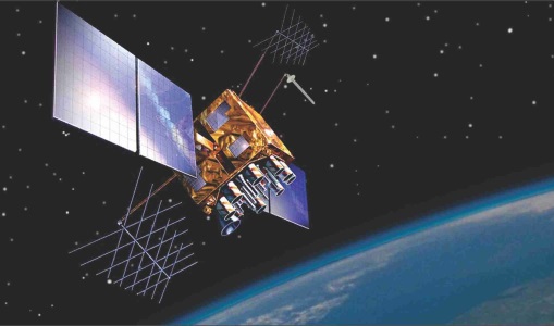
IRS-1C is part of the IRS (Indian Remote Sensing) satellites, a large family of Earth observation satellites operated by ISRO.
Mission - Heritage Missions
IRS-1D
IRS-1D was part of the IRS (Indian Remote Sensing) satellites, a large family of Earth observation satellites operated by ISRO.
Mission - Third Party Missions
IRS-P5 (Cartosat-1)
IRS-P5 (Cartosat-1) was a stereoscopic Earth observation satellite that generated Digital Elevation Models (DEMs) and other value-added products.
Activity - Projects
Auroral Electrojet and auroral Boundaries estimated from Swarm observations
In the Swarm-AEBS project, a set of new Swarm data products that characterise the auroral electrojets and auroral oval boundaries will be derived from Swarm magnetic field measurements.
Tools - Other
Swarm-Aurora
Swarm-Aurora, a web-based tool, was designed to facilitate and drive the use of Swarm in-situ measurements in auroral science.
Mission - Heritage Missions
IRS-1C and IRS-1D
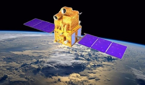
The Indian Remote Sensing satellites IRS-1C and IRS-1D were identical Earth-imaging satellites operated by the Indian Space Research Organisation.
Mission - Earth Explorers
GOCE
ESA's Gravity field and Ocean Circulation Explorer (GOCE) mission mapped Earth's geoid very accurately, opening a window into Earth's interior structure as well as the currents circulating within the depths of its oceans.
Mission - Earth Explorers
Swarm
Swarm is dedicated to creating a highly detailed survey of Earth’s geomagnetic field and its temporal evolution as well as the electric field in the atmosphere using a constellation of three identical satellites.
Data - Project Proposal (Restrained)
CartoSat-1 archive and Euro-Maps 3D Digital Surface Model
CartoSat-1 (also known as IRS-P5) archive products are available as PAN-Aft (backward), PAN-Fore (forward) and Stereo (PAN-Aft and PAN-Fore). Sensor Products Type Resolution (m) Coverage (km x km) System or radiometrically corrected Ortho corrected (DN) Neustralitz archive Global archive PAN PAN-Aft (backward) PAN-Fore (forward) Stereo (PAN-Aft+PAN-Fore) Panchromatic 2.5 27 x 27 X X 2007 - 2016 2005 - 2019 Note: Resolution 2.5 m. - Coverage 27 km x 27 km System or radiometrically corrected. For Ortho corrected products, if unavailable, user has to supply ground control information and DEM in suitable quality For Stereo ortho corrected: only one of the datasets will be ortho corrected. Euro-Maps 3D is a homogeneous, 5 m spaced digital surface model (DSM) semi-automatically derived from 2.5 m in-flight stereo data provided by IRS-P5 CartoSat-1 and developed in cooperation with the German Aerospace Center, DLR. The very detailed and accurate representation of the surface is achieved by using a sophisticated and well adapted algorithm implemented on the basis of the Semi-Global Matching approach. In addition, the final product includes detailed flanking information consisting of several pixel-based quality and traceability layers also including an ortho layer. Product Overview Post spacing 5 m Spatial reference system DD, UTM or other projections on WGS84 Height reference system EGM96 Absolute vertical accuracy LE90 5-10 m Absolute Horizontal Accuracy CE90 5-10 m Relative vertical accuracy LE90 2.5 m File format GeoTIFF, 16 bit Tiling 0.5° x 0.5° Ortho Layer Pixel Size 2.5 m The CartoSat-1 products and Euro-Maps 3D are available as part of the GAF Imagery products from the Indian missions: IRS-1C, IRS-1D, CartoSat-1 (IRS-P5), ResourceSat-1 (IRS-P6) and ResourceSat-2 (IRS-R2) missions. Euro-Maps 3D available data map
Data - EO Sign In Authentication (Open)
IRS-1C/1D European coverage
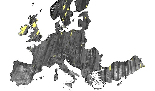
IRS-1C/1D dataset is composed of products generated by the Indian Remote Sensing (IRS) Satellites 1C/1D PAN sensor. The products, acquired from 1996 to 2004 over Europe, are radiometrically and ortho corrected level 1 black and white images at 5 metre resolution and cover an area of up to 70 x 70 km. Sensor Type Resolution (m) Coverage (km x km) System or radiometrically corrected Ortho corrected (DN) Acquisition in Neustrelitz PAN Panchromatic 5 70 x 70 X X 1996 - 2004 IRS-1C/1D PAN data coverage of Europe acquired between 1996 to 1998. Copyright: 2015 GAF AG IRS-1C/1D PAN data coverage of Europe acquired between 1999 to 2001. Copyright: 2015 GAF AG IRS-1C/1D PAN data coverage of Europe acquired between 2002 to 2004. Copyright: 2015 GAF AG Spatial coverage: Check the spatial coverage of the collection on a map available on the Third Party Missions Dissemination Service.
Data - Project Proposal (Restrained)
IRS-1C/1D Full archive
The following products are available: PAN: Panchromatic, resolution 5 m, Coverage 70 km x 70 km, radiometrically and ortho (DN) corrected, LISS-III: Multi-spectral, resolution 25 m, Coverage 140 km x 140 km, radiometrically and ortho (DN) corrected (ortho delivered without Band 5) WiFS: Multi-spectral, resolution 180 m, Coverage 800 km x 800 km, radiometrically and ortho (DN) corrected. Sensor Type Resolution (m) Coverage (km x km) System or radiometrically corrected Ortho corrected (DN) Global archive PAN Panchromatic 5 70 x 70 X X 1996 – 2007 (IRS-1C) 1998 – 2009 (IRS-1D) LISS-III Multi-spectral 25 140 x 140 X X (without band 5) WiFS Multi-spectral 180 800 km x 800 km X X Note: Whether system corrected or radiometrically corrected products are available depends on sensor and processing centre For PAN and LISS-III ortho corrected: If unavailable, user has to supply ground control information and DEM in suitable quality For WiFS ortho corrected: service based on in house available ground control information and DEM.
Mission - Copernicus Sentinels
Copernicus Sentinel-3
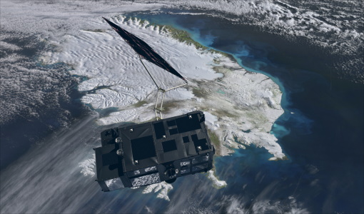
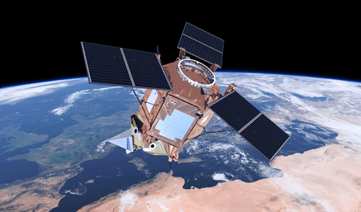
Copernicus Sentinel-3 is an European Earth Observation satellite mission developed to support Copernicus ocean, land, atmospheric, emergency, security and cryospheric applications.
Activity - General activities
GSCB and LTDP
The Copernicus programme is based on a fleet of European Earth observation satellites, built and operated by ESA, member states and commercial entities. Copernicus will also offer data from non-European satellites.
Activity - Projects
TOLEOS
The TOLEOS (Thermosphere Observations from Low-Earth Orbiting Satellites) project will produce thermosphere mass density observations from the accelerometer measurements of the GRACE, GRACE-FO, and CHAMP satellites.
Activity - Projects
Dragon 2 Cooperation Programme
The Dragon 2 Programme focussed on the exploitation of ESA, ESA's Third Party Missions and Chinese Earth observation data for science and applications development in land, ocean and atmospheric applications.
News - Announcement of Opportunity updates
Swarm DISC Deadline Extension
Swarm DISC Invitation to Tender deadline extension for SD-ITT-4.4: Swarm for Space Weather
News - Success Stories
How Envisat helped to shape global understanding of Earth’s systems
Twenty years have passed since a ground-breaking European spacecraft designed to deliver unprecedented insight into the planet’s changing environment was lofted into orbit.
News - General News
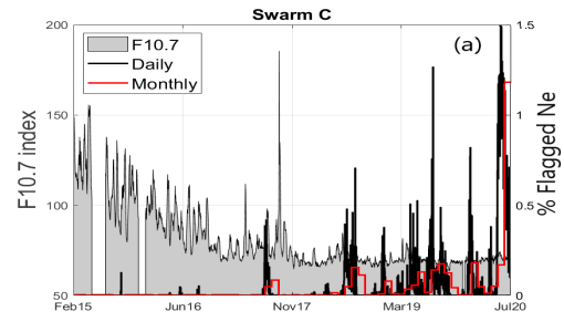
New paper “Swarm Langmuir probes' data quality validation and future improvements” published
The paper “Swarm Langmuir probes' data quality validation and future improvements” by F. Catapano et al. has been published in the Geoscientific Instrumentation, Methods and Data Systems (GI) journal in March 2022.
Tools - Catalogues
EO CAT
EO CAT is a data catalogue, offering a Next Generation Earth Observation system designed to manage end-user Earth Observation services.
