- All Categories (27)
- News (2)
- Missions (4)
- Events (6)
- Tools (5)
- Activities (6)
- Documents (4)
Tools - Other
Urban TEP
The Urban Thematic Exploitation Platform enables access, processing, uploading, visualisation, manipulation and comparison of data over urban areas.
Document - User Guide
Third Party Missions, Cat-1 Data Availability
This brochure gives a quick overview on the availability of the Third Party Missions IRS-P3, JERS-1, NIMBUS, Proba, Landsat, KOMPSAT-1, SCISAT-1, Terra/Aqua, NOAA, QSCAT, OrbView, SPOT-1,-2,-3,-4, ALOS.
Activity - Quality
SLAP
The SLAP (Systematic Landsat Archive Processing) project covers the MSS, TM and ETM+ products from Landsat missions 1 – 7, and is the first systematic reprocessing of the ESA Landsat archive.
Activity - Quality
SEOM CAWA
The Advanced Clouds, Aerosols and WAter vapour products for Sentinel-3/OLCI project aims to develop and improve the advanced atmospheric retrieval algorithms developed for MERIS and OLCI instruments.
Event - Workshop
SEASAR 2012
The European Space Agency and the Norwegian Space Centre jointly organised the fourth SAR oceanography workshop, 'SEASAR 2012', entitled 'Advances in SAR Oceanography'.
Event - Workshop
SEASAR 2006
ESA organised it's first SAR oceanography workshop, SEASAR 2006, entitled "Advances in SAR Oceanography from Envisat and ERS missions"
Document - Product Handbook
SAR Tropical Atmospheric Phenomena Handbook
ERS SAR Tropical Atmospheric Phenomena Handbook.
Activity - Cal/Val activities
S2L8VegStruc
The Retrieval of vegetation structural variables from Sentinel-2/Landsat 8 time series study's objective is to test and validate the capabilities for the retrieval of structural variables.
Activity - Cal/Val activities
MBASSS
Mer Bleue Arctic Surrogate Simulation Site (MBASSS) Sentinel-2 and Landsat 8 Validation Project objectives are to develop capability to validate Landsat 8 Operational Land Imager land data products.
Mission - Heritage Missions
Landsat-7
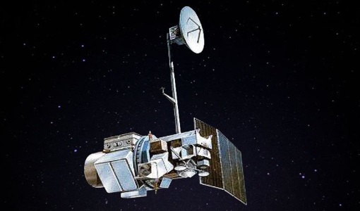
Landsat-7 is a joint USGS and NASA-led Earth observation mission, which was launched in 1999 and remains operational.
Mission - Heritage Missions
Landsat-4 and Landsat-5
The Landsat-4 and Landsat-5 missions continued the Landsat programme's goal of providing moderate-resolution optical remote sensing for land, coastal areas and shallow waters.
Mission - Heritage Missions
Landsat-1 to Landsat-3
The Landsat-1 to 3 satellites were the first in the United States' Landsat programme, dedicated to monitoring the Earth's land mass.
News - Spotlight on EO community
Interviewing Mirko Albani
ESA’s Heritage Space Programme Manager describes the goals of the programme, some of the challenges involved in preserving and improving 40 years of historical Earth observation data, and his passion for curating this long-term archive.
Tools - Other
Hydrology TEP
The Hydrology Thematic Exploitation Platform (TEP) enables access, processing, uploading, visualisation, manipulation and comparison of hydrological data.
Tools - Apps
Heritage Missions app for iOS
Download the Heritage Missions application to discover what the missions were about, how it worked and what the elements of the space and ground segment that make these missions unique.
Tools - Apps
Heritage Missions app for Android
Download the Heritage Missions application to discover what the missions were about, how it worked and what the elements of the space and ground segment that make these missions unique.
Event - Workshop
Fringe 2003 Workshop
The third ESA International Workshop on ERS SAR Interferometry and its first Workshop on ASAR interferometry: Advances in SAR interferometry from ERS and Envisat missions.
Tools - Other
Forestry TEP
The Forestry Thematic Exploitation Platform (TEP) enables users in the forestry sector to access satellite data based processing services and tools for generating value-added forest information products.
Document - Product Document
ERS-1-WSC-FDC-Product-CCT-Format.pdf
This document deals with the Product Specifications for the WSC Fast delivery copy. Valid for data processed up until end of July '95 when there was a switch in format from CEOS to CCSDS.
News - Infographics
ERS - ESA’s first Earth observation satellites
To mark the 30th anniversary of ERS, we've released a new infographic summarising the mission.


