- All Categories (57)
- Data (4)
- News (12)
- Missions (2)
- Events (9)
- Tools (2)
- Activities (2)
- Documents (26)
News - Data Release news
FDR4ALT - ESA unveils new cutting-edge ERS/Envisat Altimeter and Microwave Radiometer Datasets
The European Space Agency (ESA) has developed a comprehensive suite of innovative Earth system data records as part of the Fundamental Data Records for Altimetry project - FDR4ALT.
News - General News
Go-to guide to Third Party Mission data offering
ESA’s latest Third Party Missions Data Access Guide has been published, providing technical details and information on available data collections for all current or past Third Party Missions.
News - Thematic area articles
Remote sensing data underpin research on soil
Environmental data disseminated by ESA’s Earth observation programmes provide knowledge about the stresses on Earth’s soils – aiding many applications such as crop management, drought and flood forecasting, and ecosystem protection.
News - Thematic area articles
Global understanding of Earth's land surfaces greatly boosted by satellite data
ESA perform land surface monitoring with a range of instruments onboard satellites acquiring optical and radar data. Collections of data from these missions are freely available for research purposes.
Activity - General activities
EO Summer Schools
ESA's series of summer schools, on Monitoring of the Earth System, aims to promote the exploitation of Earth observation (EO) data.
News - Success Stories
Heritage data trains neural networks to detect urban sprawl
Using data from non-operational ESA remote sensing missions, researchers have trained a network of artificial neurons to recognise how cities change over decades. They hope this will help city planners reduce the impact that urbanisation has on the environment.
News - Data Release news
New Data Voucher for Planetscope on-demand
ESA’s Third Party Missions Programme offers researchers, scientists and companies from around the world access to Planet’s high-frequency, high-resolution satellite data for non-commercial use.
Event - Training
EO Summer School 8
ESA's series of summer schools, on Monitoring of the Earth System, aims to promote the exploitation of Earth observation data.
Event - Training
EO Summer School 5
ESA's series of summer schools, on Monitoring of the Earth System, aims to promote the exploitation of Earth observation data.
News - Events and Proceedings
Data preservation takes centre stage at Living Planet Symposium
Against the backdrop of the famed Rhine River, world-class scientists and Earth observation data-users are gathered this week in the historical city of Bonn, at the Living Planet Symposium (LPS).
News - Data Release news
PlanetScope and Skysat data available through ESA’s Third Party Missions Programme
Through ESA’s Third Party Missions Programme, researchers, scientists and companies from around the world can apply to access Planet’s high-frequency, high-resolution satellite data for non-commercial use.
News - Success Stories
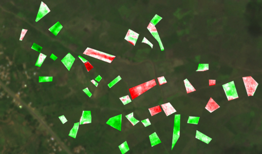
Predicting crop yield using Planet data
The world’s population continues to grow, while the climate crisis is raising Earth’s temperatures and increasing the likelihood of extreme weather events – all of which affect food security.
News - Infographics
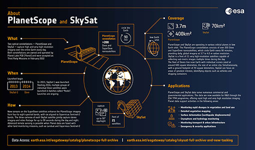
PlanetScope and SkySat - The high-resolution nanosatellite constellation
Find out more about the PlanetScope and SkySat missions in our new infographic.
News - Thematic area articles
Satellite data boost global understanding of land surface
Understanding our changing land surface is essential in the study of climate change. Satellites are used to monitor changes to the material that covers Earth’s surface, so-called land cover, such as vegetation and water.
Event - Workshop
Space and the Arctic 2009 Workshop
Temperatures in the Arctic are rising at an unprecedented rate. This workshop looked at the needs and challenges of working and living in the rapidly changing Arctic and explore how space-based services might help to meet those needs.
Tools - Apps
Heritage Missions app for iOS
Download the Heritage Missions application to discover what the missions were about, how it worked and what the elements of the space and ground segment that make these missions unique.
Tools - Apps
Heritage Missions app for Android
Download the Heritage Missions application to discover what the missions were about, how it worked and what the elements of the space and ground segment that make these missions unique.
News - Data Release news
New ERS-2 GOME Level 1 v5.1 dataset available online
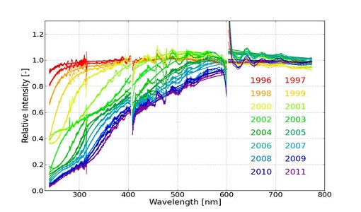
A new GOME Level 1b dataset has been generated for the 16-year mission period bringing relevant quality improvements for the revised calibration approach, compensating aging and instrument degradation, and provide enhanced accessibility.
Activity - General activities
EO Science for Society
ESA's Earth Observation Science for Society programme aims to promote scientific exploitation of satellite data, forges new scientific discoveries and pioneers new services, stimulating downstream industrial and economic growth.
Data - EO Sign In Authentication (Open)
ERS-1/2 SAR IM Precision L1 [SAR_IMP_1P]
The SAR Precision product is a multi-look (speckle-reduced), ground range image acquired in Image Mode. This product type is most applicable to users interested in remote sensing applications, but is also suitable for calibration purposes. The products are calibrated and corrected for the SAR antenna pattern and range-spreading loss. Radar backscatter can be derived from the products for geophysical modelling, but no correction is applied for terrain-induced radiometric effects. The images are not geocoded, and terrain distortion (foreshortening and layover) has not been removed. The numbering sequence relates to the satellite position and therefore differs between Ascending and Descending scenes. Product characteristics: Pixel size: 12.5 m (range - across track) x 12.5 m (azimuth - along track) Scene area: 100 km (range) x at least 102.5 km (azimuth) Scene size: 8000 pixels range x at least 8200 lines (azimuth) Pixel depth: 16 bits unsigned integer Total product volume: 125 MB Projection: Ground-range Number of looks: 3.
