- All Categories (8)
- News (2)
- Tools (2)
- Documents (4)
News - Thematic area articles
Global understanding of Earth's land surfaces greatly boosted by satellite data
ESA perform land surface monitoring with a range of instruments onboard satellites acquiring optical and radar data. Collections of data from these missions are freely available for research purposes.
News - Data Release news
Spot Extended Area mode added to ICEYE on-demand portfolio
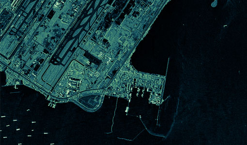
As an evolution of Spot mode, Spot Extended Area products are now available with the same resolution of Spot data (ground resolution of 1 m) but enabling to cover the area of 225 km2 (15 x 15 km) in a single SAR image.
Tools - Other
Hydrology TEP
The Hydrology Thematic Exploitation Platform (TEP) enables access, processing, uploading, visualisation, manipulation and comparison of hydrological data.
Tools - Other
Forestry TEP
The Forestry Thematic Exploitation Platform (TEP) enables users in the forestry sector to access satellite data based processing services and tools for generating value-added forest information products.
Document - General Reference
Shrimp farm inventory and monitoring
This series produced by the Environment and Natural Resources Service of FAQ aims to present the possibilities of remote sensing techniques for natural resource management and planning.
Document - General Reference
Earth-from-Space-Middle-East.pdf
This brochure is a collection of ENVISAT ASAR and MERIS, PROBA, ERS-2, Landsat mosaics.
Document - General Reference
Earth-from-Space-North-America.pdf
This brochure is a collection of Envisat MERIS, Envisat ASAR, Envisat AATSR, ERS, Proba and SPOT mosaics of North America.
Document - General Reference
Earth-from-Space-Oceans-and-Coastal-Zone.pdf
This brochure is a collection of ERS-2 SAR; ENVISAT ASAR, MERIS, AATSR; Landsat TM and Proba CHRIS mosaics.


