- All Categories (273)
- Data (3)
- News (4)
- Missions (2)
- Tools (2)
- Activities (1)
- Documents (261)
Data - Announcement of Opportunity (Restrained)
Announcement of Opportunity for S3VT (Sentinel-3 Validation Team)
In the framework of a Copernicus collaborative agreement ESA and EUMETSAT invite interested groups and individuals to support the Sentinel-3 Validation Team (S3VT).
News - Spotlight on EO community
Introducing Mirko Albani
In this short introduction, ESA's Heritage Missions Programme Manager describes what he likes most about ESA's long term archive of satellite mission data and his role in the programme.
News - Success Stories
How Envisat helped to shape global understanding of Earth’s systems
Twenty years have passed since a ground-breaking European spacecraft designed to deliver unprecedented insight into the planet’s changing environment was lofted into orbit.
Activity - Projects
Dragon 2 Cooperation Programme
The Dragon 2 Programme focussed on the exploitation of ESA, ESA's Third Party Missions and Chinese Earth observation data for science and applications development in land, ocean and atmospheric applications.
News - Success Stories
ERS Heritage Data allow for 30 years of science
At their time of launch thirty years ago, the two ERS satellites were the most sophisticated Earth observation spacecraft ever developed and launched by Europe.
Tools - Apps
Heritage Missions app for iOS
Download the Heritage Missions application to discover what the missions were about, how it worked and what the elements of the space and ground segment that make these missions unique.
Tools - Apps
Heritage Missions app for Android
Download the Heritage Missions application to discover what the missions were about, how it worked and what the elements of the space and ground segment that make these missions unique.
Mission - Copernicus Sentinels
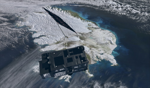
Copernicus Sentinel-3
Copernicus Sentinel-3 is an European Earth Observation satellite mission developed to support Copernicus ocean, land, atmospheric, emergency, security and cryospheric applications.
Data - Fast Registration with immediate access (Open)
ERS-1/2 SCATTEROMETER Ocean Wind field and Sea Ice probability [ASPS20.H/ASPS20.N]
The ASPS Level 2 products contain, for each node: the radar backscattering sigma nought for the three beams of the instrument, the four aliased wind solutions (Rank 1-4 wind vector) and the de-aliased wind vector flag, the sea-ice probability and sea-ice flag, the YAW quality flag. The wind retrieval is performed with the CMOD5N geophysical model function derived by ECMWF to compute the neutral winds rather than 10 m winds. ASPS L2.0 High resolution products are provided with a spatial resolution of 25x25 km and a grid spacing of 12.5 km. ASPS L2.0 Nominal resolution products are provided with a spatial resolution of 50x50 km and a grid spacing of 25 km. One product covers one orbit from ascending node crossing. Please consult the Product Quality Readme file before using the ERS ASPS data.
Data - Fast Registration with immediate access (Open)
ERS-1/2 SCATTEROMETER Nominal Resolution back-scattering measurements, Ocean Wind field [UWI]
The ERS data reprocessed with the ASPS facility is also available in the UWI format to maintain the compatibility with the FD (Fast Delivery) products. The ASPS UWI product is organised in frames of 500 x 500 km providing the radar backscattering sigma nought for the three beams of the instrument plus the wind speed and direction. The wind retrieval is performed with the CMOD5N geophysical model function derived by ECMWF to compute the neutral winds rather than 10m winds. ASPS UWI products are provided with a spatial resolution of 50 x 50 km and a grid spacing of 25 km. One product covers one orbit from ascending node crossing. Please consult the Product Quality Readme file before using the ERS ASPS data.
Mission - Heritage Missions
ERS
The ERS programme was composed of two missions, ERS-1 and ERS-2, which together observed the Earth for 20 years, from 1991 to 2011.
News - Data Release news
Updated Precise Orbit data (POD) for the full ERS-1 and ERS-2 mission available
The Precise Orbit files (ERS.ORB.POD) for the entire ERS-1 and ERS-2 mission periods have been reprocessed with up-to-date standards.
Document - Quality Report
ERS-2 AMI-SAR/AMI-Scatterometer Weekly Report 12 May 2002
ERS-2 AMI-SAR/AMI-Scatterometer Weekly Report
Document - Quality Report
ERS-2 AMI-SAR/AMI-Scatterometer Weekly Report 05 May 2002
ERS-2 AMI-SAR/AMI-Scatterometer Weekly Report
Document - Quality Report
ERS-2 AMI-SAR/AMI-Scatterometer Weekly Report 14 Apr 2002
ERS-2 AMI-SAR/AMI-Scatterometer Weekly Report
Document - Quality Report
ERS-2 AMI-SAR/AMI-Scatterometer Weekly Report 07 Apr 2002
ERS-2 AMI-SAR/AMI-Scatterometer Weekly Report
Document - Quality Report
ERS-2 AMI-SAR/AMI-Scatterometer Weekly Report 21 Apr 2002
ERS-2 AMI-SAR/AMI-Scatterometer Weekly Report
Document - Quality Report
ERS-2 AMI-SAR/AMI-Scatterometer Weekly Report 28 Apr 2002
ERS-2 AMI-SAR/AMI-Scatterometer Weekly Report
Document - Quality Report
ERS-2 AMI-SAR/AMI-Scatterometer Weekly Report 08 Jul 2002
ERS-2 AMI-SAR/AMI-Scatterometer Weekly Report
Document - Quality Report
ERS-2 AMI-SAR/AMI-Scatterometer Weekly Report 30 Jun 2002
ERS-2 AMI-SAR/AMI-Scatterometer Weekly Report


