- All Categories (24812)
- Data (31)
- News (80)
- Missions (5)
- Events (14)
- Tools (8)
- Activities (2)
- Campaigns (10)
- Documents (24662)
News - Infographics

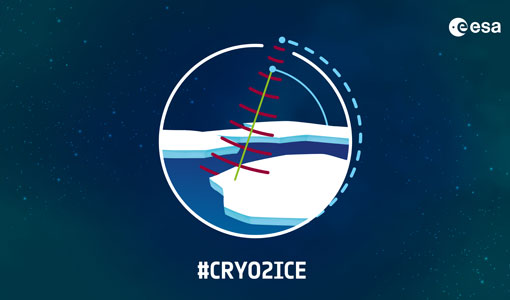
What is CRYO2ICE?
Learn about CRYO2ICE, an innovative campaign producing near simultaneous acquisitions over Antarctica from the CryoSat and ICESAT-2 missions, in this new infographic.
Tools - Analysis
VtCryoSat
VtCryoSat is a tool for easily browsing and downloading CryoSat products through an interactive and graphical web interface.
News - Data Release news

Updated CryoSat magnetometer data now available with new baseline 0201
An improved version of the CryoSat magnetic field data is now available on the Swarm Dissemination Server with new baseline 0201.
News - Data Release news

Updated CryoSat magnetometer data now available
An improved version of the CryoSat magnetic field data (version 0102) is now available in the "#CryoSat-2" folder of the ESA FTP server.
News - Thematic area articles

Transforming space data into climate action
ESA’s Earth observation activities are playing a key role in the revitalised global drive to combat climate change.
News - Success Stories
Trailblazing ERS-2 mission enables climate change applications
As ESA’s ERS-2 satellite approaches Earth’s atmosphere for reentry, it’s time to reflect on the mission’s great achievements in powering climate-related applications.
Document - General Reference

The first of ESA's first Opportunity Missions- CryoSat
This article was published in the Earth Observation Quarterly nr 63 which appeared in 1999 and describes the CryoSat Mission. In the same issue of EOQ there are various articles giving a general presentation of the ESA Living Planet programme.
Document - General Reference
The European Space Agency's Earth Explorer Mission CryoSat- Measuring Variability in the Cryosphere
This paper provides an overview of the mission and the measurement characteristics of the new SIRAL instrument: examples of data acquired on recent preparatory campaigns are presented, preparatory plans for calibration and validation of CryoSat data are also described.
Document - General Reference
The CryoSat System - the satellite and its radar altimeter
This article was published in the ESA Bulletin Nr. 122 and describes the elements of the satellite that are to be launched into space.
Document - General Reference
The CryoSat Data Products- their generation, in-situ validation and applications
This article was published in the ESA Bulletin Nr. 122 and describes those parts of the overall system that will not be launched into space
Document - General Reference
Taking-the-Measure-of-Earth-Fifteen-Years-of-Progress-in-Radar-Altimetry.pdf
This article is extracted from ESA Bulletin Nr. 128.
News - Data Release news

Systematic swath elevation and monthly DEMs over the Greenland Ice Sheet margin from CryoSat
The CryoTEMPO-EOLIS (Elevation Over Land Ice from Swath), the first of the CryoTEMPO products, is now available.
News - Data Release news

Systematic swath elevation and monthly DEMs over the Antarctica Ice Sheet margin from CryoSat 2
Land-ice is declining globally, raising sea levels worldwide and impacting glacial risks and access to fresh-water in high-mountain glaciers regions.
News - General News
Stunning new features for ESA and NASA altimetry portal cs2eo.org
Working with combined ESA and NASA altimetry data is easier than ever thanks to a range of handy new features on cs2eo.org.
News - Operational News
SIRAL measurements continue during CRYO2ICE
On 16 July, ESA is kicking off its CRYO2ICE campaign that aims to raise CryoSat-2's orbit by approximately 900 metres, bringing it in sync with NASA's ICESat-2.
News - Events and Proceedings

Seventh CryoSat Quality Working Group meeting - final report
The 7th CryoSat Quality Working Group (QWG) meeting Summary and Recommendation Report are available to download.
Data - EO Sign In Authentication (Open)
Sea Ice Thematic Data Product [ALT_TDP_SI]
This is the Sea Ice Thematic Data Product (TDP) V1 resulting from the ESA FDR4ALT project and containing the sea ice related geophysical parameters, along with associated uncertainties: snow depth, radar and sea-ice freeboard, sea ice thickness and concentration. The collection covers data for the ERS-1, ERS-2 and Envisat missions, and bases on Level 1 data coming from previous reprocessing (ERS REAPER and the Envisat V3.0) but taking into account the improvements made at Level 0/Level 1 in the frame of FDR4ALT (ALT FDR). The Sea Ice TDP provides data from the northern or southern hemisphere in two files corresponding to the Arctic and Antarctic regions respectively for the winter periods only, i.e., October to June for the Arctic, and May to November for the Antarctic. For many aspects, the Sea Ice TDP is very innovative: First time series of sea-ice thickness estimates for ERS Homogeneous calibration, allowing the first Arctic radar freeboard time series from ERS-1 (1991) to CryoSat-2 (2021) Uncertainties estimated along-track with a bottom-up approach based on dominant sources ERS pulse blurring error corrected using literature procedure [Peacock, 2004] The FDR4ALT products are available in NetCDF format. Free standard tools for reading NetCDF data can be used. Information for expert altimetry users is also available in a dedicated NetCDF group within the products. Please consult the FDR4ALT Product User Guide before using the data. The FDR4ALT datasets represent the new reference data for the ERS/Envisat altimetry missions, superseding any previous mission data. Users are strongly encouraged to make use of these datasets for optimal results.
Activity - Quality
SCIRoCCo
The SCIRoCCo project is an interdisciplinary cooperation of scatterometry experts aimed at promoting the continuing exploitation of ESA's unique 20 years' worth of ERS Scatterometer data.
News - Thematic area articles

Satellites reveal changes to Earth’s icy zones
ESA’s Earth observation activities are helping scientists investigate the influence of climate change on widespread ice-losses across the planet.
News - Thematic area articles

Satellite data central to ocean monitoring
Over 95% of Earth’s water is found in our oceans, and yet sadly, oceans are under stress from climate change and pollution. Monitoring our oceans is vital for Earth’s survival and satellites are the primary means of long-term and independent observation of our vast ocean bodies and their associated coastal zones.