- All Categories (581)
- Data (13)
- News (20)
- Missions (3)
- Events (10)
- Tools (5)
- Activities (14)
- Documents (516)
Document - Proceedings

ERS-Envisat-symposium-proceedings.pdf
This document contains the proceedings of the ERS-Envisat Symposium, which took place in 2000.
Activity - Projects
Swarm-Aurora
Swarm-Aurora, a web-based tool, provides access to quick-look summary data for an array of ground-based instruments and Swarm in situ measurements, enabling researchers to identify events of interest.
Activity - Projects

Auroral Electrojet and auroral Boundaries estimated from Swarm observations
In the Swarm-AEBS project, a set of new Swarm data products that characterise the auroral electrojets and auroral oval boundaries will be derived from Swarm magnetic field measurements.
Activity - Projects
SIFACIT
The project SIFACIT (Swarm Data Quality Investigation of Field-Aligned Current Products, Ionosphere, and Thermosphere Systems) focuses on the study of the Field-Aligned Currents.
Tools - Other

Swarm-Aurora
Swarm-Aurora, a web-based tool, was designed to facilitate and drive the use of Swarm in-situ measurements in auroral science.
Tools - Other
AMPS
AMPS is a climatological model of polar ionospheric currents, based on magnetic field measurements from the CHAMP and Swarm satellites.
Activity - Projects

Swarm - Spherical Elementary Current System
The Swarm-SECS project investigated how the method of Spherical Elementary Current Systems can be applied to Swarm magnetic and electric field data in order to create new data products.
Mission - Earth Explorers

GOCE
ESA's Gravity field and Ocean Circulation Explorer (GOCE) mission mapped Earth's geoid very accurately, opening a window into Earth's interior structure as well as the currents circulating within the depths of its oceans.
Mission - Earth Explorers
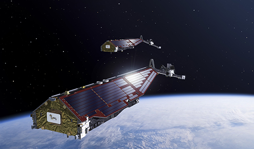
Swarm
Swarm is dedicated to creating a highly detailed survey of Earth’s geomagnetic field and its temporal evolution as well as the electric field in the atmosphere using a constellation of three identical satellites.
Data - Data Description
GRACE-A and GRACE-B Level 1B, Level 1B combined and Level 2 Data Products
Level-1A Data Products are the result of a non-destructive processing applied to the Level-0 data at NASA/JPL. The sensor calibration factors are applied in order to convert the binary encoded measurements to engineering units. Where necessary, time tag integer second ambiguity is resolved and data are time tagged to the respective satellite receiver clock time. Editing and quality control flags are added, and the data is reformatted for further processing. The Level-1A data are reversible to Level-0, except for the bad data packets. This level also includes the ancillary data products needed for processing to the next data level. The Level-1B Data Products are the result of a possibly destructive, or irreversible, processing applied to both the Level-1A and Level-0 data at NASA/JPL. The data are correctly time-tagged, and data sample rate is reduced from the higher rates of the previous levels. Collectively, the processing from Level-0 to Level-1B is called the Level-1 Processing. This level also includes the ancillary data products generated during this processing, and the additional data needed for further processing. The Level-2 data products include the static and time-variable (monthly) gravity field and related data products derived from the application of Level-2 processing at GFZ, UTCSR and JPL to the previous level data products. This level also includes the ancillary data products such as GFZ's Level-1B short-term atmosphere and ocean de-aliasing product (AOD1B) generated during this processing. GRACE-A and GRACE-B Level-1B Data Product: Satellite clock solution [GA-OG-1B-CLKDAT, GB-OG-1B-CLKDAT, GRACE CLKDAT]: Offset of the satellite receiver clock relative to GPS time, obtained by linear fit to raw on-board clock offset estimates GPS flight data [GA-OG-1B-GPSDAT, GB-OG-1B-GPSDAT, GRACE GPSDAT]: Preprocessed and calibrated GPS code and phase tracking data edited and decimated from instrument high-rate (10 s (code) or 1 s (phase)) to low-rate (10 s) samples for science use (1 file per day, level-1 format) Accelerometer Housekeeping data [GA-OG-1B-ACCHKP, GB-OG-1B-ACCHKP, GRACE ACCHKP]: Accelerometer proof-mass bias voltages, capacitive sensor outputs, instrument control unit (ICU) and sensor unit (SU) temperatures, reference voltages, primary and secondary power supply voltages (1 file per day, level-1 format) Accelerometer data [GA-OG-1B-ACCDAT, GB-OG-1B-ACCDAT, GRACE ACCDAT]: Preprocessed and calibrated Level-1B accelerometer data edited and decimated from instrument high-rate (0.1 s) to low-rate (1s) samples for science use (1 file per day, level-1 format) Intermediate clock solution [GA-OG-1B-INTCLK, GB-OG-1B-INTCLK, GRACE INTCLK]: derived with GIPSY POD software (300 s sample rate) (1 file per day, GIPSY format) Instrument processing unit (IPU) Housekeeping data [GA-OG-1B-IPUHKP, GB-OG-1B-IPUHKP, GRACE IPUHKP]: edited and decimated from high-rate (TBD s) to low-rate (TBD s) samples for science use (1 file per day, level-1 format) Spacecraft Mass Housekeeping data [GA-OG-1B-MASDAT, GB-OG-1B-MASDAT, GRACE MASDAT]: Level 1B Data as a function of time GPS navigation solution data [GA-OG-1B-NAVSOL, GB-OG-1B-NAVSOL, GRACE NAVSOL]: edited and decimated from instrument high-rate (60 s) to low-rate (30 s) samples for science use (1 file per day, level-1 format) OBDH time mapping to GPS time Housekeeping data [GA-OG-1B-OBDHTM, GB-OG-1B-OBDHTM, GRACE OBDHTM]: On-board data handling (OBDH) time mapping data (OBDH time to receiver time Star camera data [GA-OG-1B-SCAATT, GB-OG-1B-SCAATT, GRACE SCAATT]: Preprocessed and calibrated star camera quaternion data edited and decimated from instrument high-rate (1 s) to low-rate (5 s) samples for science use (1 file per day, level-1 format) Thruster activation Housekeeping data [GA-OG-1B-THRDAT, GB-OG-1B-THRDAT, GRACE THRDAT]: GN2 thruster data used for attitude (10 mN) and orbit (40 mN) control GN2 tank temperature and pressure Housekeeping data [GA-OG-1B-TNKDAT, GB-OG-1B-TNKDAT, GRACE TNKDAT]: GN2 tank temperature and pressure data Oscillator frequency data [GA-OG-1B-USODAT, GB-OG-1B-USODAT, GRACE USODAT]: derived from POD product GRACE-A and GRACE-B Combined Level-1B Data Product Preprocessed and calibrated k-band ranging data [GA-OG-1B-KBRDAT, GB-OG-1B-KBRDAT, GRACE KBRDAT]: range, range-rate and range-acceleration data edited and decimated from instrument high-rate (0.1 s) to low-rate (5 s) samples for science use (1 file per day, level-1 format) Atmosphere and Ocean De-aliasing Product [GA-OG-1B-ATMOCN, GB-OG-1B-ATMOCN, GRACE ATMOCN]: GRACE Atmosphere and Ocean De-aliasing Product. GRACE Level-2 Data Product: GAC [GA-OG-_2-GAC, GB-OG-_2-GAC, GRACE GAC]: Combination of non-tidal atmosphere and ocean spherical harmonic coefficients provided as average over certain time span (same as corresponding GSM product) based on level-1 AOD1B product (1file per time span, level-2 format) GCM [GA-OG-_2-GCM, GB-OG-_2-GCM, GRACE GCM]: Spherical harmonic coefficients and standard deviations of the long-term static gravity field estimated by combination of GRACE satellite instrument data and other information for a dedicated time span (multiple years) and spatial resolution (1 file per time span, level-2 format) GAB [GA-OG-_2-GAB, GB-OG-_2-GAB, GRACE GAB]: Non-tidal ocean spherical harmonic coefficients provided as average over certain time span (same as corresponding GSM product) based on level-1 AOD1B product (1file per time span, level-2 format) GAD [GA-OG-_2-GAD, GB-OG-_2-GAD, GRACE GAD]: bottom pressure product - combination of surface pressure and ocean (over the oceans, and zero over land). Spherical harmonic coefficients provided as average over certain time span (same as corresponding GSM product) based on level-1 AOD1B product (1file per time span, level-2 format) GSM [GA-OG-_2-GSM, GB-OG-_2-GSM, GRACE GSM]: Spherical harmonic coefficients and standard deviations of the static gravity field estimated from GRACE satellite instrument data only for a dedicated time span (e.g. weekly, monthly, multiple years) and spatial resolution (1 file per time span, level-2 format).
Data - Open access (Open)

Swarm Geodesy/Gravity
Monthly gravity field of the Earth, non-gravitational accelerations.
Data - Open access (Open)

Swarm Level 1B
The Level 1b products of the Swarm mission contains time-series of quality-screen, calibrated, and corrected measurements given in physical, SI units in geo-localized reference frames. Level 1b products are provided individually for each of the three satellites Swarm A, Swarm B, and Swarm C on a daily basis.
Data - Open access (Open)
Swarm Space Weather
Environmental conditions in Earth's magnetosphere, ionosphere and thermosphere due to the solar activity that drive the Sun-Earth interactions.
Data - Open access (Open)
Swarm Ionosphere/Magnetosphere
Spherical harmonic model of the large-scale magnetospheric field and its Earth-induced counterpart, spherical harmonic model of the daily geomagnetic variation at middle latitudes and low latitudes, Ionospheric bubble index, ionospheric total electron content, ionosphericfield-aligned currents, dayside ionospheric equatorial electric field, ionospheric plasma density and plasma irregularities.
Data - Open access (Open)
Swarm Level 2 longterm
The Swarm Level 2 Long Term data products are the corrected and formatted output from each of the three Swarm satellites. By a complex assimilation of these individual satellite measurements into one set of products for the satellite constellation, the Swarm Level 2 Processor ensures a very significant improvement of the quality of the final scientific data products.
Data - Open access (Open)
Swarm Core
Spherical harmonic model of the main (core) field and its temporal variation.
Data - Open access (Open)
Swarm Level 2 daily
The Swarm Level 1b data products are the corrected and formatted output from each of the three Swarm satellites. By a complex assimilation of these individual satellite measurements into one set of products for the satellite constellation, the Swarm Level 2 Processor ensures a very significant improvement of the quality of the final scientific data products.